
First days: Tralee, The Cliffs of Moher, & The Burren
Once again I wish to acknowledge and thank my wonderful friend Shoba Nayar who edits my writing, and who’s careful eye and amazing suggestions helps bring alive, stories from our travels!
Where in the world are we? Ireland!!
Final planning for our trip on the ‘Wild Atlantic Way’, Ireland
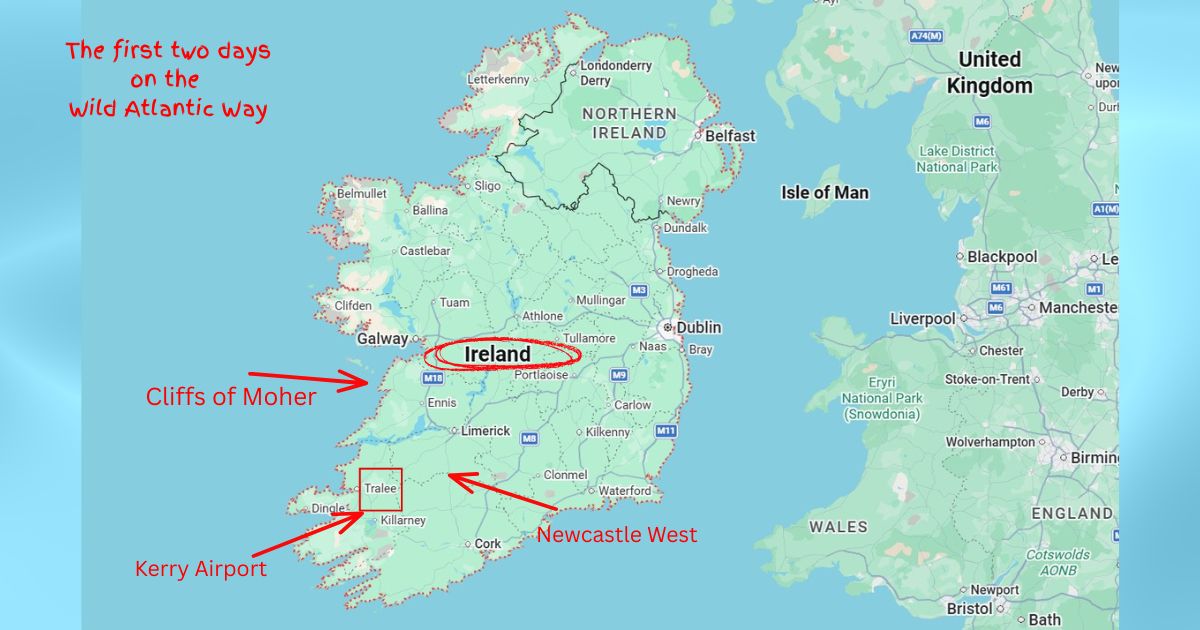
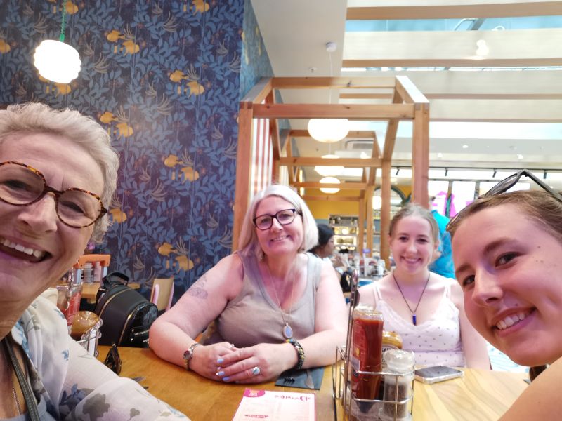
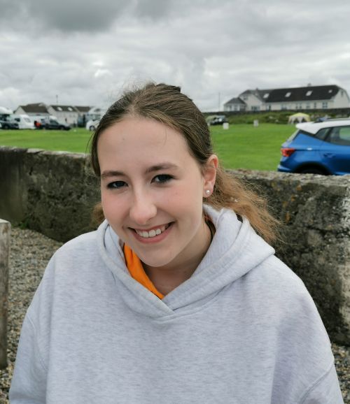
Arriving from Spain into the pretty countryside of Norfolk, England to spend time with my daughter Dionee, husband Marcus, and my twin granddaughters, Francesca and Matilda, so began a wonderful holiday. After much prior planning and researching, we had decided to spend 8 days on the Wild Atlantic Way on the West Coast of Ireland. With a strong Irish heritage, this journey seemed special in some way.
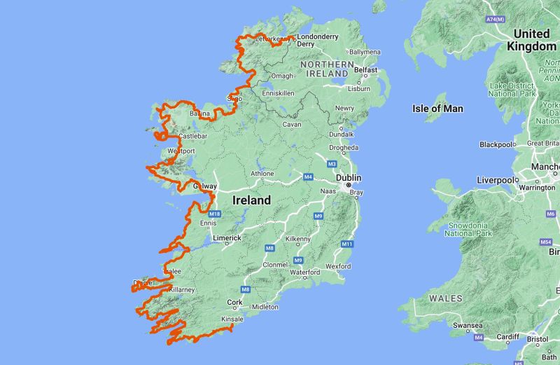
The Wild Atlantic Way is an epic 2,600km (1,600 mi) coastal driving route, defined as ‘the longest coastal path in the world’. Starting at the Inishowen Peninsula in County Donegal in the far north and stretching down to Kinsale in County Cork on the south east coast, the drive showcases dramatic scenery with stunning beaches, villages to melt your heart, cliffs of dizzying heights, and the culture that Ireland is famous for—rich, local and steeped in ancient history. It flows through nine counties, and you could spend many months exploring the nooks and crannies of this ‘beyond amazing’ trail.
Read more here: https://www.thewildatlanticway.com
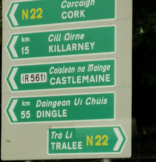
Arriving in Ireland at Kerry Airport
Remember to open up the groups of photos to see them fully!
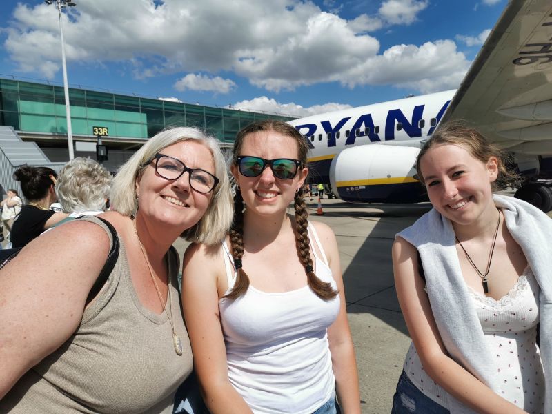
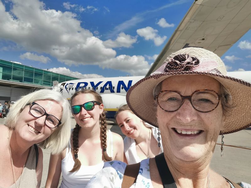
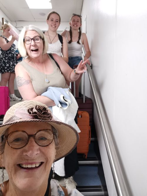
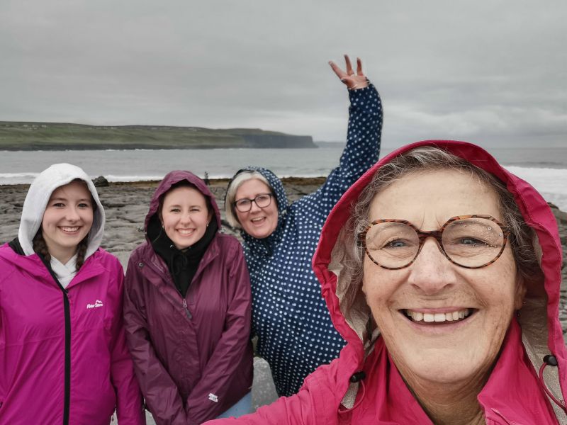
At the airport, going to the tarmac, and on the tarmac about to board the plane!
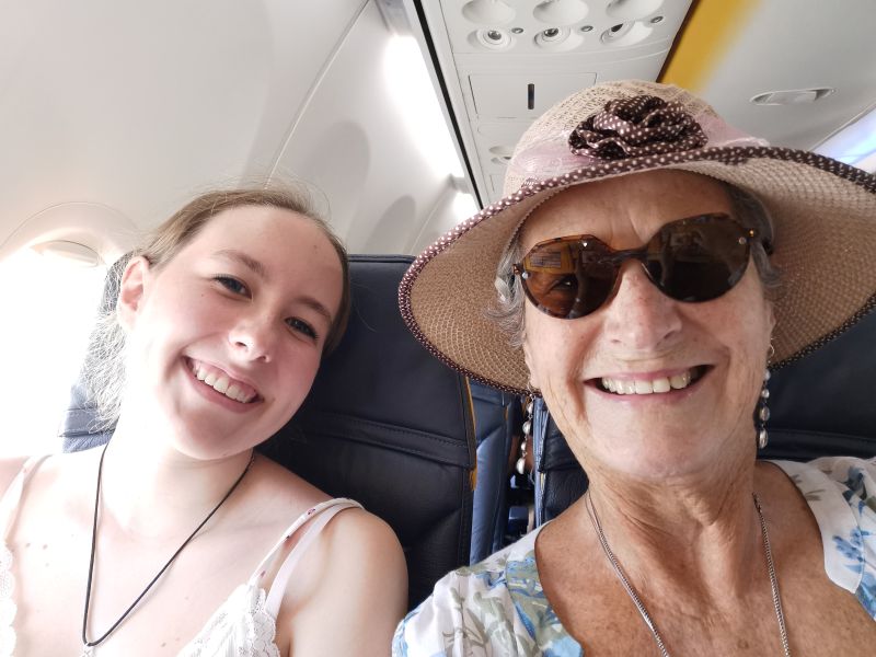
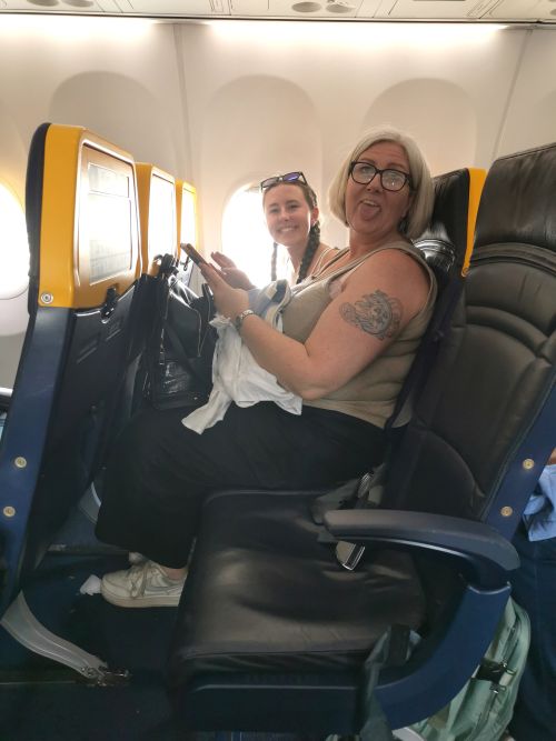
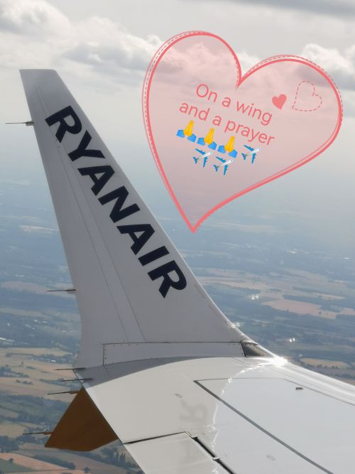
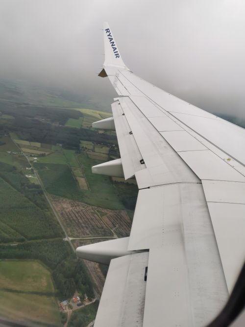
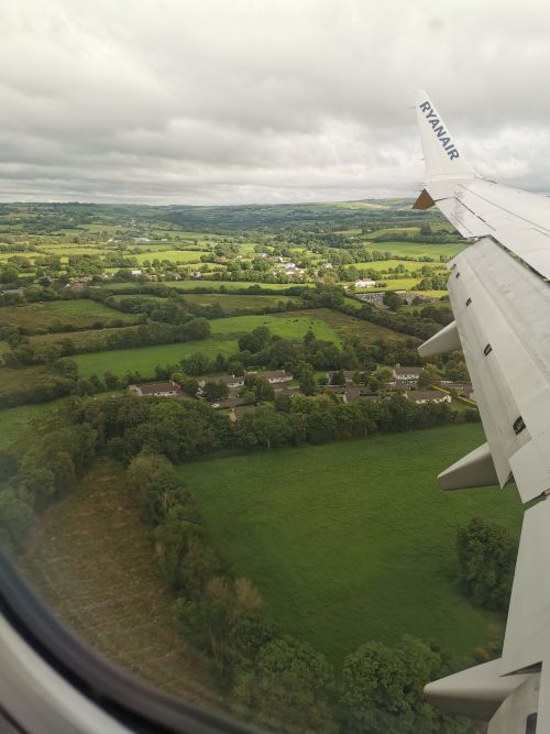
On the plane, leaving, England, coming out of the clouds and flying into Kerry Airport and the sign to Tralee
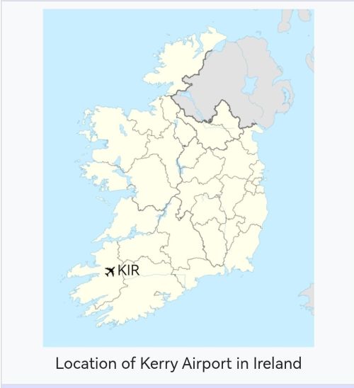
We flew to Kerry Airport (also called Farranfore Airport) in Farranfore, County Kerry. Situated between Tralee and the ‘Ring of Kerry’, we flew down through the thick clouds and over the rolling green hills, forests, and farms. Yes, Ireland is as green as you hear in stories, and we enjoyed seeing it from the air before we landed. We took a taxi to Tralee, where we stayed for one night. Situated on the northern entrance to the Dingle Peninsula, the purpose of our stay was twofold; first, to enjoy this beautiful town and second, to visit the church where Dionee’s ancestors, Daniel and Joanna, were married in 1875, before leaving to settle in Aotearoa New Zealand.
Exploring Tralee
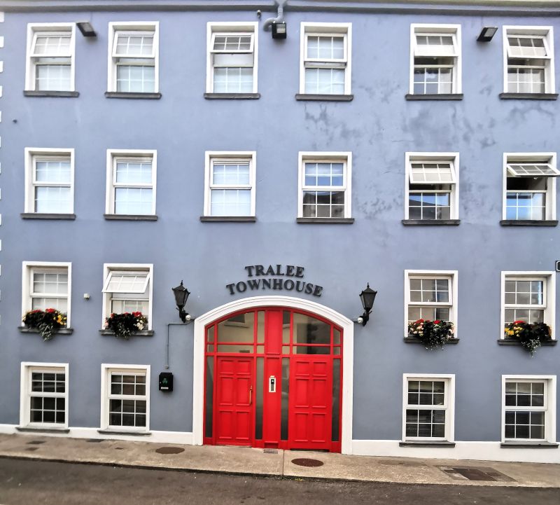
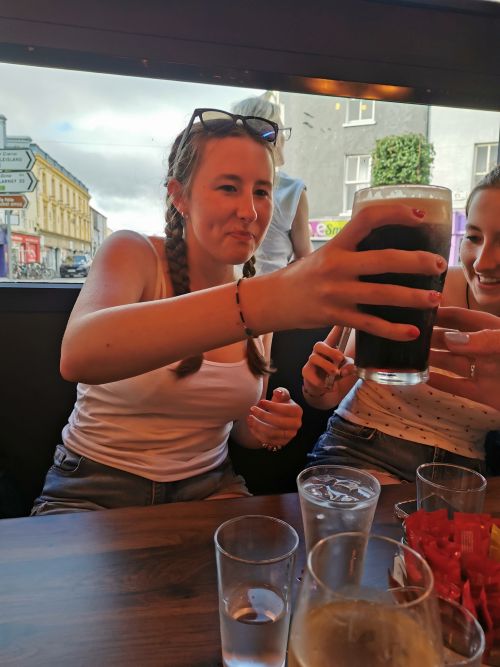
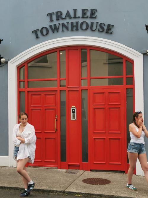
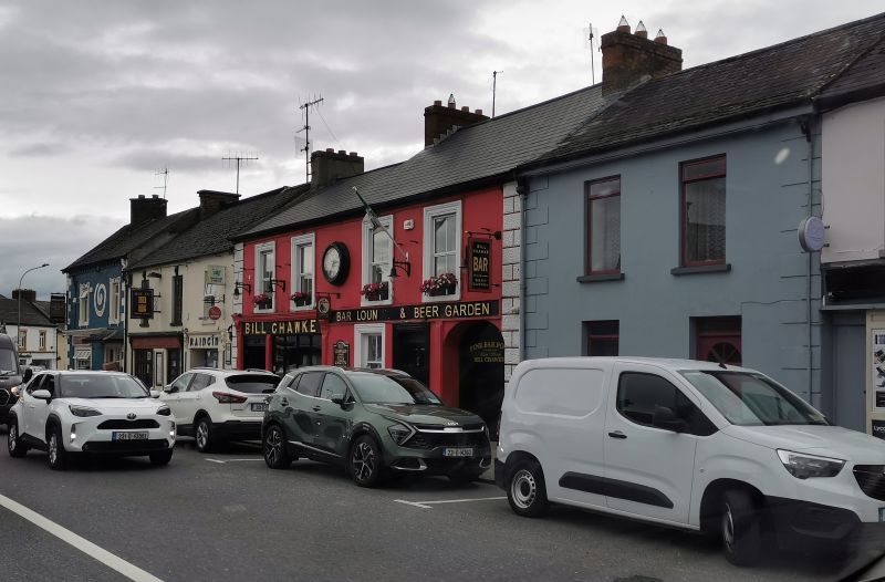
After we checked into ‘Tralee Townhouse’, we explored the locale. The trading day was winding down but we walked around the streets and stopped at ‘Kirby’s, The Brogue Inn’, for a nice meal. Dionee and Francesca enjoyed Guinness, the famous Irish ‘black stuff’ drink loved by many.
Remember to open up the groups of photos to see them fully!
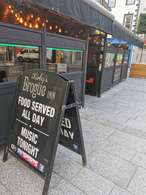
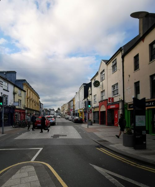
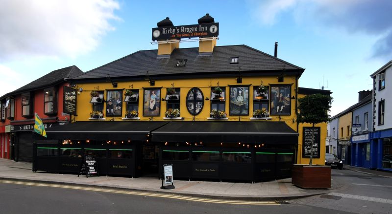
Kirby’s Brogue Inn and the view down the street from the door
Originating in the brewery owned by Arthur Guinness in Dublin in 1759, it was described as stout and, exactly 10 years later, Guinness first exported its ale in 6 and a half barrels to Great Britain. It is now brewed in 50 countries and can be purchased in over 120 countries.
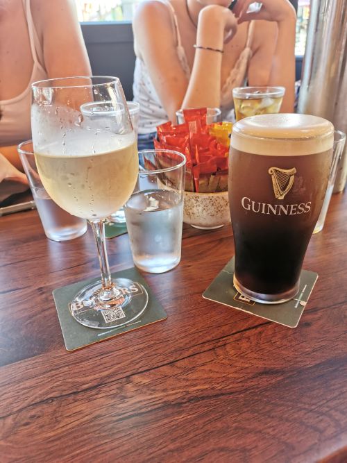
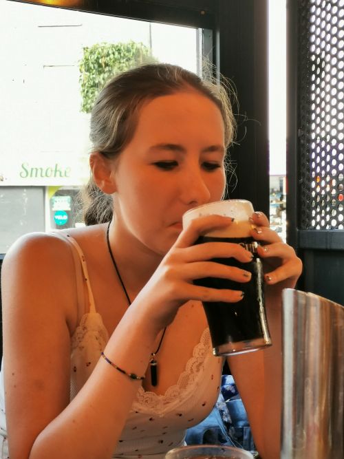
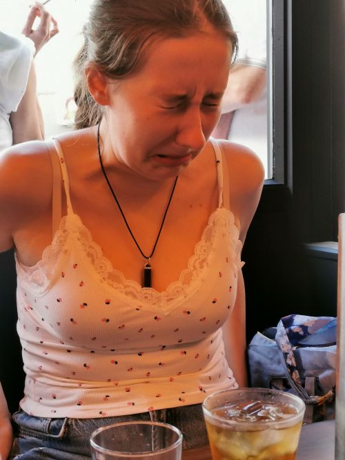
Tasting Guinness in ‘Kirby’s Brogue Inn’
With a distinctive dark colour and signature creamy head, the flavour is described as complex yet balanced, with roasted barley notes like coffee and chocolate, but having a sweet velvety texture with a clean bitterish finish. Rich, creamy, smooth, velvety, malty, roasted, bitter-sweet and iconic are some descriptors I found and, having tasted it, I would agree.
Discovering some history about Tralee
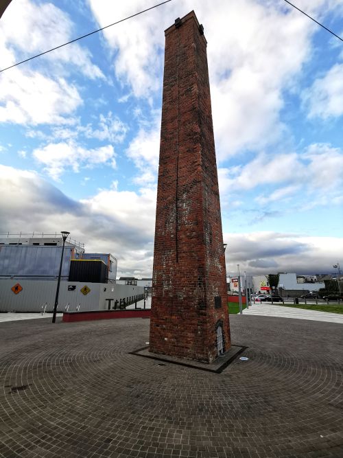
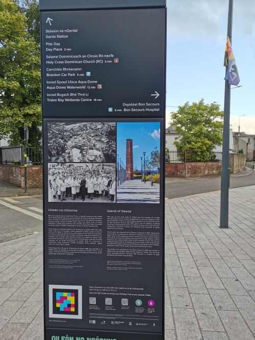
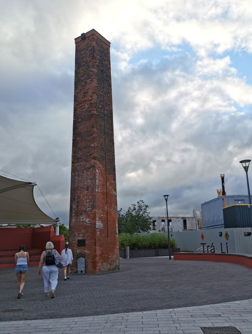
On the way back, we saw a tall brick chimney in a large public urban space called ‘Island of Geese’ (named after the street bordering it) in an area near our townhouse, and so we went to take a look. Reading a little of the history on an information board, we discovered it was a monument to the town’s former prestigious ‘bacon factory’. After it closed in 2008, the area was derelict for some years before the site was regenerated, then gifted to the people of Tralee, where the early 20th century chimney has become “a symbol of past prosperity and future regeneration”. (quote taken from the information board). The area is now used for hosting events, the Rose of Tralee Civic Welcome, Christmas markets, and the Tralee food festival.
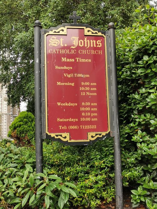
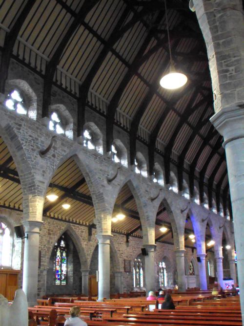
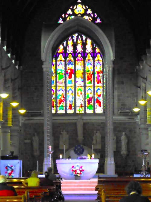
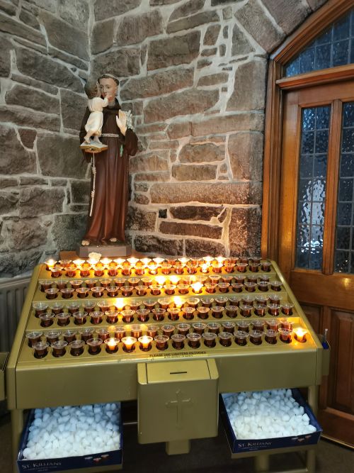
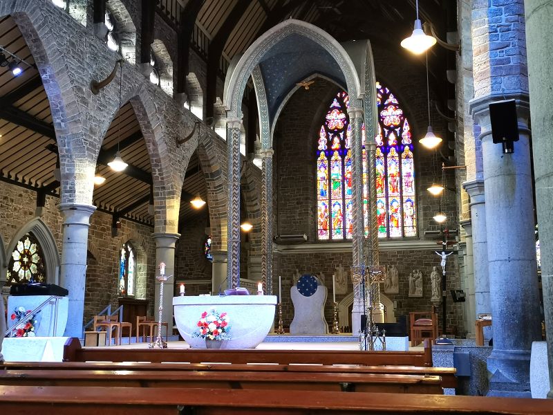
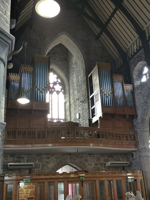
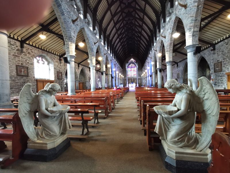
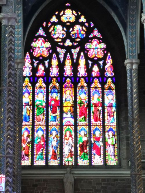
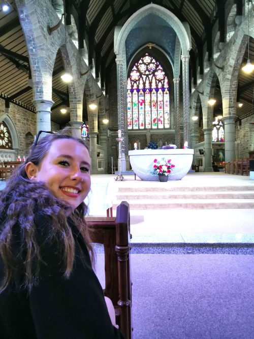
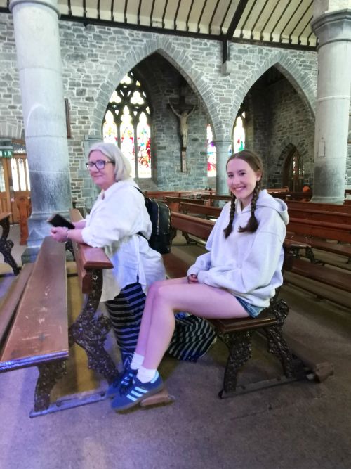
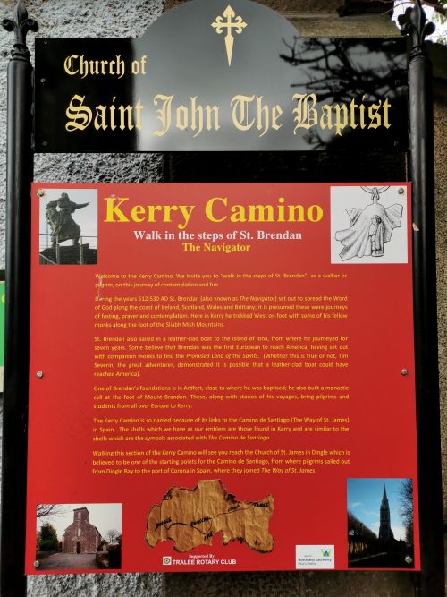
Visiting St John’s Catholic Church, Tralee
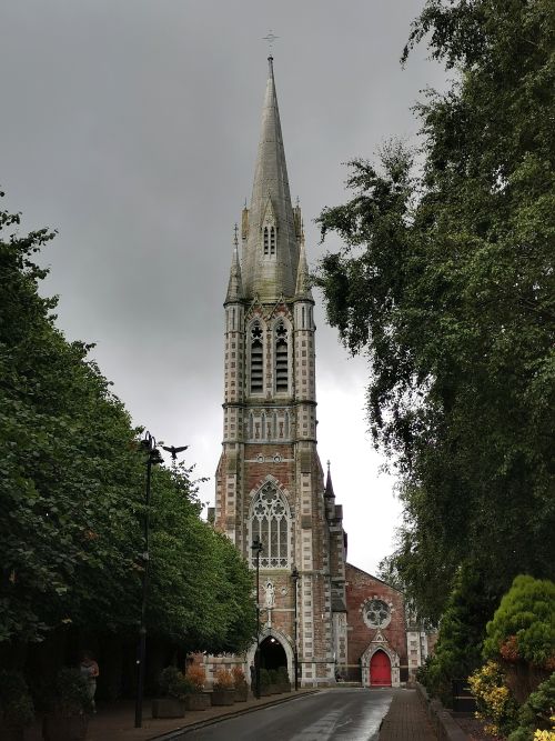
The next morning, our first destination was a nice walk to St John’s Catholic Church where Daniel and Joanna married. We enjoyed spending time in this beautiful church with lovely naves and stained glass windows. We lit a candle, said a prayer for the ancestors, and sat in silence. After some time we got ready to leave, noting that there were quite a lot of people arriving and thought maybe a Mass was about to begin. When we exited the church, we realised there was a funeral about to start. A man standing to the side, who actually looked a little like Dionee’s uncles, came up and spoke to her in a way that suggested recognition, which we found amusing!
Remember to open up the groups of photos to see them fully!
A little about Tralee:

The town of ‘Tra Li’ was founded in 1216 by Anglo-Norman magnate John FitzThomas Fitzgerald, under whose ‘reign’ it remained until the Denny Family took over in the 16th century. A mix of winding medieval and Georgian lanes and streets were established before the Desmond Rebellions against Queen Elizabeth I, which culminated in the medieval town being burnt in 1580 and the granting of the town to Edward Denny. The town continued to develop into a market centre, where its evolution now sees Tralee as the capital of County Kerry. It is a cultural hub known for its textiles and bacon, heritage events such as the Rose of Tralee, and landmarks like the Blennerville Windmill. The Windmill is a fully restored, working, 18th-century windmill with a visitor centre and exhibitions on the history of milling. The Rose of Tralee is an international annual festival which celebrates Irish culture with parades, markets, and the crowning of the Rose of Tralee. It is a wonderful base for exploring the Ring of Kerry, the Wild Atlantic Way, the Dingle Peninsula, and the Killarney National Park.
Click here to read about Tralee:
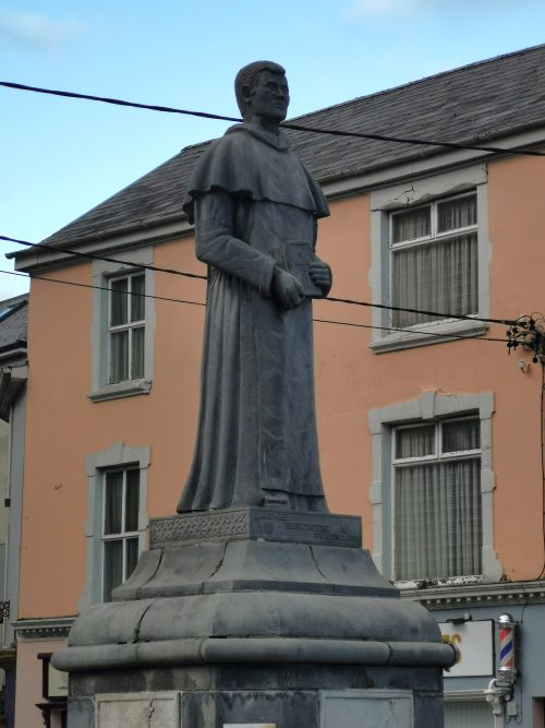

The Dominican Friar Statue, near the Dominican Church Tralee celebrating their presence in the area since 1243 (not the most famous statue – but one near where we stayed)
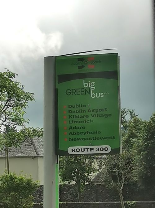
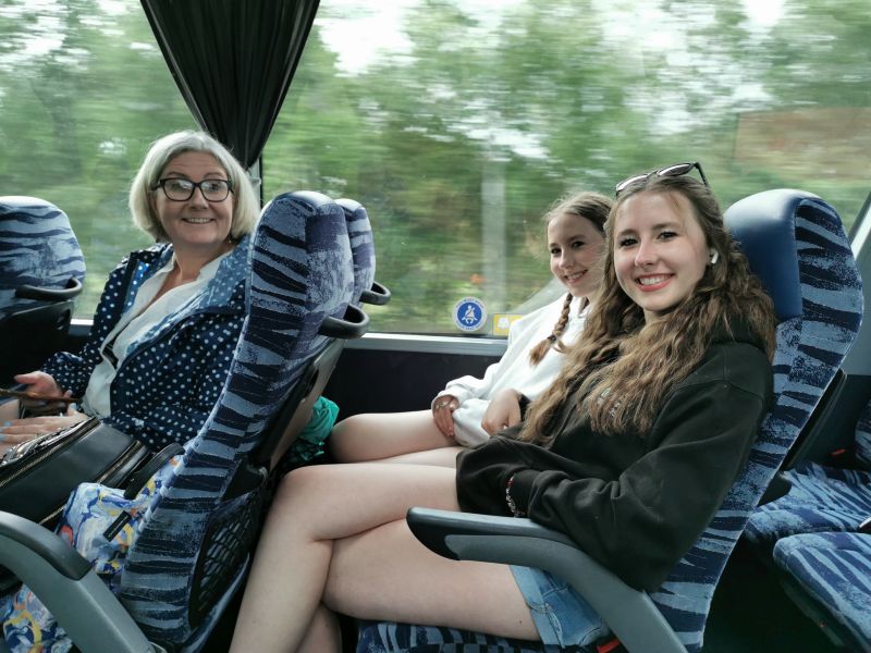
The bus ride to Newcastle West
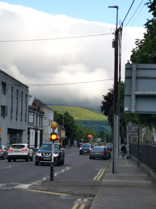
Leaving the Tralee Townhouse, finding the bus stop and the street opposite
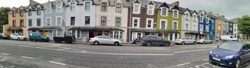
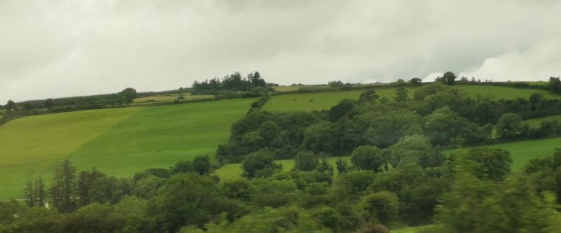
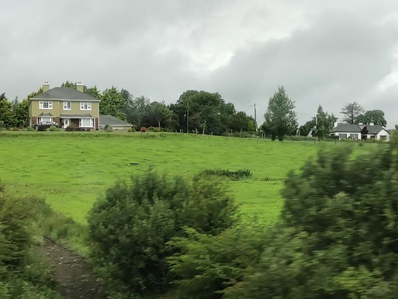
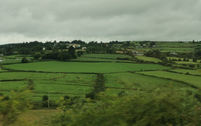
Later, after locating our bus stop opposite some colourful houses near the edge of town, we made our way to Newcastle West. The drive took us through lush green rolling hills interspersed with a number of new and big houses on farms along the way.
Remember to open up the groups of photos to see them fully!
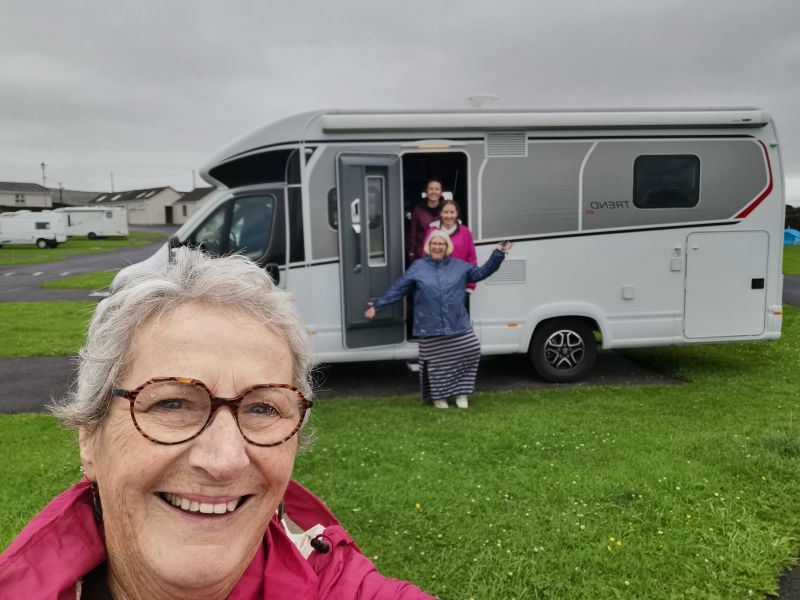
We had lunch, got grocery supplies, and took a taxi out of town to ‘Cara Motorhomes’ where we met the friendly team whom I had booked with. After doing the necessary preliminaries, we drove out of the gate in our campervan, and turned towards the highway, commencing the next leg of our holiday on the ‘Wild Atlantic Day’.

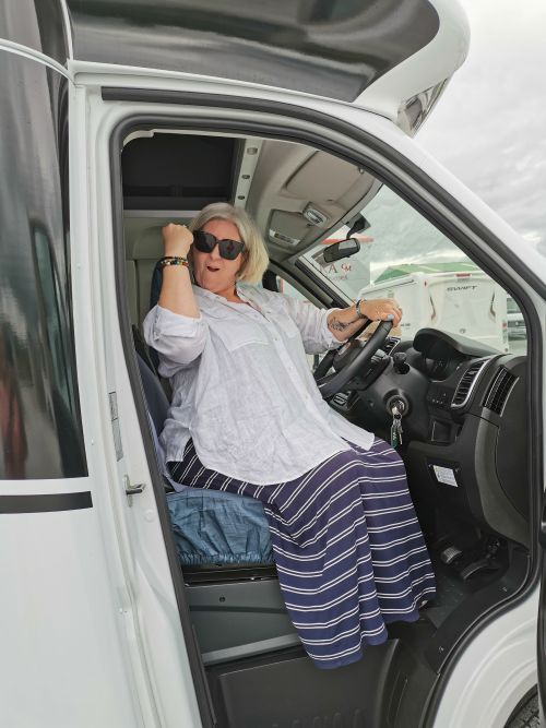
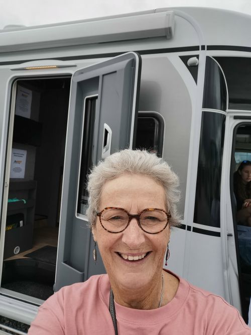
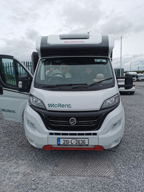
Ready to drive out of the gates of Cara Motorhomes, Newcastle West
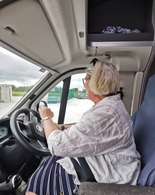
Under way in the campervan with mascots and choosing the right path! Towards Limerick!
Driving to the Cliffs of Moher
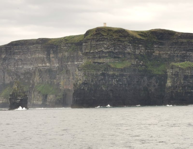
We drove around the outskirts of Limerick and on towards the west coast with our destination of Doolin at the infamous Cliffs of Moher (County Clare). The Cliffs have inspired many generations of artists who have created memories via music, poetry and art. The history of their formation is incredible and has been studied intensively by scientists and geologists. The landscape is mesmerising, and we planned to take a boat trip to view the cliffs from the oceanside.
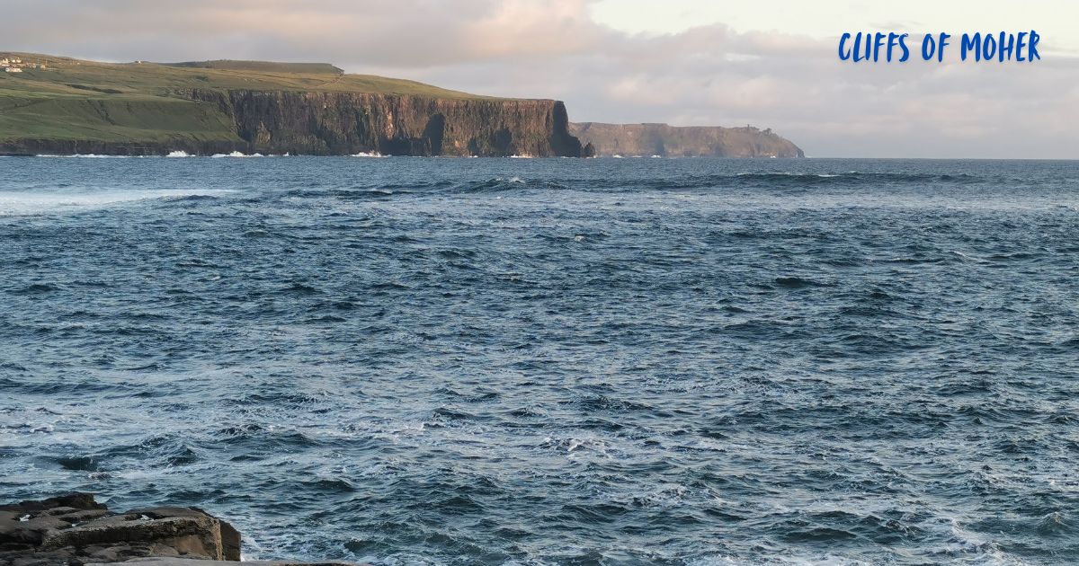
Some views of The Cliffs of Moher
As we drove along, Dionee mentioned that she kept seeing a place name on road signs by the highway, and we laughed when we worked out it was Irish for EXIT (Scoir) and not a place name at all!
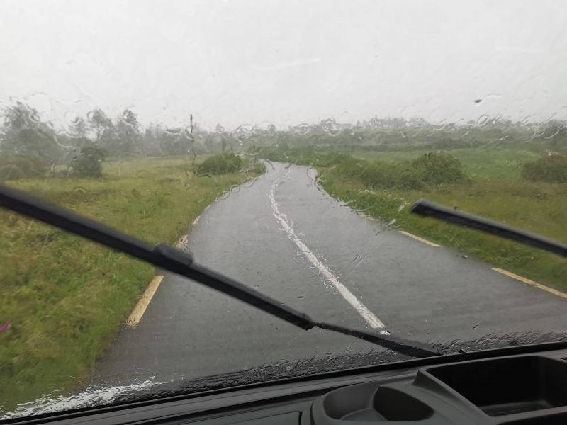
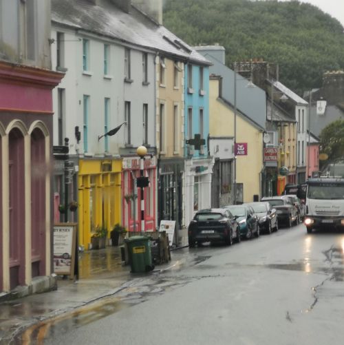
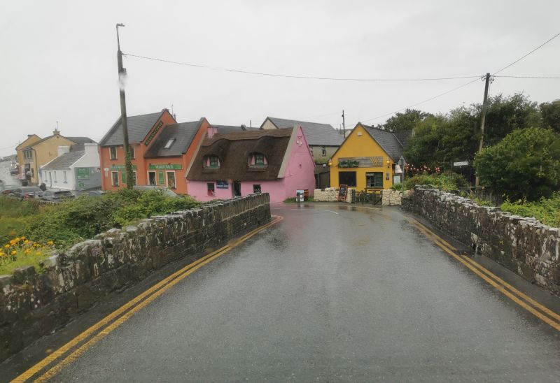
Soon, heavy rain started and, as the roads narrowed towards the coast, we were barely crawling along, hoping we would reach Doolin in time to catch the boat, if the rain stopped. There had been a big storm out in the Atlantic Ocean, and we knew that the weather for this trip would be ‘patchy’, meaning it could be nice but with some rain and cold wind, and mist, but sometimes sunny too. Driving into Doolin, over a little bridge with the houses painted pink, yellow, orange, and white, with thatched roofs and cute windows, the pelting rain stopped in an instant. It felt like a miracle.
Remember to open up the groups of photos to see them fully!
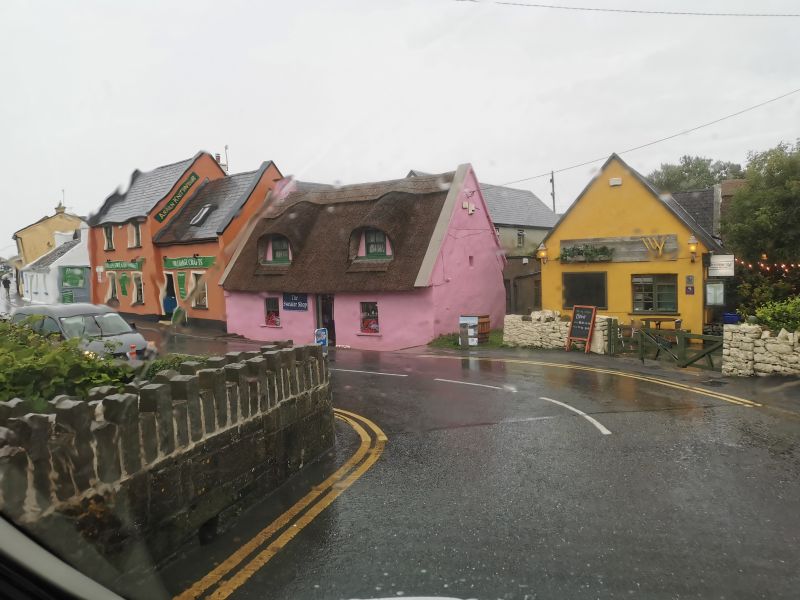
Wet Wet Wet!! arriving in Doolin
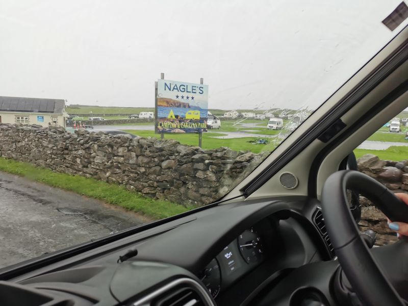
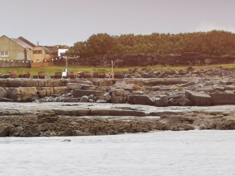
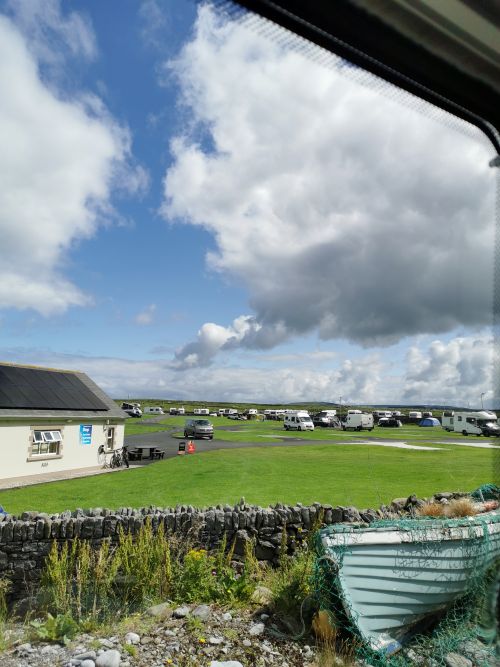
(Right click on ‘HOME’ to open in a new window and see the Nagle’s Camping & Caravan Park)
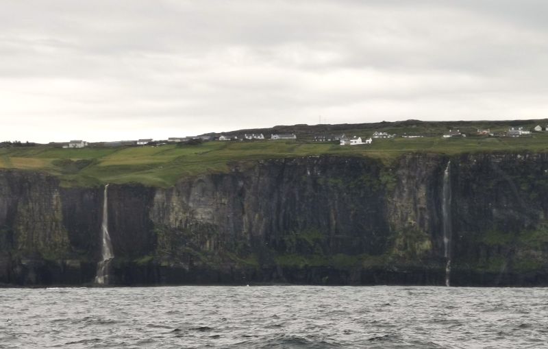
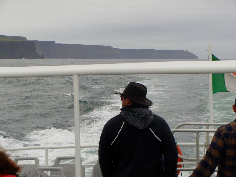
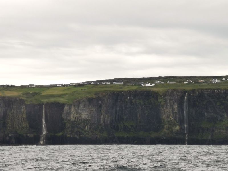
We parked the campervan in the camping ground, and I phoned to see if the boat was still going out as the sea looked rough and the skies ominous! Yes, came the reply! And so we booked and ran down to the boat harbour nearby, passing previous passengers soaked to the skin from the heavy rain. Getting there just in time we told the ticket collector we had booked just 10 minutes before and found out that the person on the end of the phone had booked us for the middle of July and not that day. We laughed as he said, “Jump aboard, and we will sort it out”. We motored out of the harbour, rocking and rolling on the tide after the storm. We went to the top of the boat and saw the most magnificent views of the cliffs with white and pastel painted houses on the sloping green hills where rivers of water flow over the lower cliffs in full waterfalls, landing on the black rocks far below.
Remember to open up the groups of photos to see them fully!
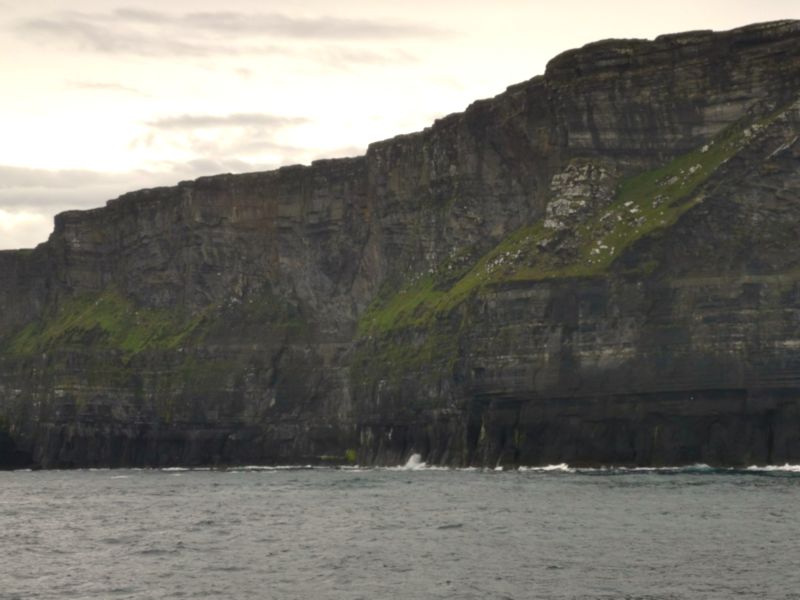
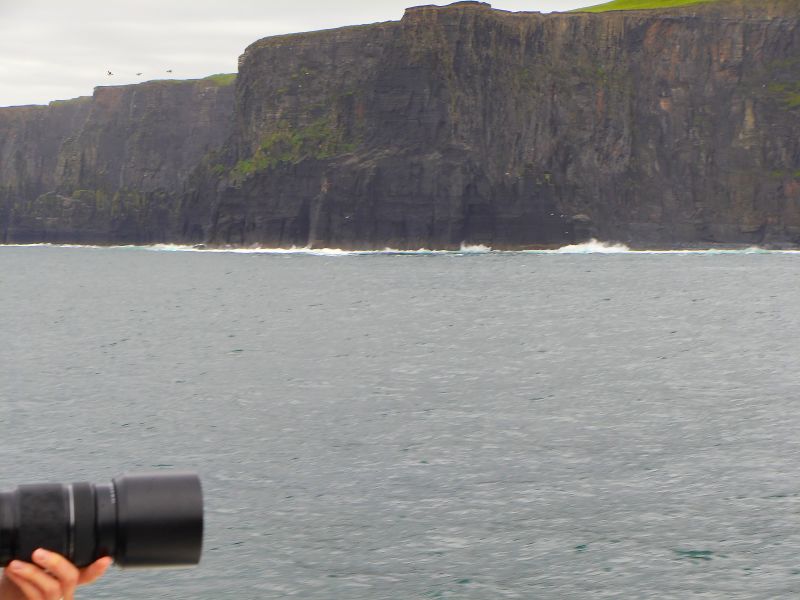
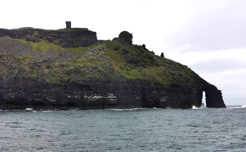
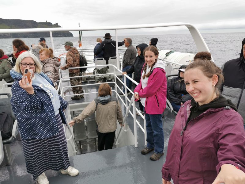
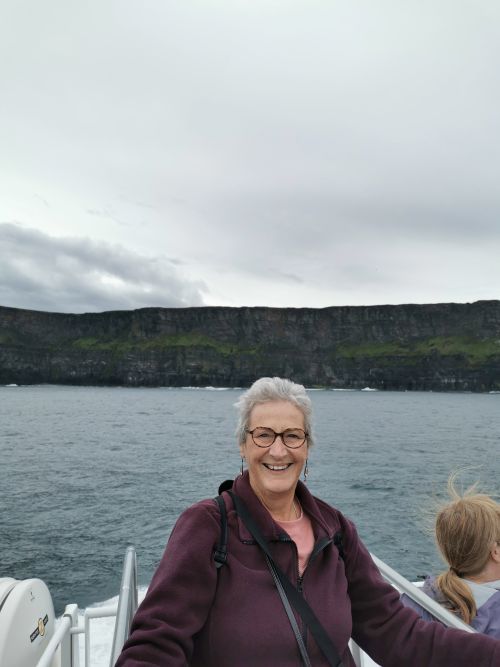
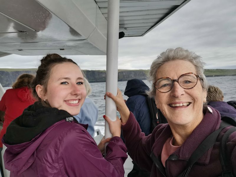
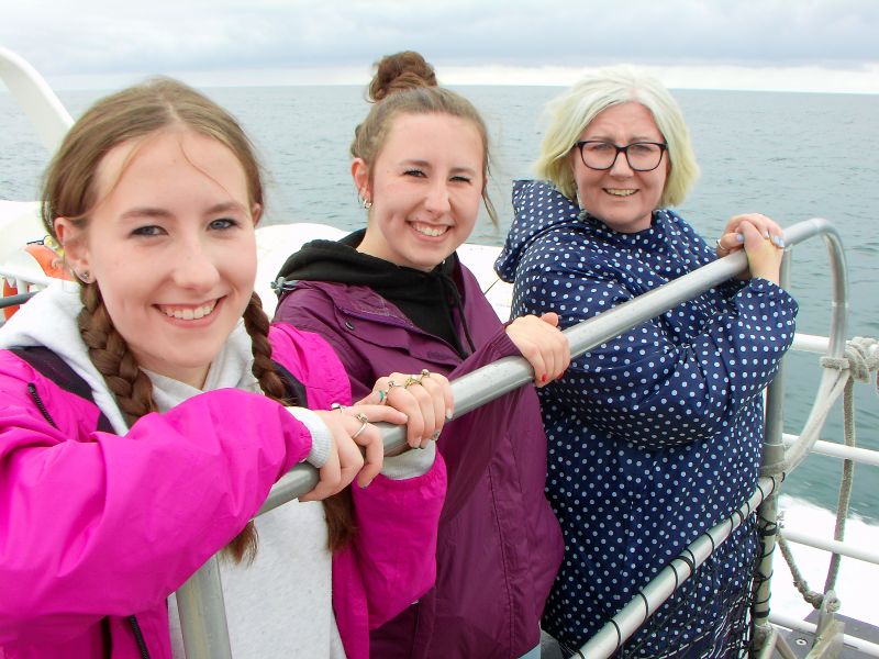
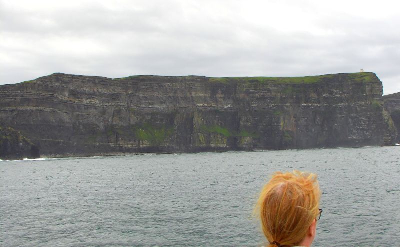
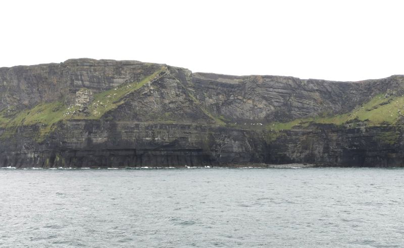
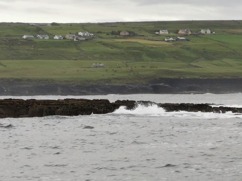
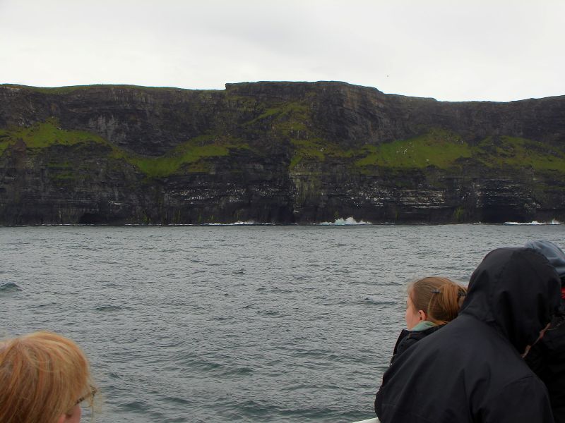
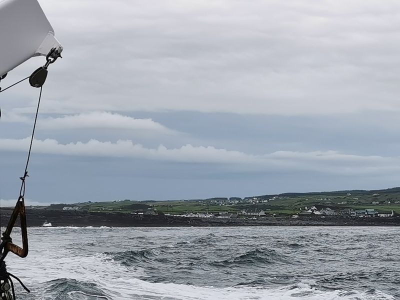

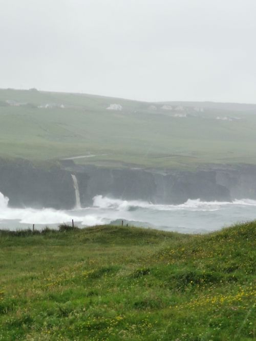
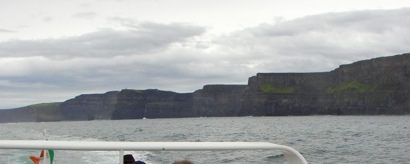
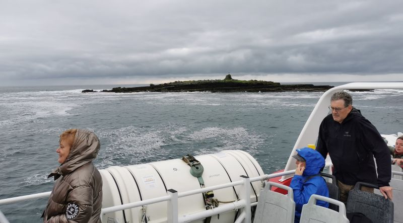
The cliffs rose higher and higher, and soon we were far from the shore as we bobbed over the waves, racing towards our destination below the ‘Moher Fort Site Telegraph Station’ about 15km (10mi) down the coast. This was a sharp promontory, and the wild seas still bucked and kicked as we arrived, listening to the captain’s narrative about the area. The cliffs, now black and glistening from the rain, which was threatening to fall again, were a formidable sight that wowed everyone on the boat. We moved closer to the cliffs and slowly glided over the waves as we moved back up the shoreline towards Doolin. There are several stacks of rock which, at one time, were connected to the land. One famous stack that we spent time observing is the ‘An Branán Mór Sea Stack’. There is also the ‘Harry Potter Sea Cave’, where ‘some filming’ of one of the movies (in 2010) and the ‘Princess Bride’ (1987) was made. The cliffs contain Ireland’s largest seabird colony, of which the popular Puffins are one such attraction. It was a fabulous trip, and Dionee said it was amazing to see the cliffs from the sea rather than from on top, which is where she had last seen them from more than 20 years before. The waterfalls were amazing as we glided back into the harbour and stepped off the boat onto dry land. From the pier at Doolin, you can see the Aran Islands and Crab Island, where the coast guard station, which served the area in the 1830s, can still be seen on top of the sloping grey blocks of rock.
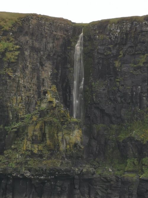
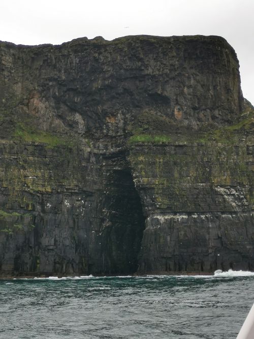
Crab Island, waterfall, amazing cliffs and the cave where filming of scenes of movies were filmed!
Click this link to read about the Cliffs of Moher:
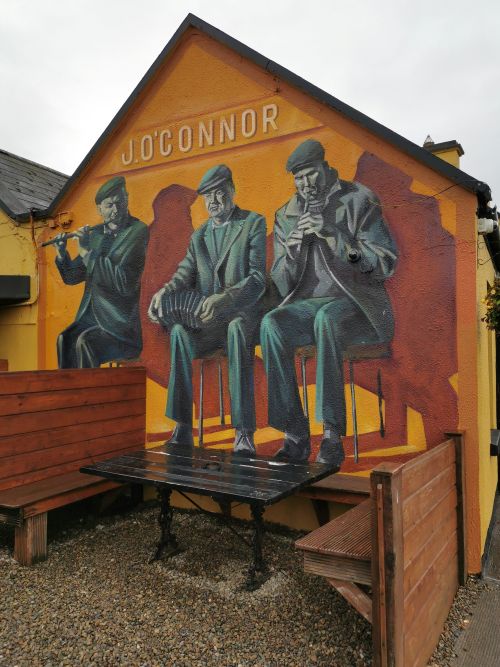
Dinner at Gus O’Connor’s Pub, in Doolin
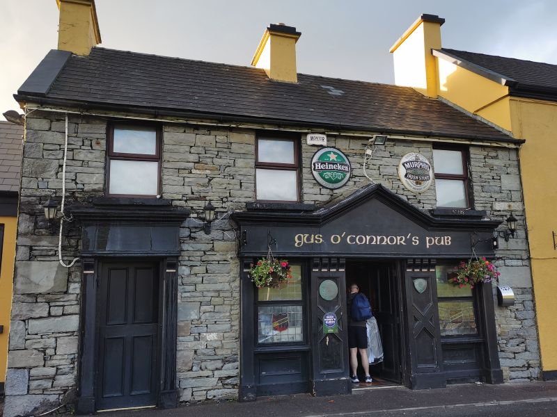
Later in the evening, we walked about 1.3k (0.8mi) back along Fisher street towards the village and had dinner at the very busy Gus O’Connor’s Pub, a warm, inviting tavern. Opened in 1832 it offers traditional Irish food and live music. The food was delicious, and we walked back to the village in the clear, dry evening air, with the promise of nice weather the following day!
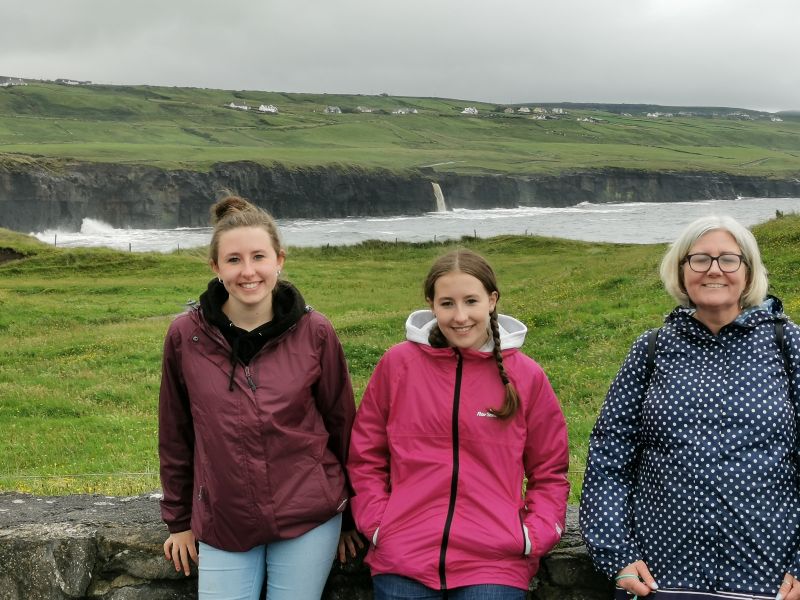
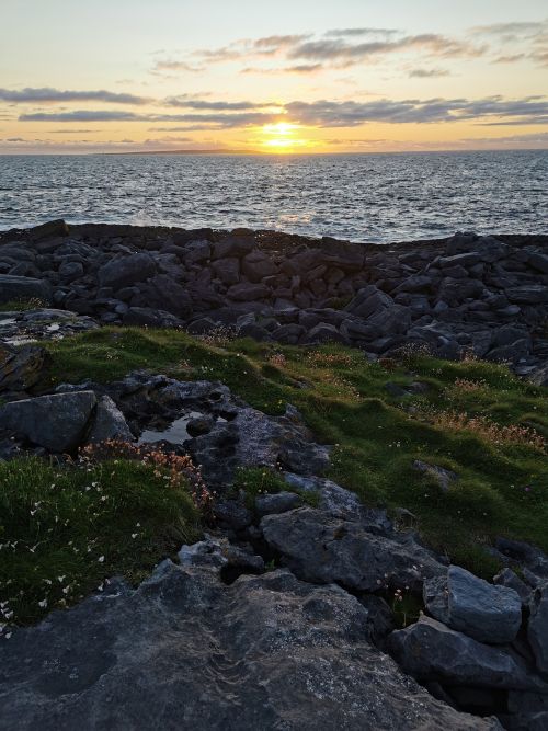
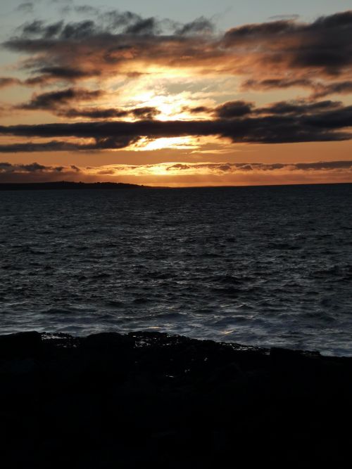
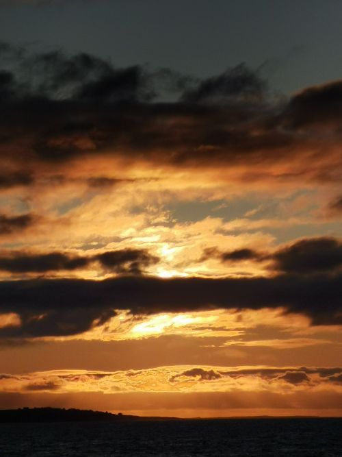
A sunset walk at Doolin

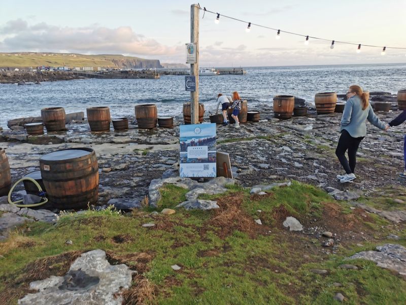
The sun was setting over the western horizon past the Aan Islands, and so we walked over the rocks past the seaweed baths in barrels and towards the edge of the cliffs to watch the sun go down.
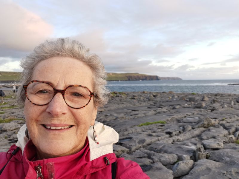
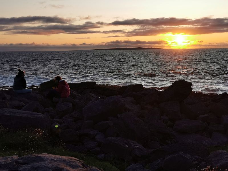
Walking to see the sunset and striated rocks at Doolin
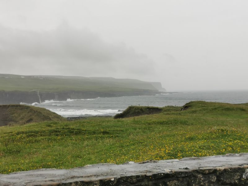
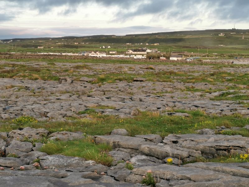
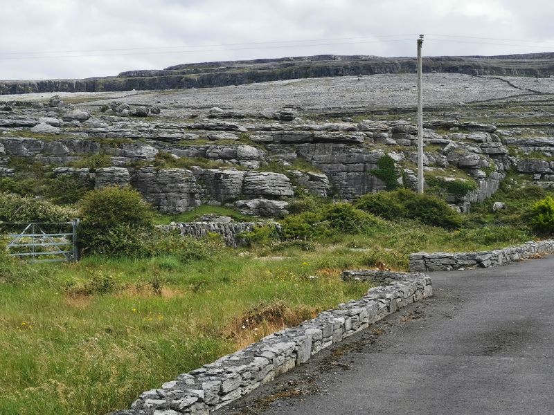
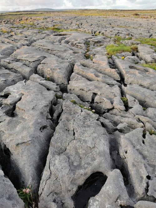
The landscape was amazing, and the photos show the fissured rocks affected by millions of years of geological creation. The area sits within the famous UNESCO Global Geopark, ‘The Burren and Cliffs of Moher’. The following day, when we drove up the coastal road towards Black Head and towards Galway, I can only say the rock formations were almost beyond description. The best I can do is say, they were stark, grey, lavyered, striated, fissured, and high, developed over millions of years and creating such a spectacle of what I can only call natural art.
Remember to open up the groups of photos to see them fully!

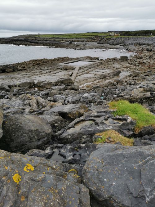
Rock formations, the salt water pool and views of the coastline around Doolin & the Nagel’s camping and caravan park
About the Burren:
This amazing Geopark setting on the West Coast of Ireland, south of Galway, is remarkable for its geology, ecology, and archaeology, with agricultural history that has shaped the food, art, music, and culture of the region. ‘The Burren’ (An Bhoireann [Irish] – a rocky place) was underlain by rocks deposited during the Carboniferous Period in the earth’s early development about 330 million years ago when Ireland was situated south of the equator. The rocks drifted northwards, shaped by massive global environmental changes, great earth movements, exposed to wind, water, and ice, to form what we see today. The stepwise mountains developed over different periods of time in this ancient karst landscape. The rocks of ‘The Burren’ have recorded the history of the interactions of the waves, currents, tides, and wind. The limestone rock took about 20 million years to form, and fossils, skeletons of organisms which were former inhabitants of the ancient tropical sea, are found here. Tectonic stresses crashing into other land masses, uplifting, twisting, and folding occurred, tilting the land. ‘The Burren’ has been subjected to several ice ages and ice of about 200m (656ft) and moving glaciers pulled boulders and large rocks called ‘erratics’ from the landscape and deposited them elsewhere.
The unique landscape, magnificent cliffs (the 200m/656ft high Cliffs of Moher), lakes, caves, plateaus, and hills are of extraordinary beauty. The most famous cave is the Doolin Cave, discovered in 1952, with its 9m (30ft) gigantic stalactite, which is thought to have taken more than 70,000 years to form. An area not too far from the Doolin caves houses several spa wells discovered in the early 1700s. The waters of these spas were analysed and certified to be medically beneficial. Single farmers would flock there after harvest to relieve their sore bodies and with the hope of finding a wife.
There is evidence that 6,000 years ago, prehistoric hunter-gatherers lived in ‘The Burren’. Hut sites, kitchen middens (scrap heap), and primitive tools have been found by archaeologists in the sand dunes at Fanore Beach. However, discoveries in caves suggest people lived in the Geopark as long ago as 12,500 years, residing along the coast and building cairns, communal cooking places, hill forts, along with ritual and burial sites called Dolmens. One Dolmen, dated back to 5,800 and 5,200 years ago, had 36 individuals in its tomb.
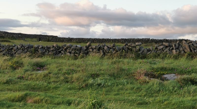
Since the arrival of the Neolithic people in ‘The Burren’ 6,000 years ago, farming of sheep and cattle has continued. Churches, forts, and monasteries, along with remnants of virtually unchanged dry-stone walls, are dotted on the landscape. Seaweed has always been gathered along the coastline, and during the famine of the 1840s it became an important food during extreme scarcity.
The Burren Way is a 123km (76mi) walking trail meandering across the Geopark as Green Roads, paths, ancient cattle droving, and forestry roads. Arctic, alpine, and Mediterranean flowers are found growing side by side in this biodiverse environment. Irish butterfly species and various types of birds are also found among this diverse vegetation.
(Information from www.burrengeopark.ie ‘Stone, Water & Ice’ booklet)
Leaving Doolin
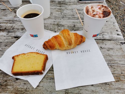
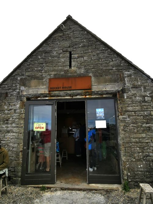
We slept our first night in the campervan and in the morning had a light breakfast at the cafe, ‘Rocket House’, attached to the Nagel’s Camping & Caravan Park before driving to our next stop at Clifden. We planned to hug the coast and stop frequently to enjoy as much of the Wild Atlantic Way as possible. Our route will cover but a part of this coastal path, and you have stepped into the first days with us; now come along for a ride!
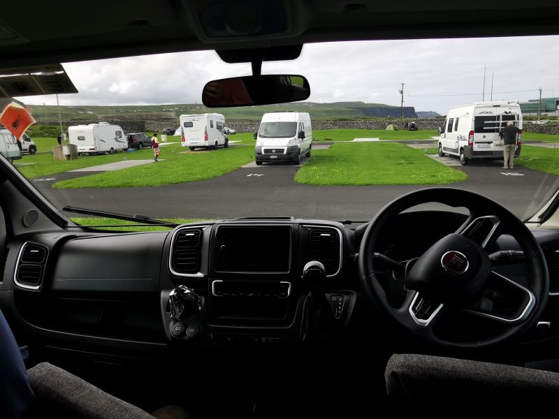
The Cliffs of Moher as seen from the camping ground, in the van and leaving Nagel’s camping and caravan park with the Burren way in the distance