
Once again I wish to acknowledge and thank my wonderful friend Shoba Nayar who edits my writing, and who’s careful eye and amazing suggestions helps bring alive, stories from our travels!
Where in he world are we? Southern Spain
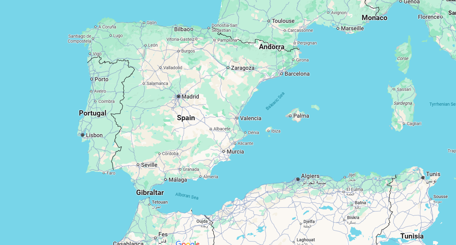
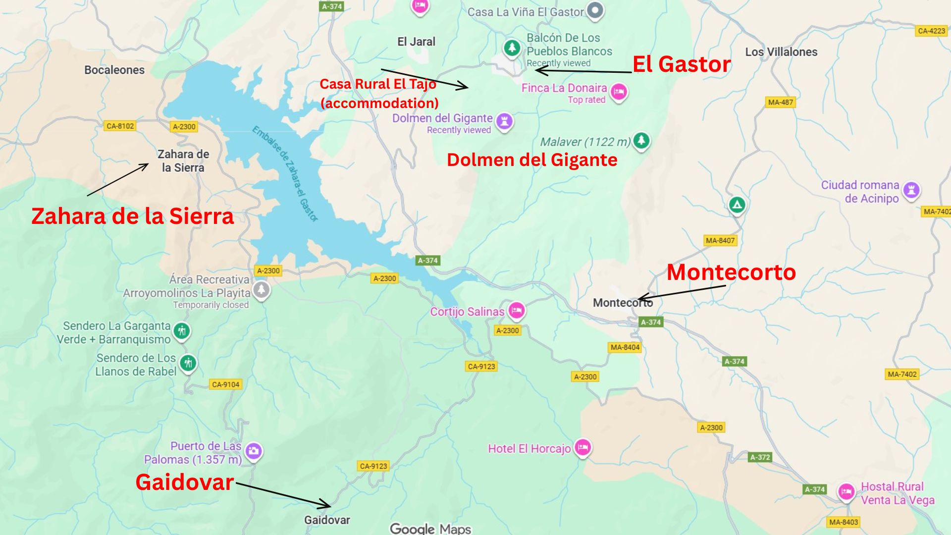
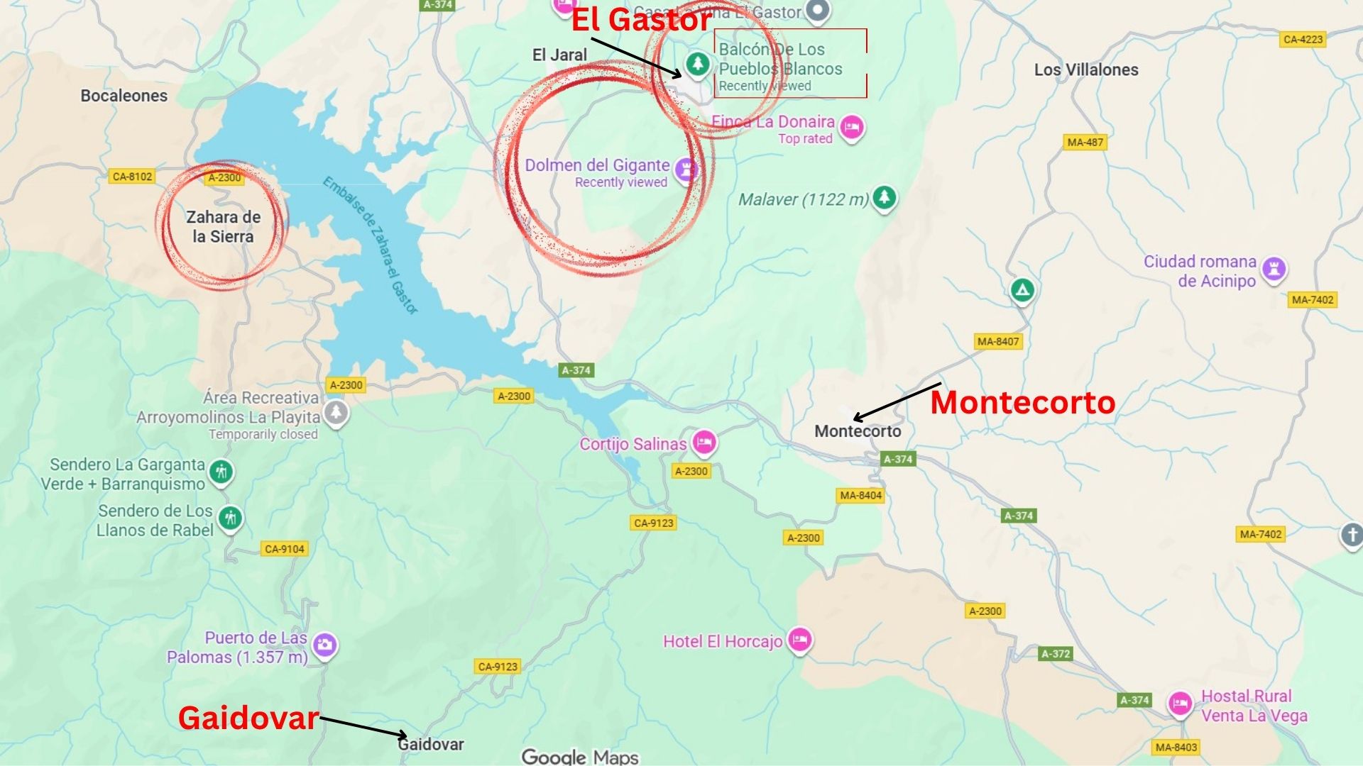
Some maps of the area as mentioned in the story!

Following an amazing 5 days exploring the Villaluenga del Rosario region, we were ready to move to our next location and adventure! (see my last story – click here 👇) https://teresaglobaltravels.com/category/destinations
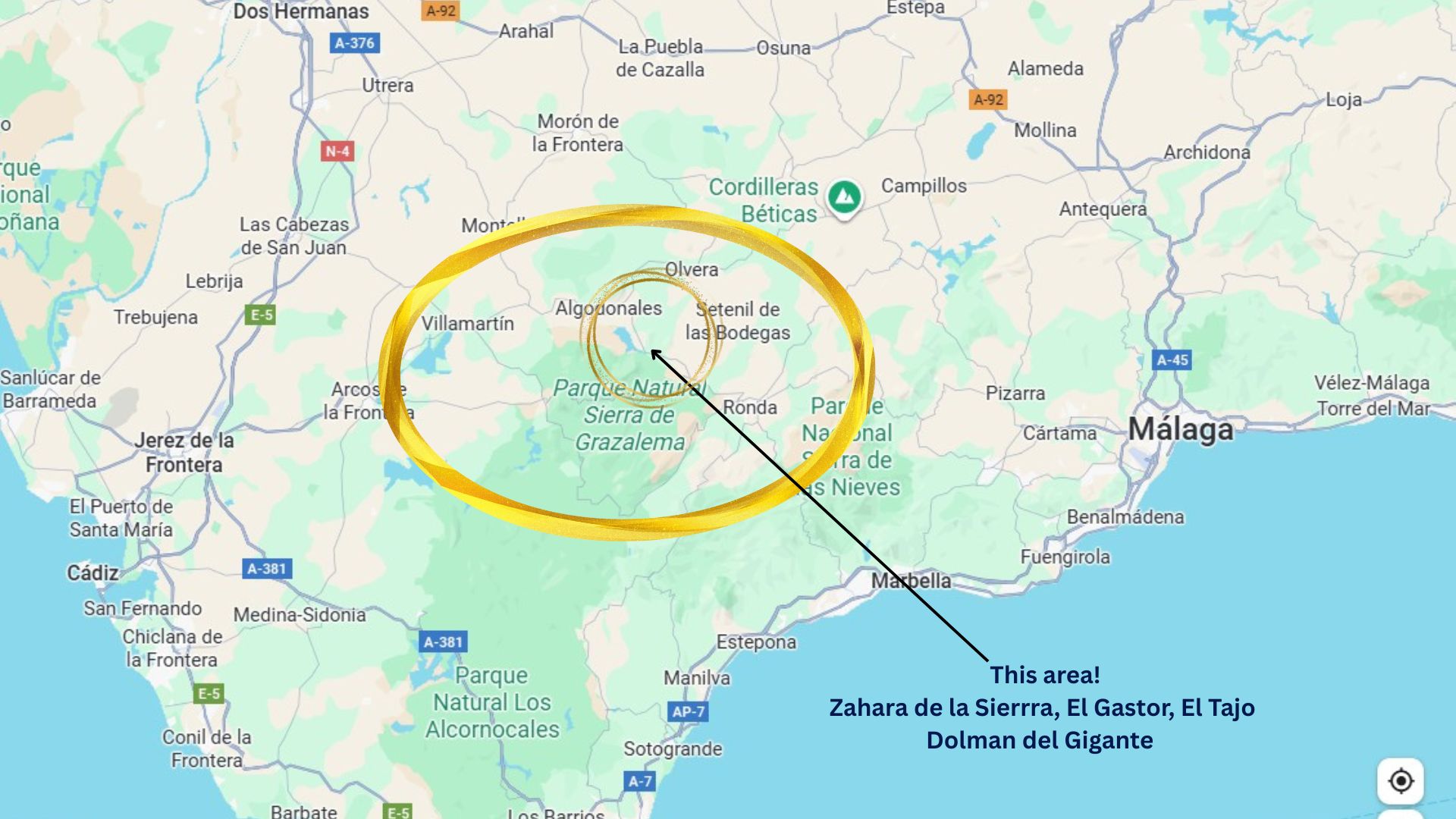
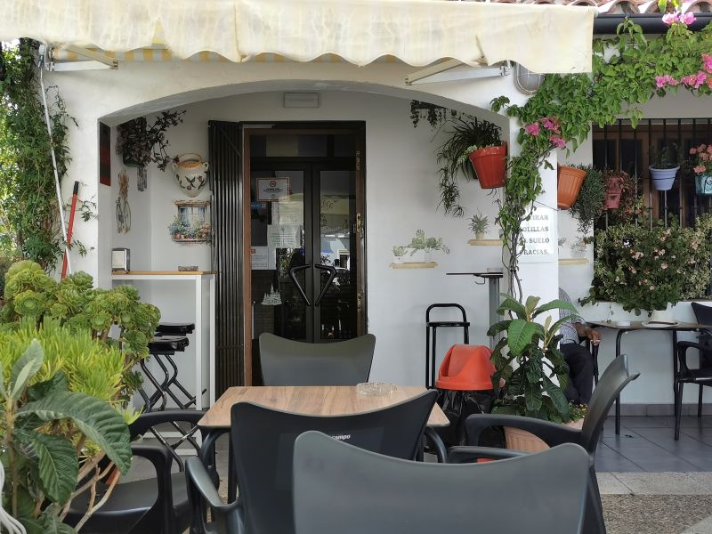
We kick-started our morning with a final coffee at La Posada and farewells to our hosts, and then negotiated the steep streets out of the village. Back on the main road to Grazalema, which by now we knew so well, we branched off just before entering the town and took the road via Gaidovar towards the ‘Embalse de Zahara-el Gastor’ (a lake) and our next accommodation—Casa Rural El Tajo (rural house)—located high on the hills near El Gastor and under the impressive rock formation of Tajo Algarín.
Gaidovar Valley
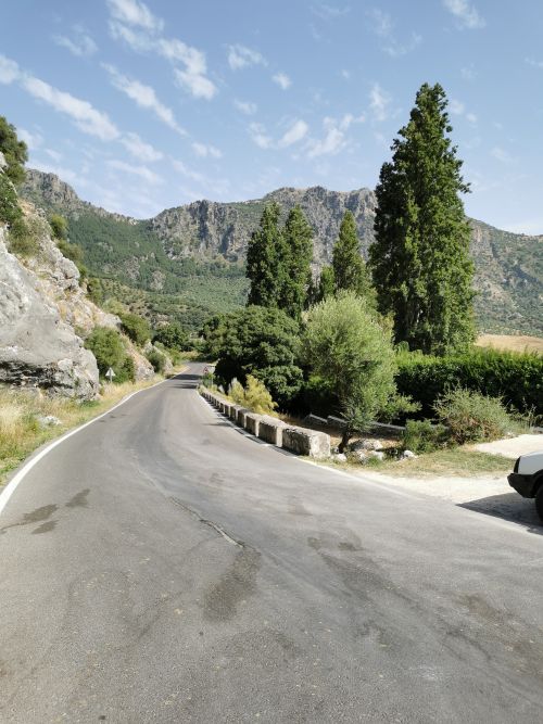
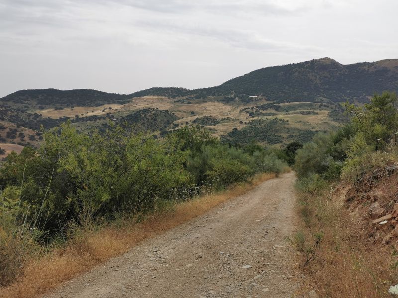
Turning towards the Puerto Chico 827m (2714ft) mountain pass, and a new region of the Grazalema National Park to explore, we climbed the road that wound high up and over the saddle before driving down into the Gaidovar valley. The road is narrow, but the views are spectacular. My only regret is that I didn’t take more photos on this route.
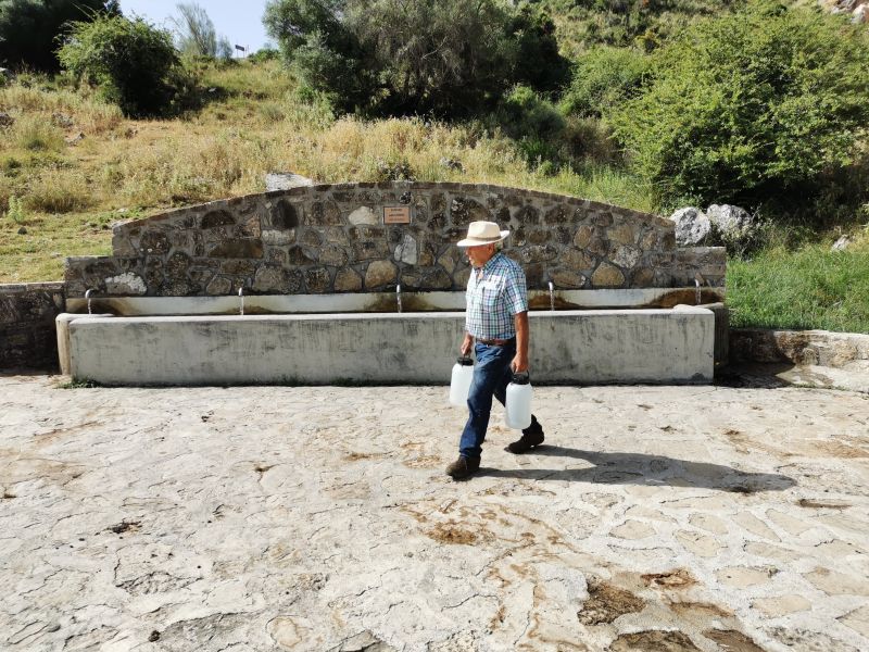
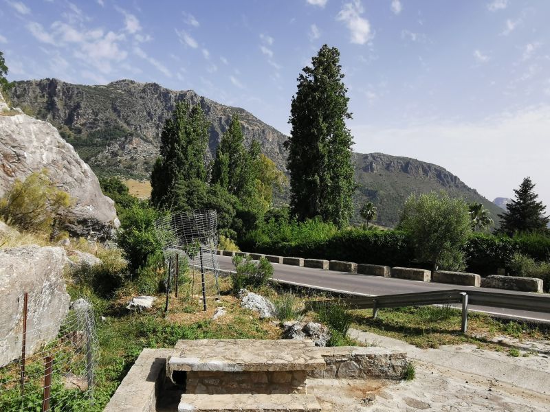
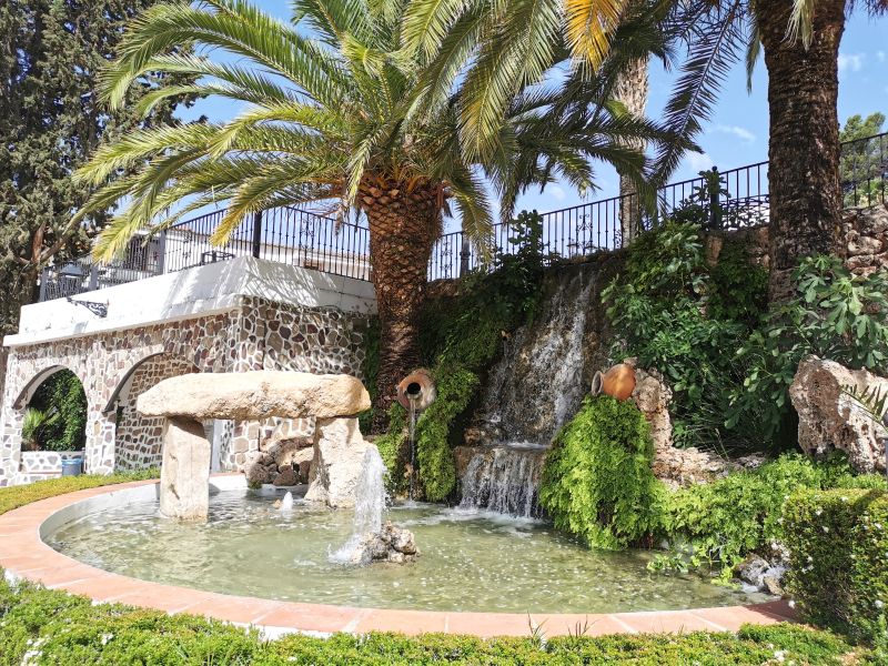
On the way down from the pass we stopped at a very interesting fountain, ‘Aguafría’, also known as Fuentría Fountain, where the Ruta Molinos Harineros (walking tracks) are signposted as the trails cross the main road and pass through car parking areas. This fountain has 5 outlets along the narrow water trough that is used by locals and travellers alike (and, while we were there, a herd of cows who stopped to drink from the fountain!).
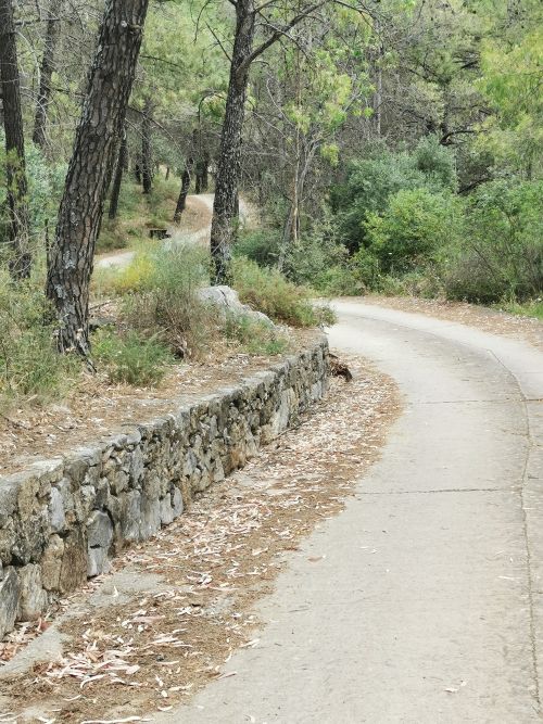
From the car park, the view down the valley was breathtaking but difficult to photograph due to tall trees blocking a good frame! We were able to see the medieval stone road that links Grazalema to Gaidóvar (de la Ribera). Although much of the road has been damaged by time or covered with undergrowth, it can still be used by hikers in the area.
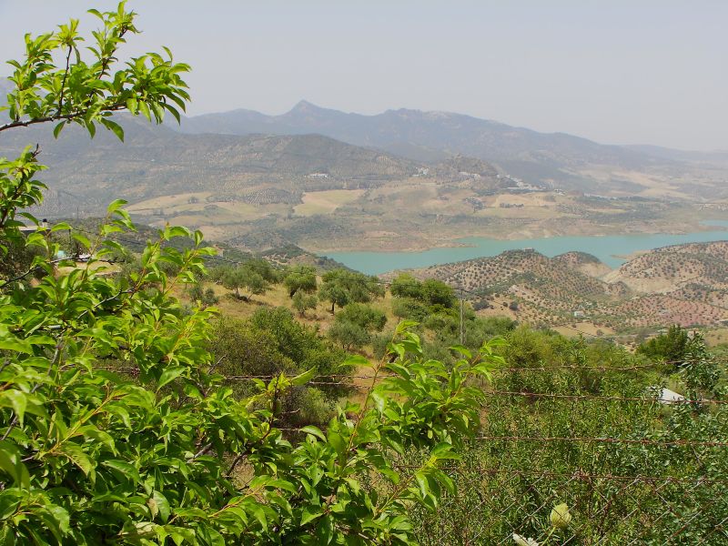
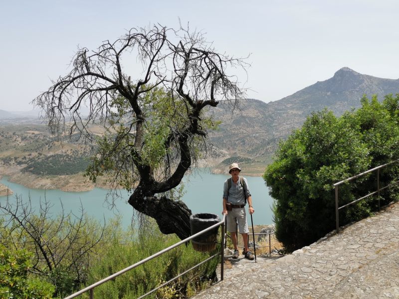
The drive through this fertile valley was beautiful, surrounded by the cliffs, rolling meadows, poplar trees, olive and almond groves, rural houses, farms, and rivers. Historically, there were flour and fulling mills, and factories for felting and blanket making, fueled by the bountiful water supplying the valley. On this ‘Flour Mills Route’, the road passes the Ermita de Huestra Señora del Rosario. Be warned, there are limited places to park and nowhere to stop and get refreshments; but words can not fully describe the canvas of what we saw and enjoyed as we drove toward the ‘Embalse de Zahara–el Gastor. Fed by the Guadalete River, this reservoir was built in 1992 for agriculture and tourism, and resulted in the creation of an artificial beach.
Leaving the car park at the Fuentría Fountain to go down the Gaidovar Valley with Monte Prieto beyond (above)
Montecorto
We still had time before checking in to our accommodation, so we headed towards Montecorto, a nearby town, to get grocery supplies. The village sits on the side of a mountainous hill called Malaver, 1122m (3,681 ft) in the Serrania de Ronda and has its origins in prehistoric Neolithic times. Traces of the ancient cultures that populated Andalucia over millennia can be found, including a Necropolis, Roman theatre, and Moorish castle, which cover major timeframes in the ruling of European history.
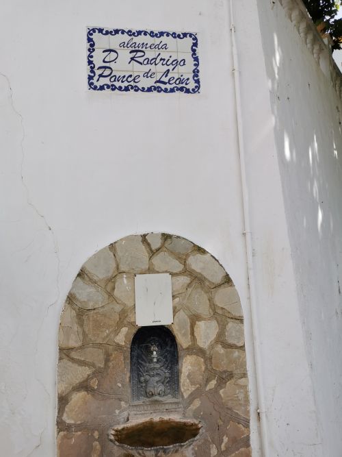
A more modern monument—the ‘Fountain of Dolmen—was built in 2006. Located in the Plaza called Pablo Ruiz Picasso, it stands testament to the history of the town and the rich water supply in the area. This fountain is named after nearby Roman remains on the road to Ronda, ‘Dolmen de la Giganta o del Chopo’, and in the photos you can see a stone replica in the town’s fountain.
Running from the top of the town and coming from an area called the ‘Twelve Pools’, is a water canal called ‘acequita benito’. It crosses Montecorto and runs to a watermill on the edge of town; and the water is used to supply the rich and fragrant plant life, gardens, and orchards of the area.
After buying our groceries and having a coffee, we returned to the car, passing the Parroquia de Montecorto (Temple of Our Lady of Carmen – Patron Saint of Montecorto). First built in Plaza Ermita in the 16th century, it was demolished in the 1950s and rebuilt in 1958/59 only to be damaged in landslides and heavy rain in 1963 and subsequently demolished. The current church, built on this site, was inaugurated in July 2002.

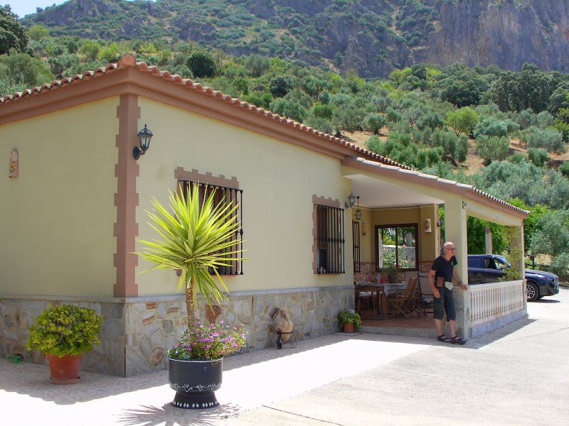
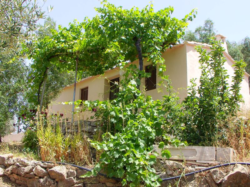
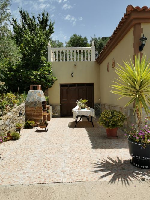
Casa Rural El Tajo – our accommodation
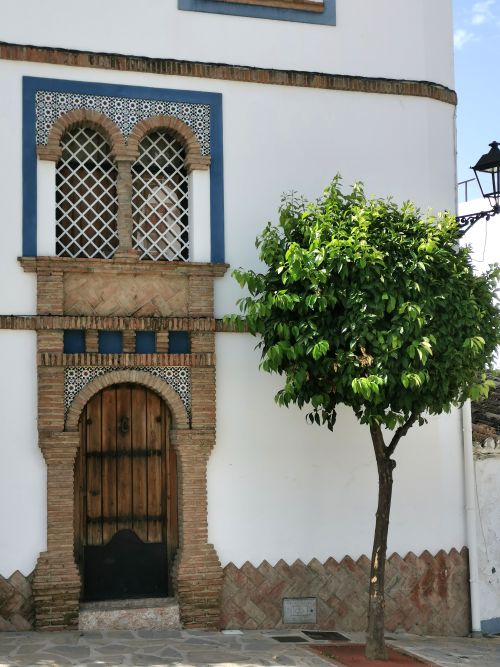
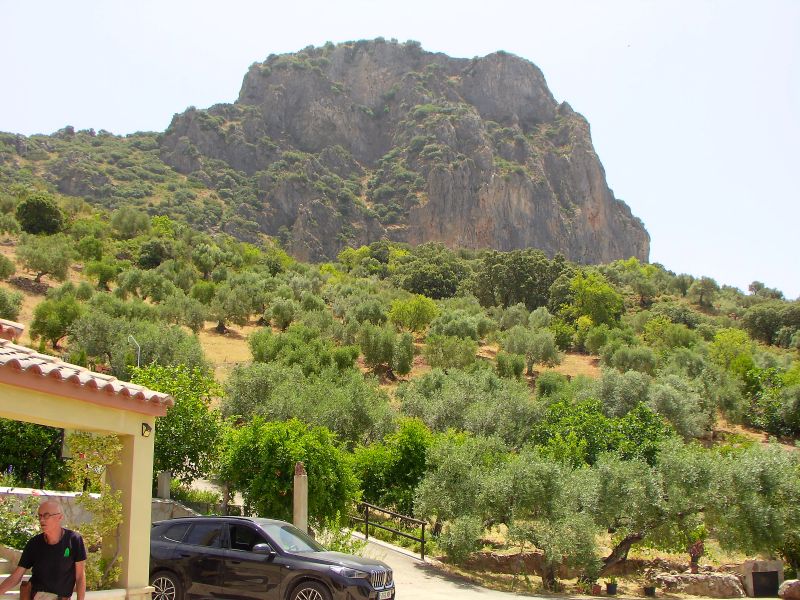
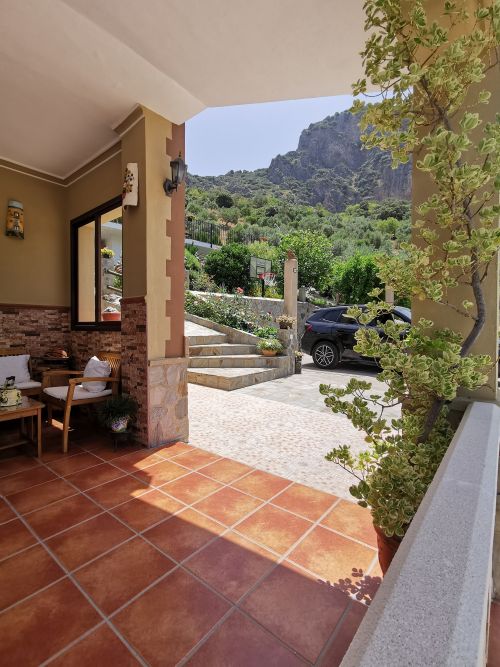
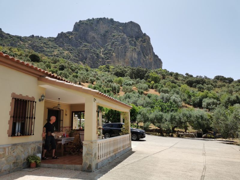
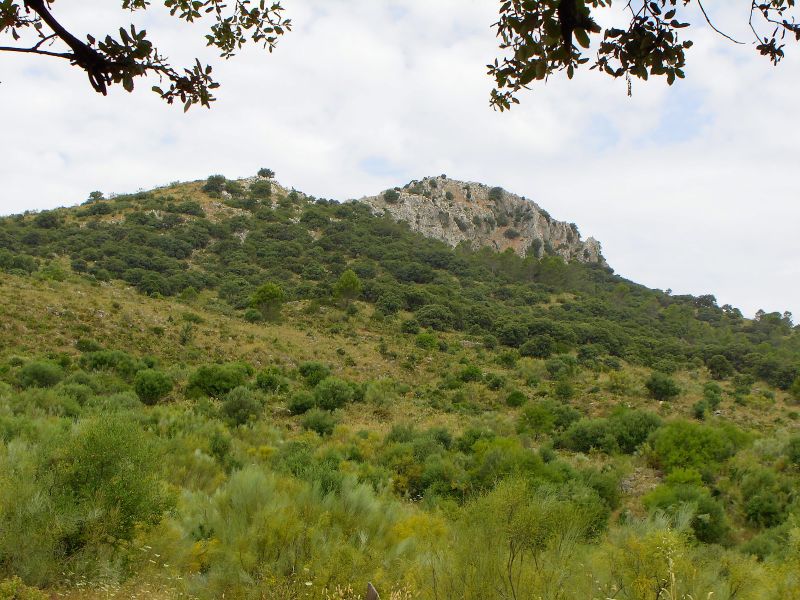
Leaving Montecorto, we drove back towards the ‘Embalse de Zahara-el Gastor’ along the Rio Guadalete on its northern edge, up into the hills branching off onto the road that leads to El Gastor. El Gastor is one of the Pueblos Blancos of Andalućia (white villages) known as Balcón de los Pueblos Blancos ‘Balcony of the White Villages’, and lies beyond the saddle of the hills, Tajo Algarín (commonly known as ‘Gastor Rocks’) and El Jaral. We arrived at our rural house—Casa Rural El Tajo and met our host Maria.

(search Google Maps / El Gastor / Spain and click on Casa Rural El Tajo) There is no website, but a phone number to contact
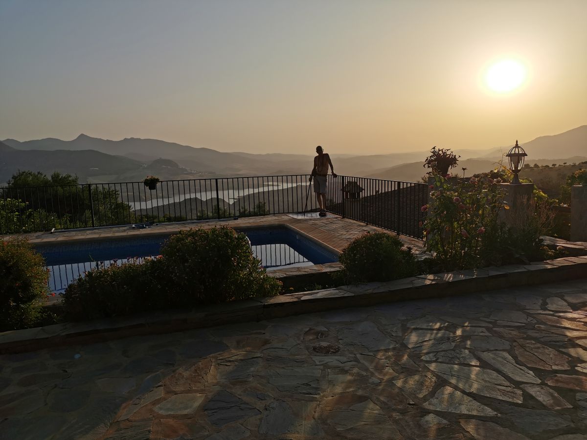
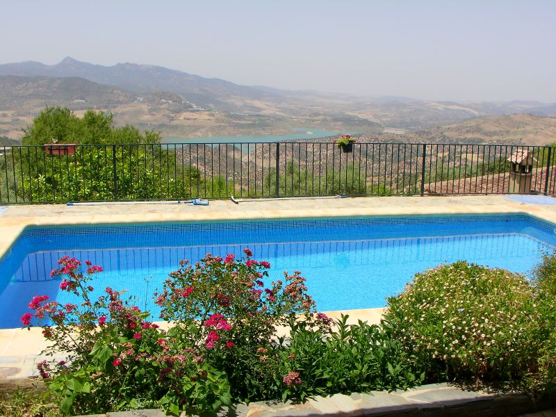
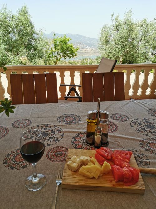
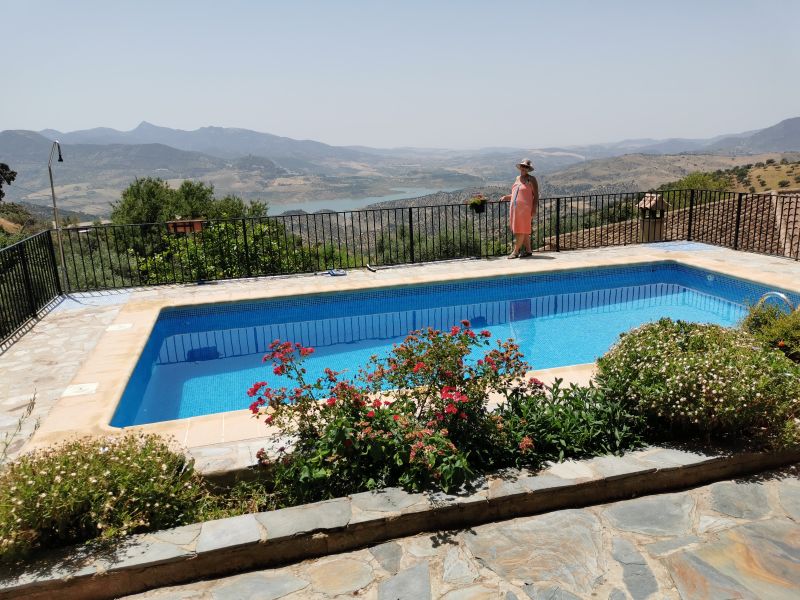
We were delighted with our home for the next 3 nights. Complete with breathtaking views; gardens full of fruit trees, grape vines, colourful flower bushes; and the most divine swimming pool, beyond which where chickens ran free, this place was perfect for our needs.
Remember to open up the groups of photos to see them fully!
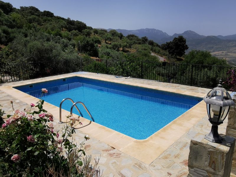
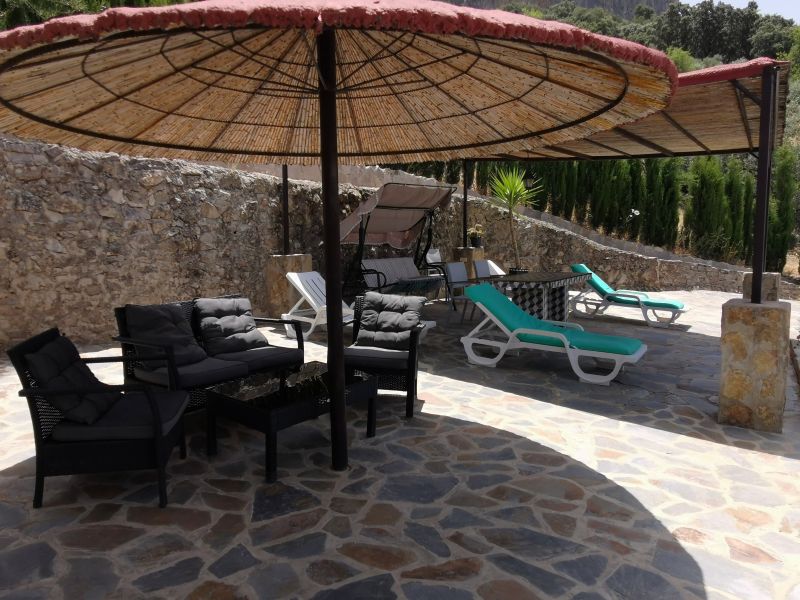
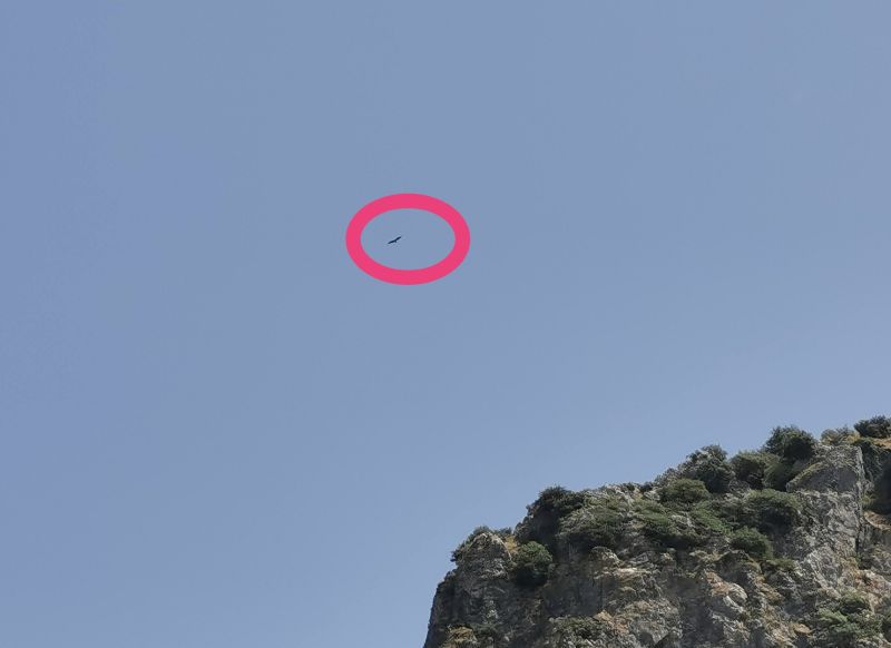
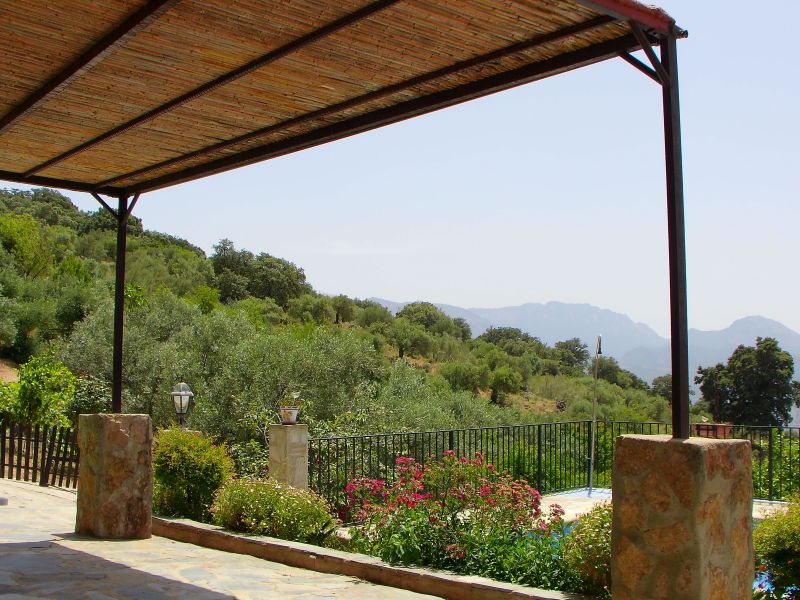
We had this lovely haven all to ourselves, with a few scattered neighbours, and the somewhat isolation was delightful. We swam and watched the vultures flying over the pinnacles above our casa, swirling and swooping, following patterns in groups, tandem and sometimes alone. They were a joy to watch and sometimes came down quite close to our place, where you could see their eyes and hear the zoom of their wing noise as they passed by, delighting our senses and sense of adventure. Hard to catch on an actual camera, the shutter clicked in my heart, full of joy and wonder.

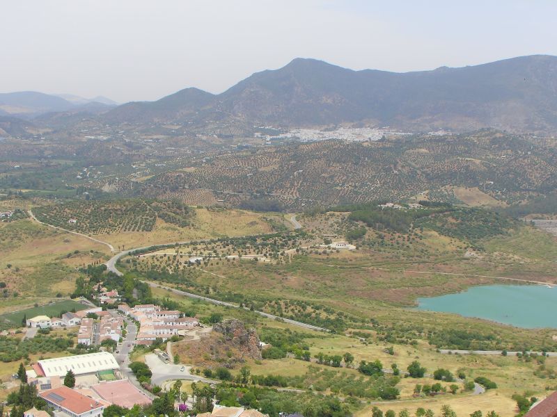
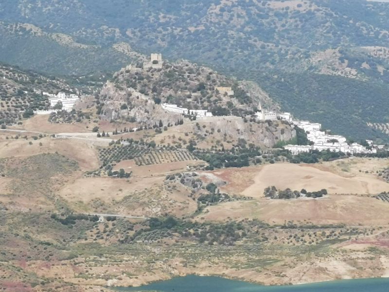
El Taho (see the arrow) as seen from the Zahara de la Sierra castle
Our first visit to El Gastor
In the evening, we went over the hill into El Gastor in the hope of getting some dinner but aside from a few places offering drinks, we were out of luck. However, the supermarket was open, so we bought ingredients to cook back home.
The lack of parking and narrow streets made it hard to negotiate the car around tight corners, but we managed to make our way back to El Tajo where we relaxed for dinner on our front veranda with a view over the embalse to the town of Zahara de la Sierra. We had visited Zahara and the Castle (Castillo de Zahara de la Sierra) in 2008 and climbed the narrow steps, but were keen to repeat this experience the following day. In the meantime, it was so warm we were able to swim in the late evening, lie on the loungers, and relax before sleeping.

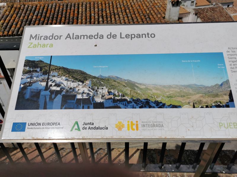
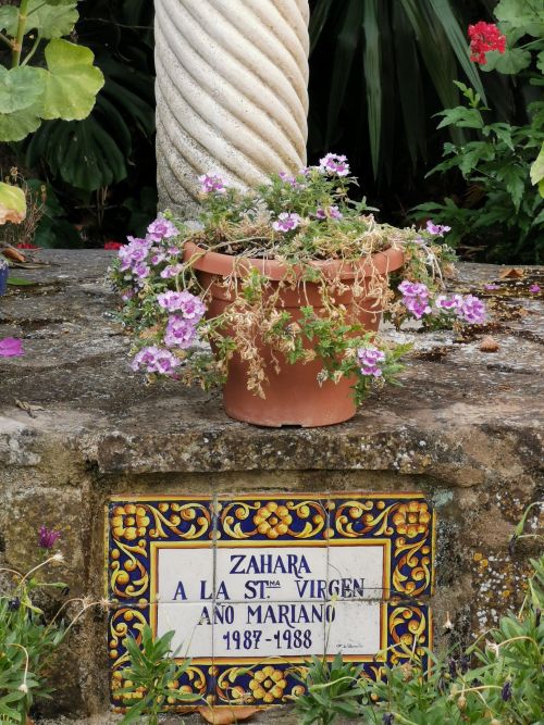
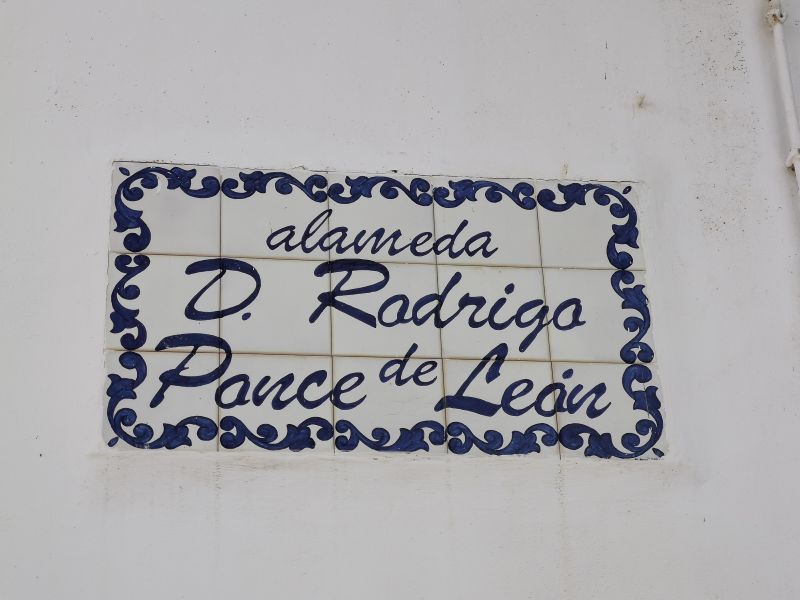
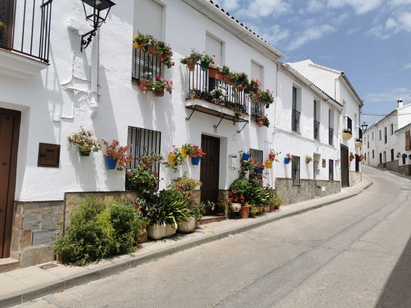
Zahara de la Sierra

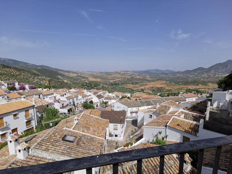
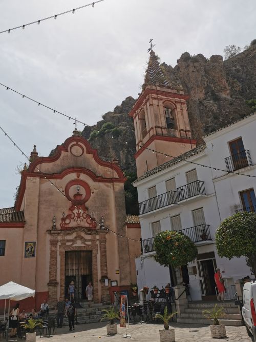
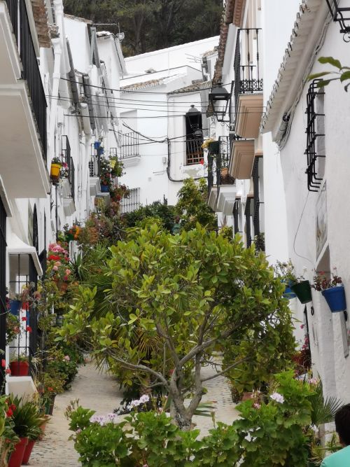
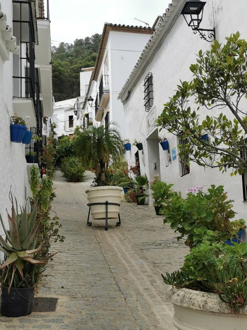
The following day, we drove to Zahara, enjoying the natural beauty of the area. Finding a car park, we took our time wandering around the upper echelons of the town, enjoying the views, balconies, and streets. Zahara is not so big and although the streets are steep, it is easy to walk around.

Remember to open up the groups of photos to see them fully!
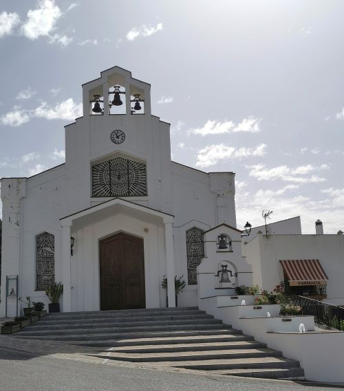
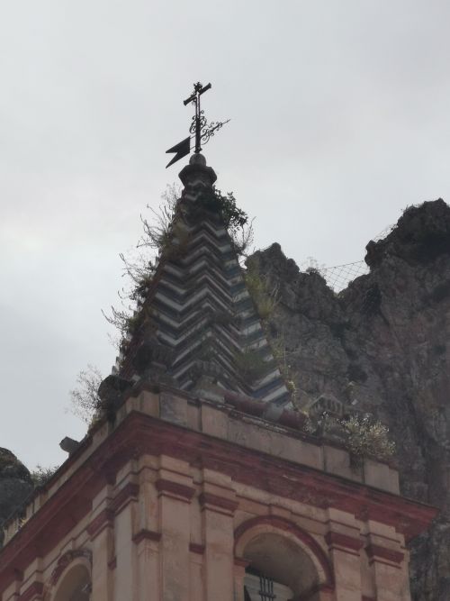
We made our way to the town square, where restaurants, shops, and churches are situated. The Capilla de San Juan de Letrán (Chapel of San Juan de Letrán) is a small church on the site of a previous hermitage of the same name. Built in 1958, it has a wide single nave with a large semicircular doorway, which has a gable above holding 3 bells made the same year the church was built.
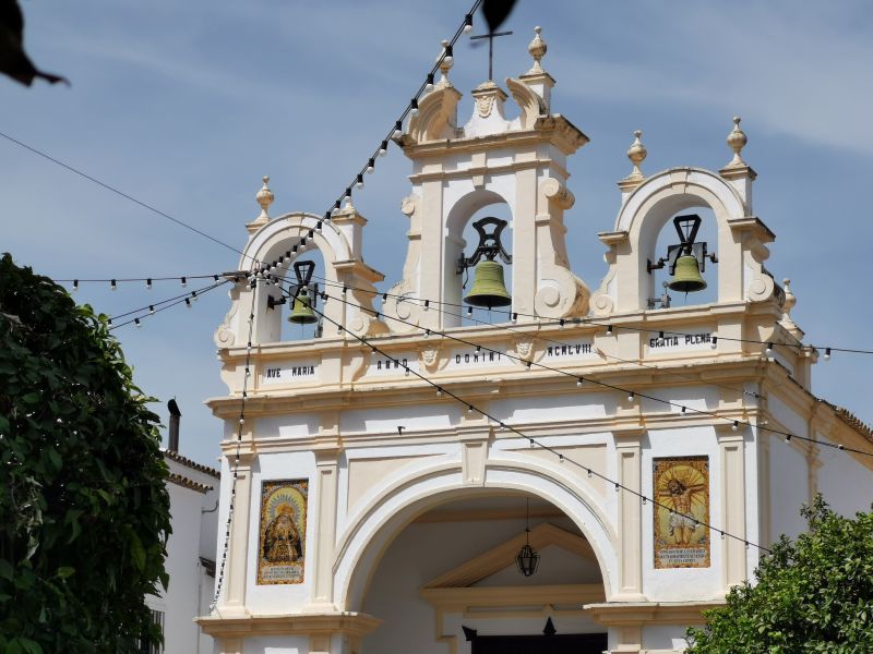

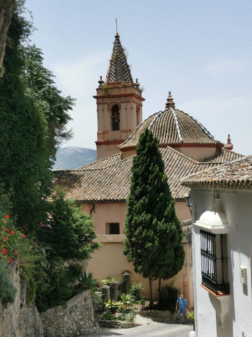
The Iglesia de Santa Maria de la Mesa (Church of St Mary) is a small 18th-century baroque-style church with a wide central nave, which you pass on the steep streets leading out of the main town centre towards the climb to the castle. As often happens, it was built on the remains of an ancient Arab mosque that existed at the time of the Reconquista, when it was then blessed and converted into a church.

Remember to open up the groups of photos to see them fully!

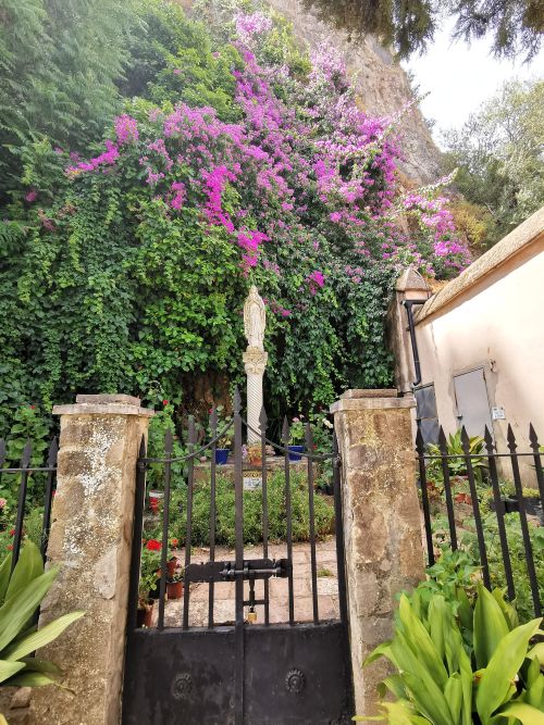
The gardens of the statue at The Iglesia de Santa Maria de la Mesa (Church of St Mary) Zahara de la Sierra
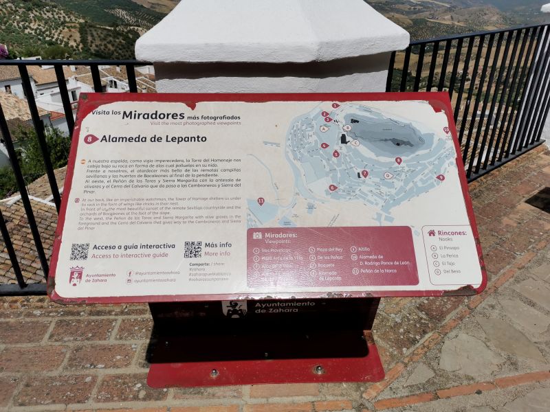
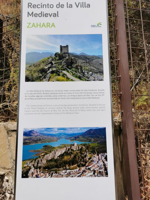
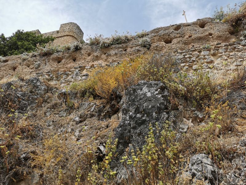
The Nasrid Castle: ‘the castle on the hill’
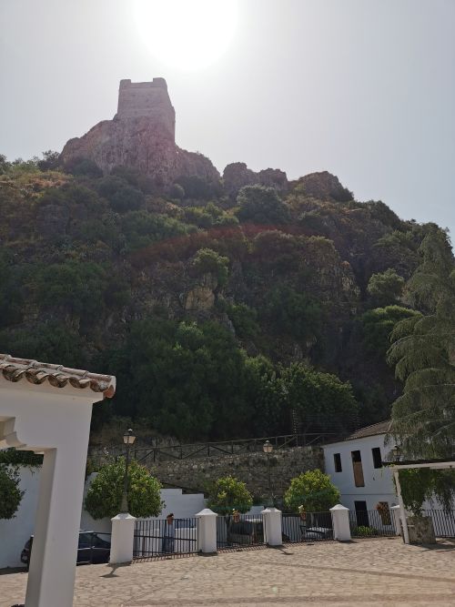
The 13th-century Nasrid castle, ‘Muralla Urbana de Zahara de la Sierra’, or Castillo de Zahara de la Sierra, sits on a rock pinnacle overlooking the town and provides a 360-degree vista from the highest point. The name of the castle loosely translates from Arabic as ‘the castle on the hill’ and was fondly called the ‘Moorish eagles nest’ by British traveller Richard Ford, as suggested by Chris Chaplow in Andalucia.com and the history of Zahara de la Sierra.
https://www.andalucia.com/province/cadiz/zaharadelasierra/history.htm
There are signs of prehistoric occupation in Zahara de la Sierra, and there was a Roman Oppidum (village) on the hill prior to the Moorish occupation, which began in the 12th century. Rule see-sawed with the Christians, Nasrid rulers, and Castilian forces taking turns at ruling this region until 1483. The Moors built the ‘castle on this hill’, which is a strategic point for defending the territory of the Guadalete Valley and the border of the Christian territories; however, the area was known to have origins dating back to the 8th century. There have been artefacts found indicating human existence back 5,000 years, which ties in with other historical findings in caves, dolmens, and villages of Andalućia.
In the 18th century, the population declined, with a further decrease when the embalse was created and land was submerged between the 1970s and 1990s. During the time of the Reconquista, when the Christians and Moors were battling for possession of the region in the 1400s, there were no women or children in the village, and it was only inhabited by soldiers.


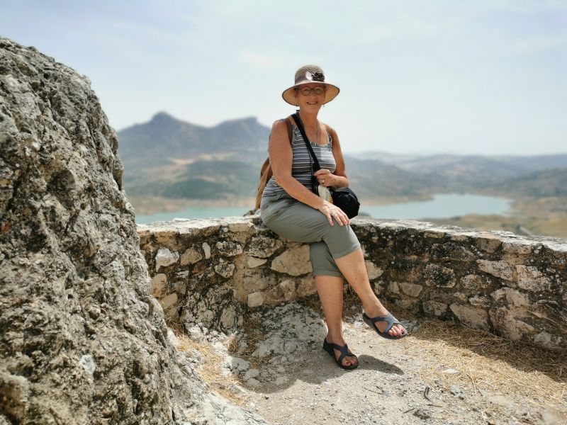
Views from the balconies of the Castle in Zahara de la Sierra (Orange arrow points to Casa Rural El Tajo area)
The town is beautiful, and we walked the paths until we found the ticket booth and gates into the walking tracks.
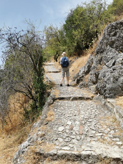
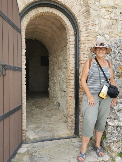
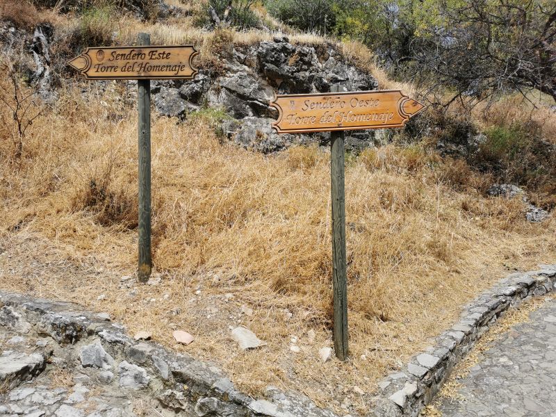
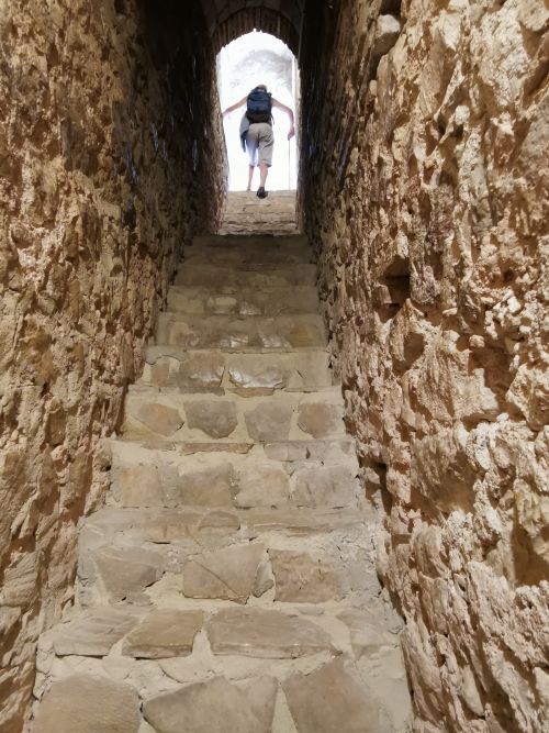
From here we made our way to the remains of the Moorish castle that was built on top of the lookout tower, the Torre del Homenaje and stands guard above the village. The path is paved and well defined with frequent viewing platforms and rest spots under the trees for shade on a hot day. We wound our way up the path and steps, which at times are quite steep, reaching the door of the castle as we drew in breath from the steepness of the track and at the vista laid before us.
Remember to open up the groups of photos to see them fully!
The track to the door of the Nasrid Castle
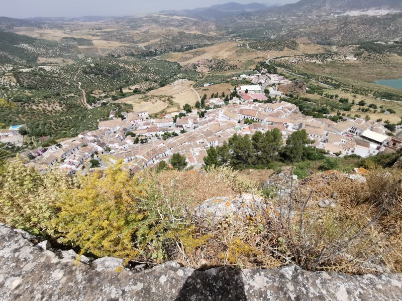
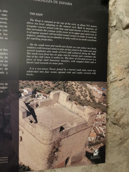
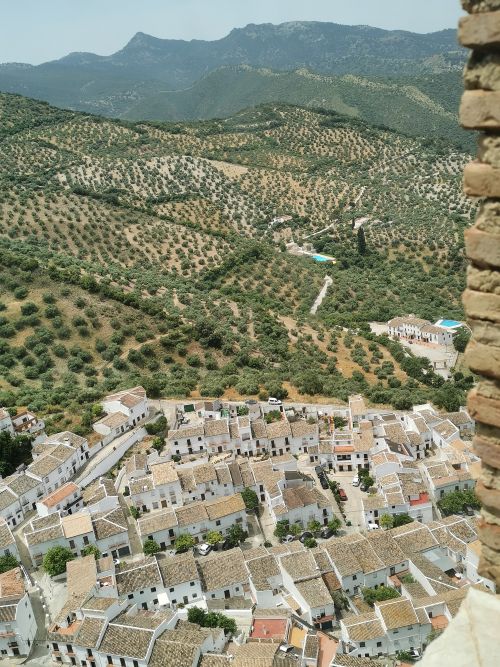
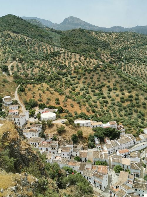
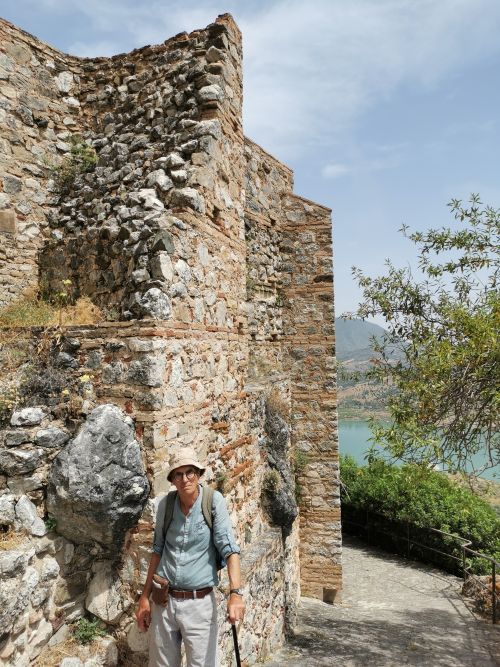
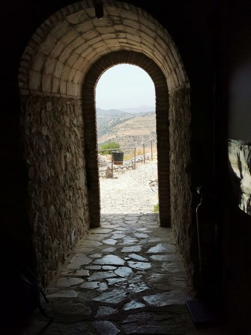
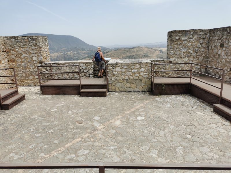
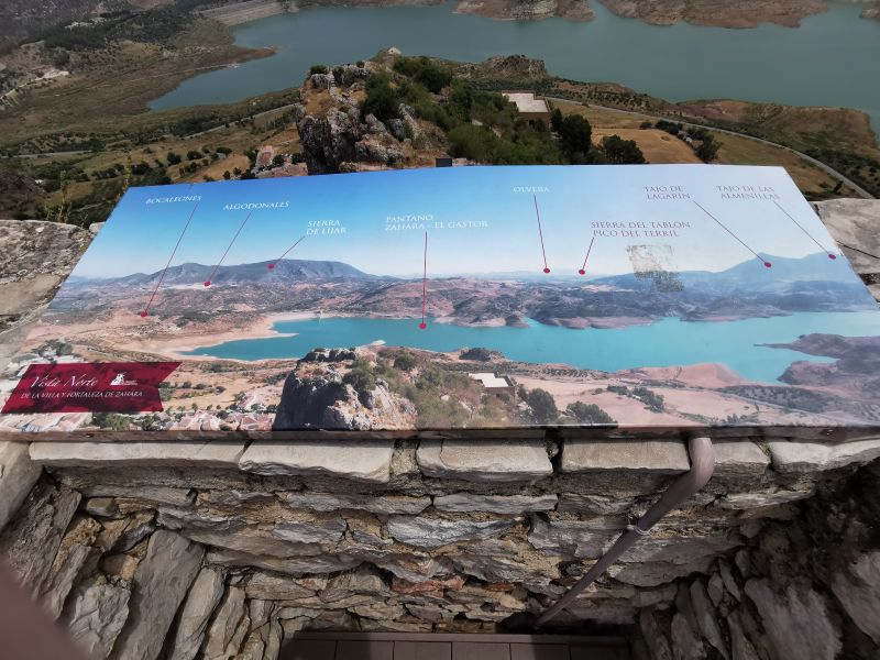
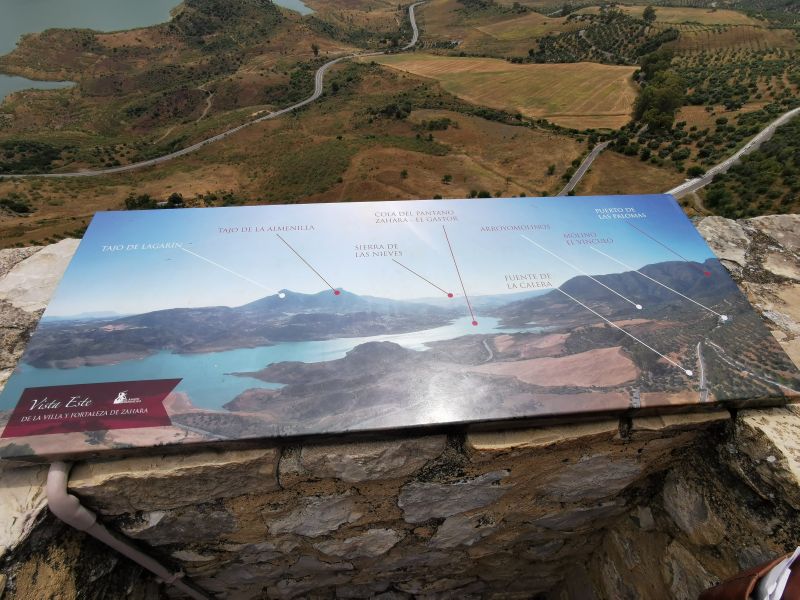
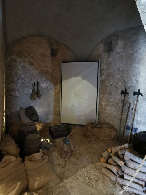
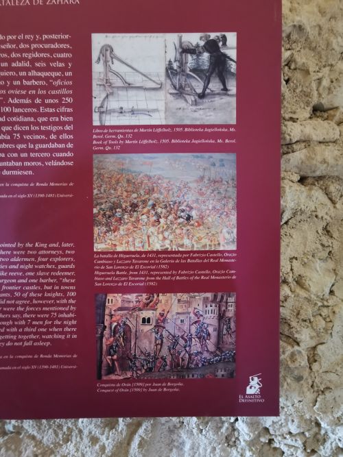
The castle has undergone recent renovations and now houses displays of ‘how it must have been’ with signboards describing various aspects of life back when the castle was operational. Although in those days it would have been quite dark, today it is well lit. After looking around and reading the information boards, we took the narrow, steep stairs to the roof. Once up there, the 360 degree views were expansive and impressive with olive groves, rural Cortijo (rural farm houses), swimming pools, the embalse, the dam, and roads leading in every direction. There were platforms and safety rails, the walls were very thick, and information boards described what the observer was seeing.


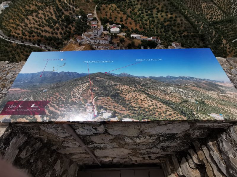
The view from the castle over the lower end of Zahara towards Algodonales (white village)
Carefully and slowly, so as not to fall (like I did in 2008), we came back down the steep, narrow stairways and looked again at the displays on offer.

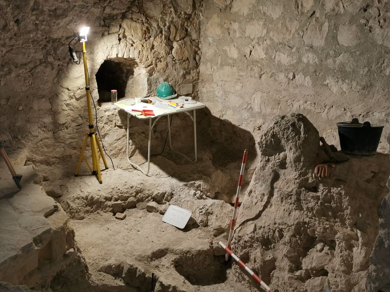
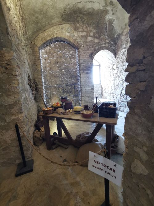
Inside the castle there are displays and archaeological digs (above)
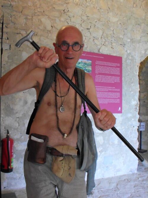
Sign boards and Manfred playing at being an ancient soldier in the castle where he could not touch the real battle equipment (below)
Outside in the heat, we made our way down the track to the car park. Manfred chatted to an Argentinian visitor, while I walked on ahead, sitting under some trees in the shade, waiting for them to arrive at the car park.
Lunch in Zahara de la Sierra
We meandered down to the town centre and had lunch at one of the only restaurants still open during the siesta time. We sat and enjoyed for some time as we reminisced about the festival of Corpus Christi that was happening in 2008 when we were last in this pretty town. We purchased some souvenir items and t-shirts and eventually made our way over to the car park on the far side of the hill below the castle.
Remember to open up the groups of photos to see them fully!

Back at El Tajo, we rested, swam, and enjoyed our haven on the hill with the vultures swooping overhead, diving and gliding on the eddies of wind from their pinnacle above our casa. It was nice to enjoy dinner outside on the veranda each evening and watch the changing colours of the sunsets far away.
https://www.spain-holiday.com/Zahara-de-la-Sierra/articles/visiting-zahara-de-la-sierra-andalucia
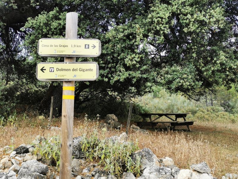
Dolmen del Gigante
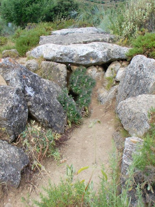
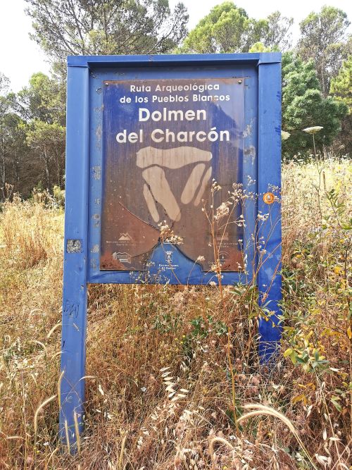
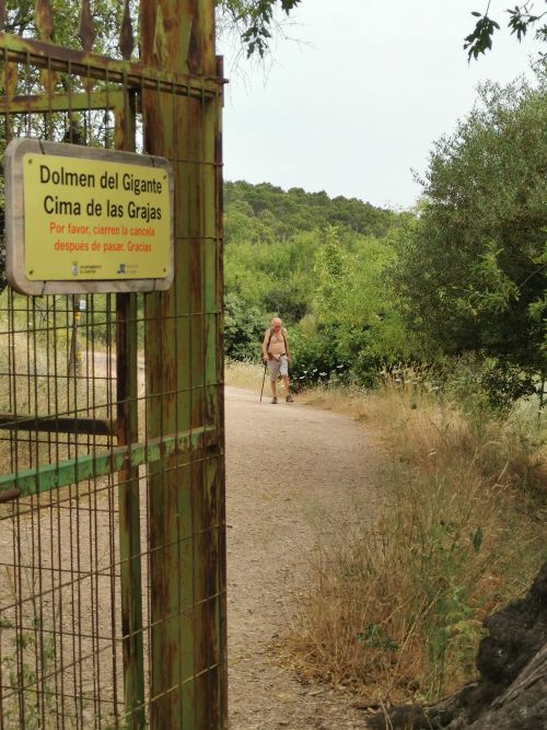
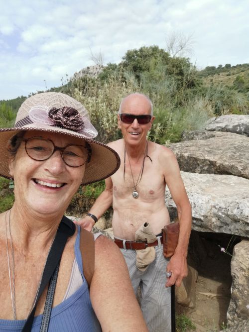
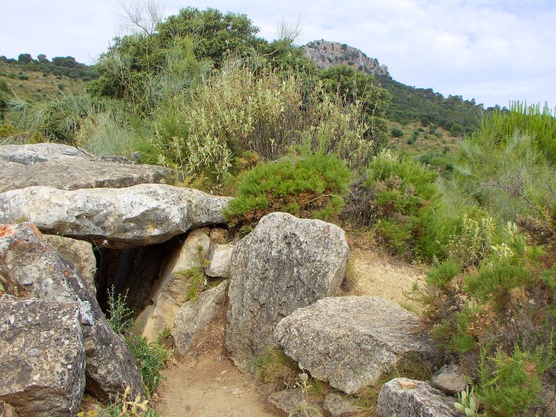
One of the great things about spring and summer in Spain is that upon waking, there is no need to check the weather forecast to determine what to wear! The next day, we dressed for a hike to the Dolmen de el Charcón, also known as the Dolmen del Gigante, on the hills above El Gastor. Manfred had researched the route to this remote Dolmen, and we found our way to a parking spot, from which we embarked on a 1.5 km walk (with 1.2km 1200m/3,937ft of elevation gain).
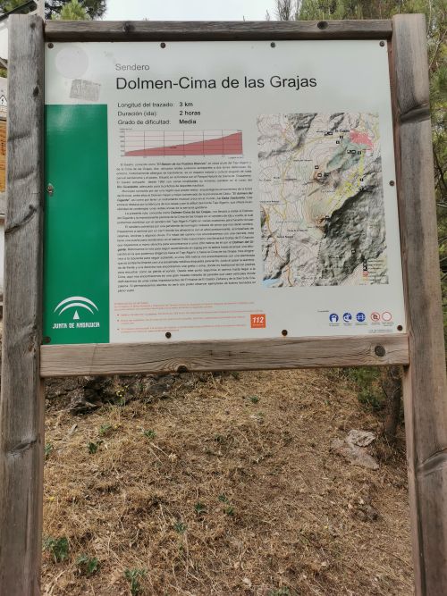
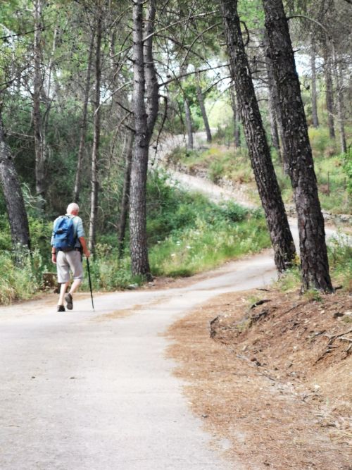

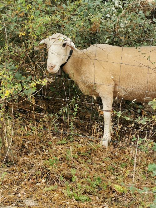
Good walking shoes are recommended for this challenging track, which goes steeply up a road through trees and then low brush, passing goats and sheep with bells that tinkled in the warm morning air.
We arrived at a huge gate that spanned the whole road, but with a small walk-through gate on the side. Passing through, we soon found ourselves at a picnic table under a tree with signs to the Dolmen.
Remember to open up the groups of photos to see them fully!
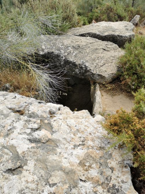
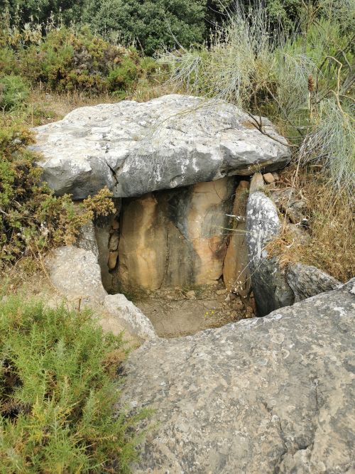
Dolmens are ancient burial sites, characterised by stone pillars and a stone roof. The Dolmen del Gigante dates back to the megalithic period (around 2500BC–200AD), and it is suggested that it approximately 4,000 years old. This was the time when people lived in small communities or villages and were primarily hunter-gatherers, with some agriculture and care of animals. Their tools and utensils were primitive and made of ceramic, stone and/or bone, and these objects were often buried with the owner and bear testament to human settlement and their spiritual practices.

Collective burial practices were common on the Iberian Peninsula and, in this case, the folklore is that it was built by giants; therefore, the name comes from this story. Dolmen del Gigante is a protected archaeological site. It serves as an educational resource and is of cultural significance, drawing tourist interest to help understand ancient civilisations. It has been integrated into hiking routes, providing tangible connections to the deep roots of traditions and myths of rural Andalućia.
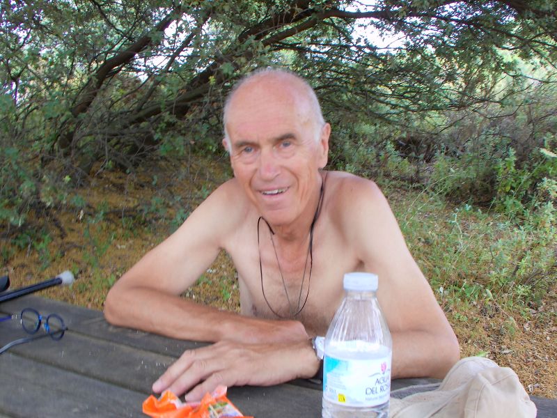
Stopping to have an essential snack and well-needed drink, we continued the short walk to the Dolmen.
Here we spent time looking into them and taking photos before being driven away by insects, somewhat like horse flies, that started biting us! It was not as peaceful at the site as is written in the guidebook due to the insects, but it was still a lovely walk.
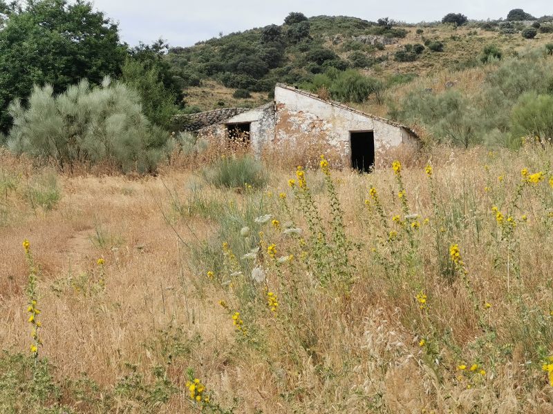
The nature area is lovely, and we passed old cortijos and farm buildings, now long abandoned, but adding intrigue as to who had lived here. Manfred suggested we could live there unnoticed!
We retraced our steps back down the steep track, through the low bushes and trees, to the car. The view of the valleys and surrounding hills was vast and spectacular, with many cortijo and olive groves stretching as far as the eye could see to the next white village against yet another hill on the horizon.
Remember to open up the groups of photos to see them fully!
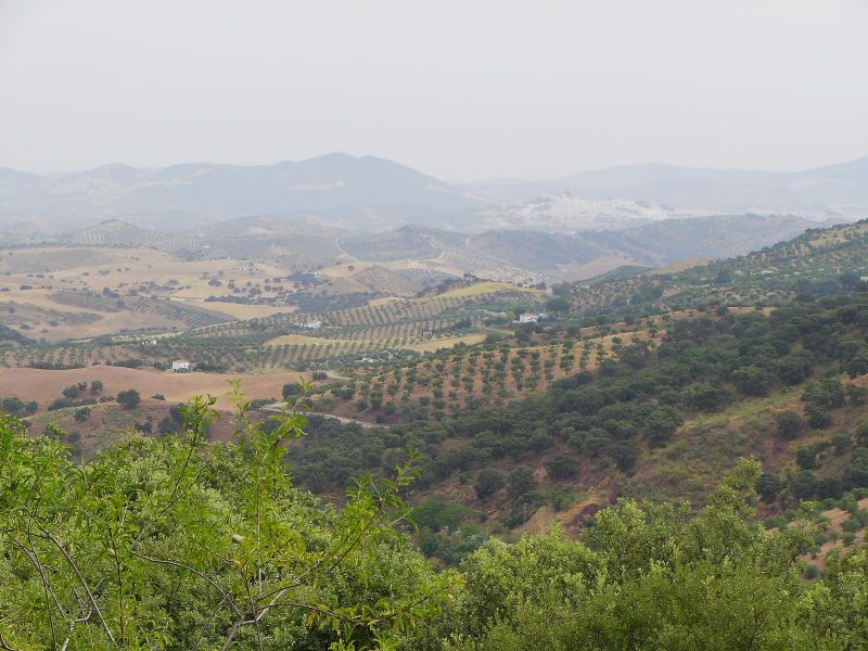
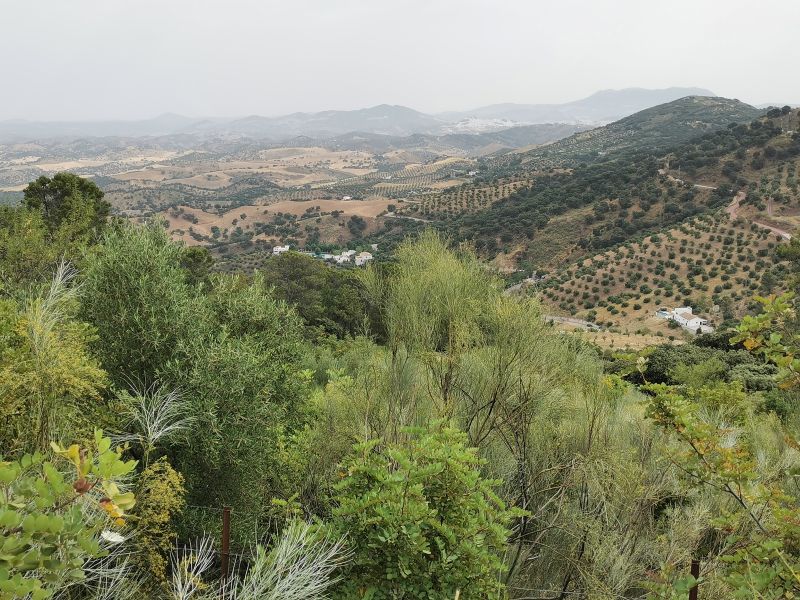
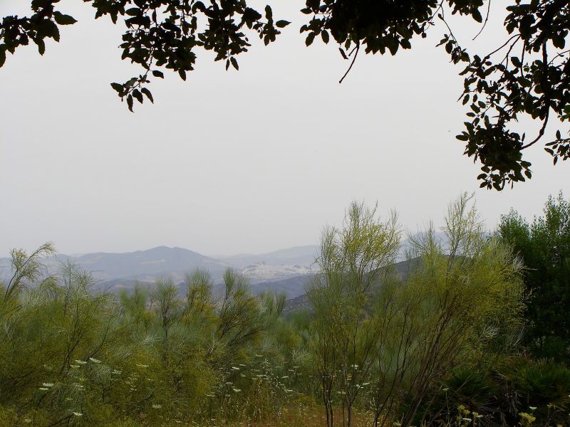
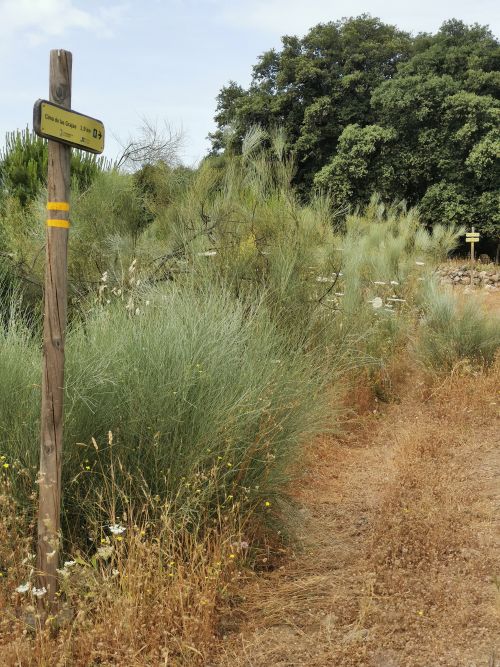
From the Dolmen del Gigante towards the Cima de las Grajas and Tajo Algarín and above to the vast horizons as seen from the track to get here.
El Gastor
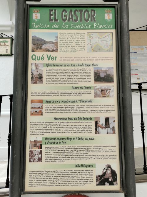
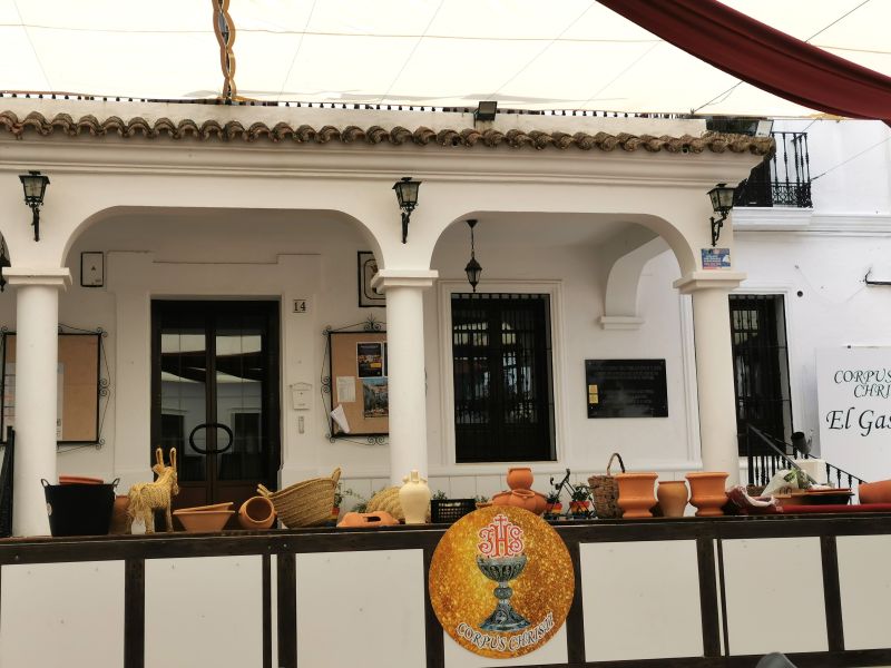
We went down into El Gastor, parking closer to the entrance to the town to avoid the narrow, steep streets and walked down to the Plaza de la Constitución, where the townsfolk were setting up for the Corpus Christi festival at the museum (Museo De Usos Y Costumbres Populares). Alongside is the 18th-century Church of San José (Iglesia de San José), and the main street runs through the middle of the plaza, making it a busy thoroughfare in this rural townscape. El Gastor sits at 1,060m (3,477 ft), offering fantastic views of the nearby rolling hills, olive groves and other white villages.
Like most of the Andalućian territory, the colourful history of conquest and reconquest follows that of the region; however, in 1834, El Gastor gained its own autonomy and was able to establish a town hall! Following prehistoric times, it had been a military outpost for Zahara de la Sierra into the late 14th century. The village in its current form took root in the 16th century, and it is known for famous bandits in the early 1800s, such as José Maria Hinojosa Cabacho, ‘El Tempranillo’.


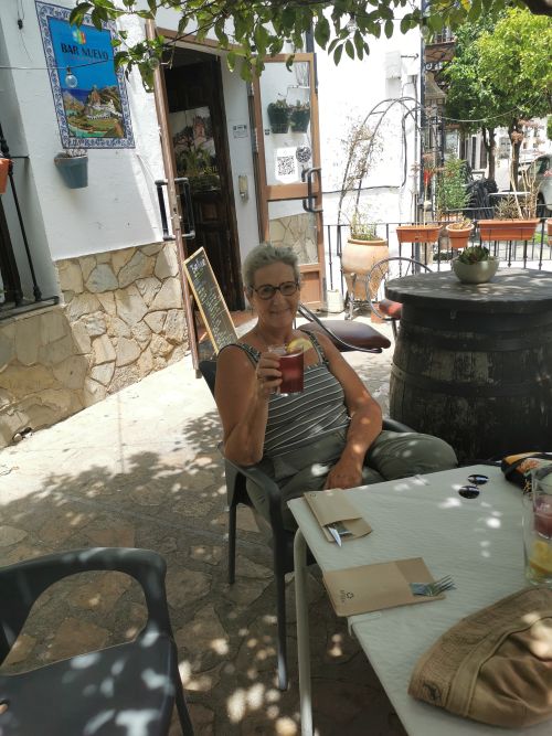
We had lunch on the terrace of the plaza before making our way to a bakery to buy goodies and then back to the car—both of these events were not without some amusement.
At the bakery, we made our choices and stood near the counter waiting to pay while several local ladies were chatting in Spanish with the owner. We waited for quite some time while they carried on talking, and eventually I interrupted to ask if we could be served (por favor/please). After much eye rolling by the ladies of the town, we paid for our purchases and moved out of the shop. Manfred, who understood their conversation, said they were just ‘gossiping’ about the local townsfolk. We laughed at being made to wait over gossip and moved on into a narrow street where a huge truck was blocking our exit as it tried to round the tight corner. Eventually the truck managed to offload its payload of greenery for the festival and came down the narrow street, causing us to pull ourselves into doorways to let it pass.

This website about El Gastor– click English, but just enjoy the YouTube in here too.
Or:

We made our way back to El Tajo and spent the rest of the day and evening in the swimming pool, eating dinner on the terrace and enjoying our haven on the hill as we planned our route to our next destination. This was to be 3 nights at a Rural Cortijo, ‘La Cansina’ at Mairena del Alcor, a village a little beyond the outskirts of Seville. From here, we spent a day in Seville and enjoyed the villages of Carmona and Mairena del Alcor. Come to the next story to explore with us!
https://www.lacansina.com (select English)
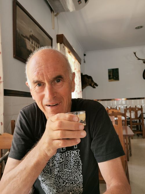
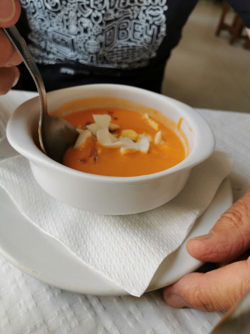
At lunch on the way to Mairena del Alcor near Seville & Manfred’s gazpacho