Once again I wish to acknowledge and thank my wonderful friend Shoba Nayar who edits my writing, and who’s careful eye and amazing suggestions helps bring alive, stories from our travels!
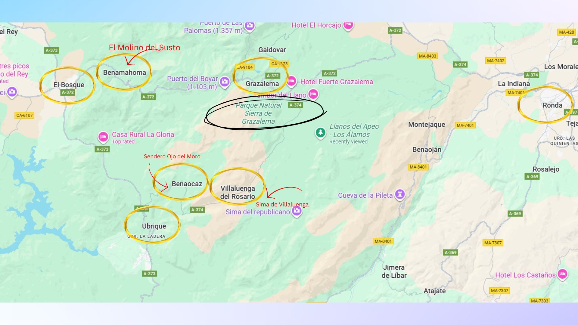
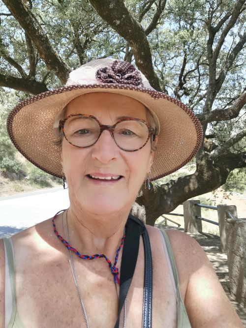
Where in he world are we? Southern Spain
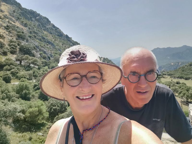
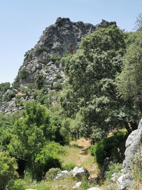
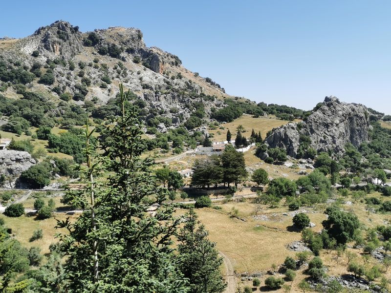
Grazalema National Park, Andalucía

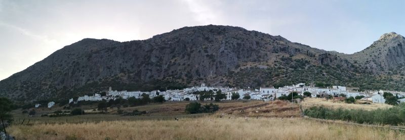
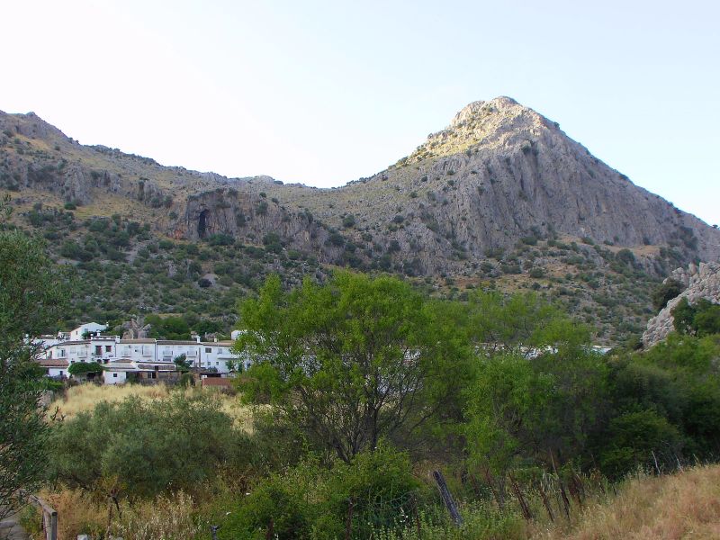
Villaluenga del Rosario and the region we explored
In the last story from Ronda, I ended with an introduction to this adventure…
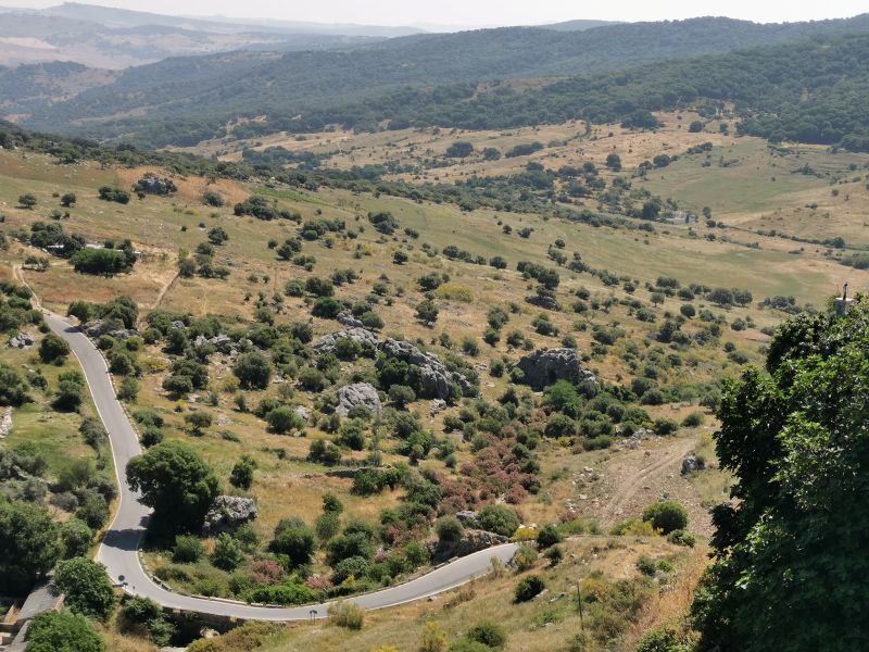
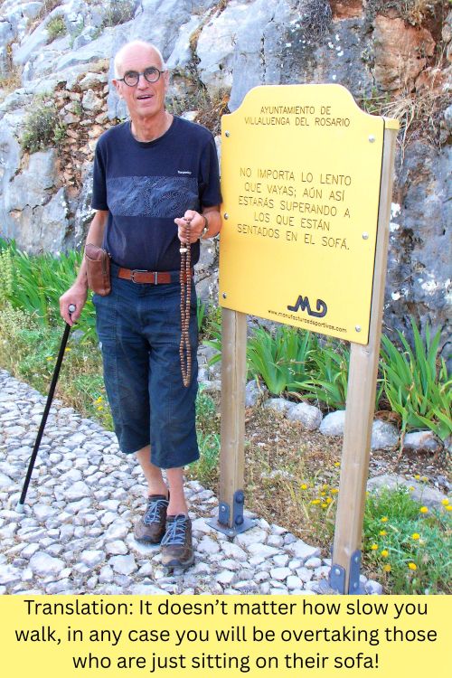
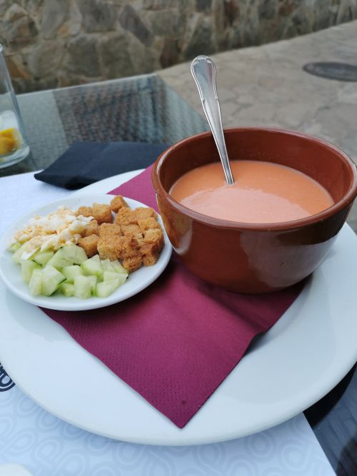
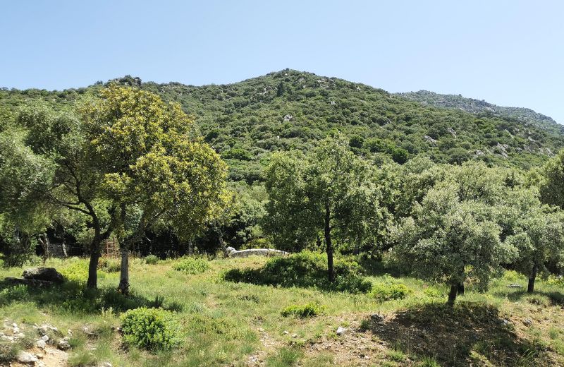
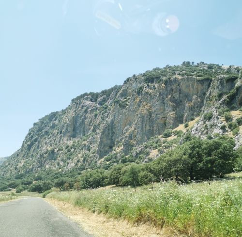
‘Soon we were back on the road, driving high over the hills, through the cork forests and down into Grazalema National Park to stay 5 nights in the small ‘white village’ Villaluengo del Rosario, sitting on the steep lower slopes below the cliffs of Navazo Alto Mountain deep in the national park. Grazalema town is only a 25-minute drive (18km) from Las Piletas, but it took us longer as we stopped to admire and photograph the beauty of the vistas. After a delicious lunch in Grazalema, we drove around the cliffs of the national park to Villaluenga del Rosario (approx. 20 minutes; 13km). We planned to explore the region, visiting much-loved towns from our first visit in 2008, discovering new and exciting walking trails, delving further into the region’s culinary delights, and making the most of the rich cultural experiences’.
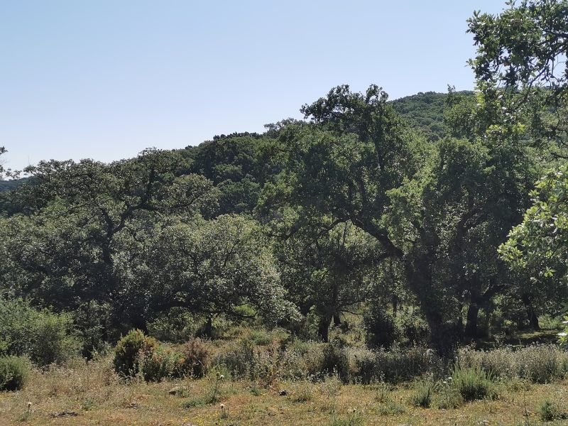
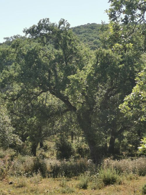
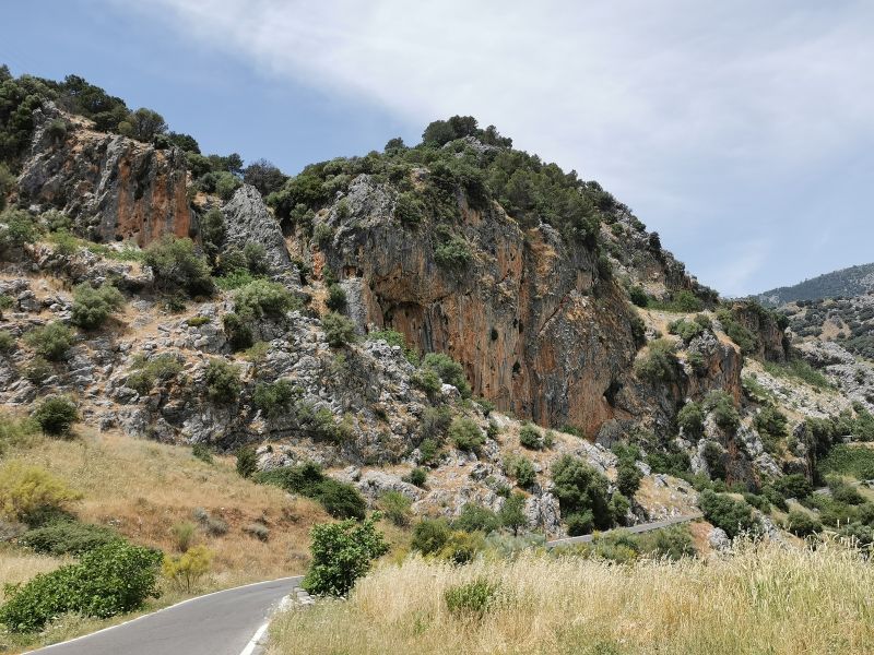
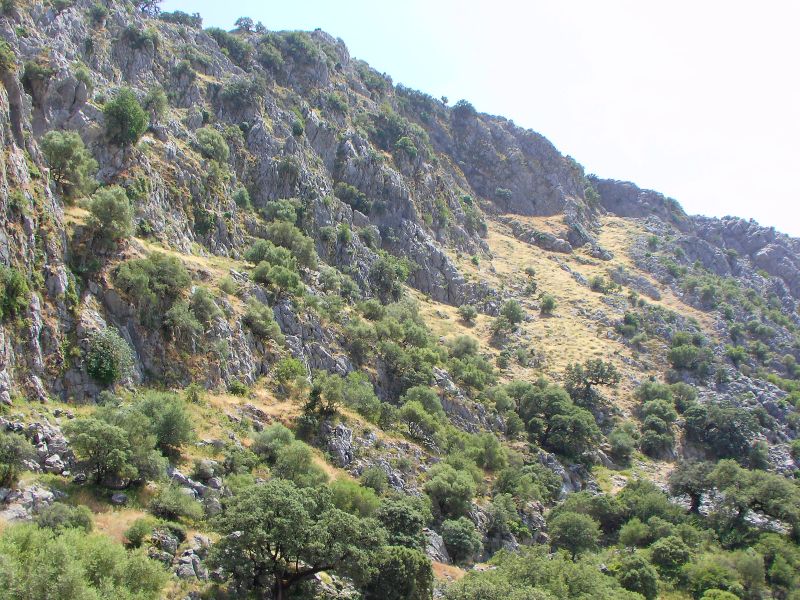
A drive through the cork forests towards Grazalema
Previously on our journey here In 2008, when we drove through the cork forests on the narrow sealed roads raised above the forest floor, it was not uncommon to see a family of cork fed pigs roaming across the road. So while we stopped several times to enjoy the canvas spread before us, we were also on the lookout for the local wildlife!
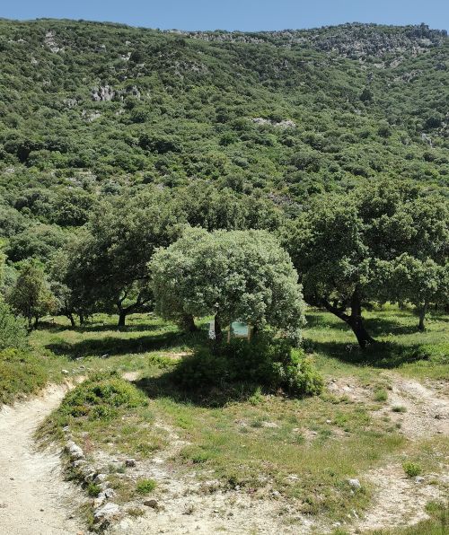
Remember to open up the groups of photos to see them fully!

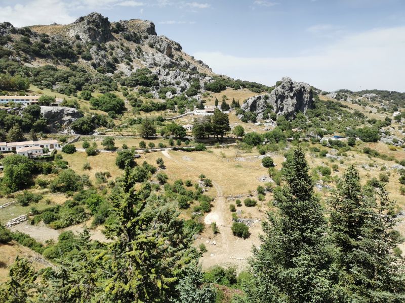
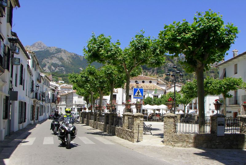
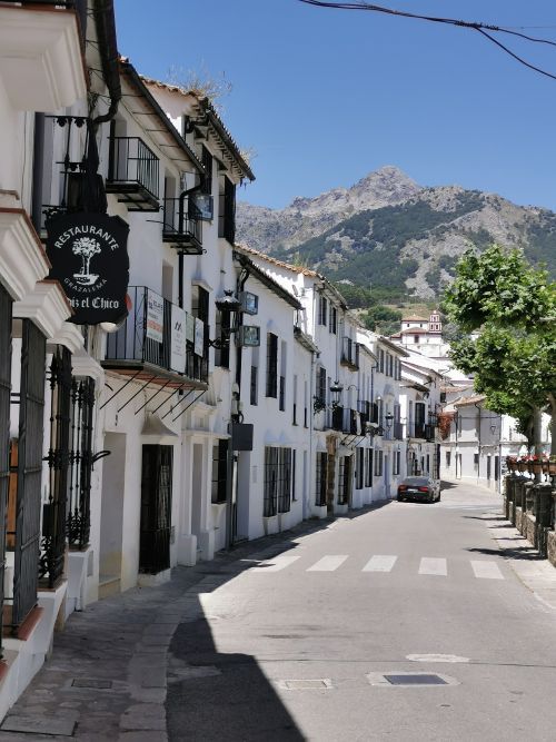
Approaching Grazalema
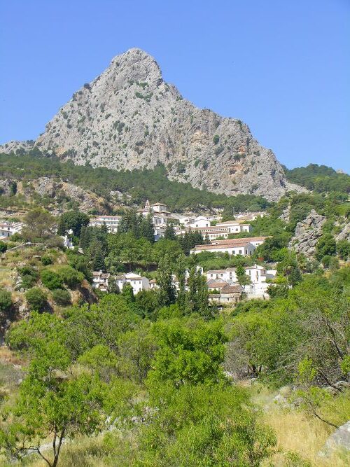
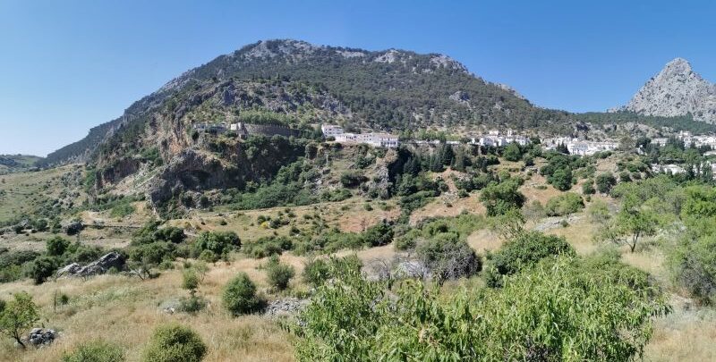
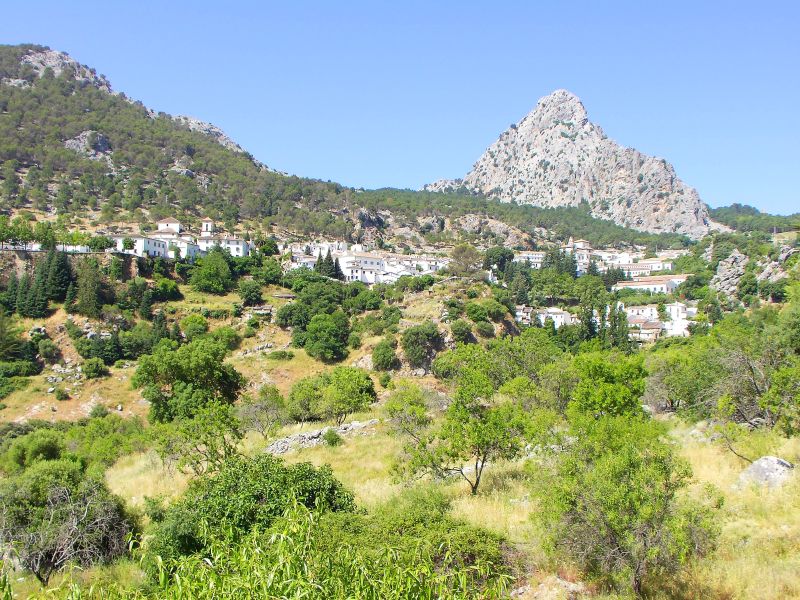
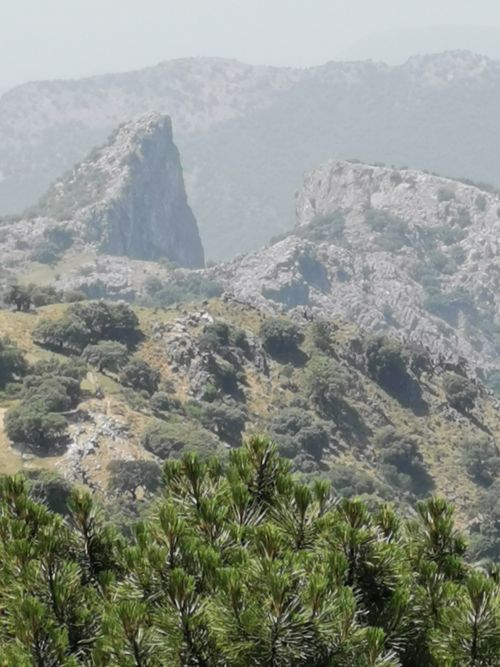
We drove towards Grazalema, passing the gigantic limestone cliffs used for rock climbing and the Queso Payoyo (Payoyo goat cheese) factory, and were soon on the outskirts of the town. We had loved staying in Grazalema in 2008 and were happy to be back to find our favourite restaurants, the town square, the amazing iconic views, and the vibe of this happy town. Approaching Grazalema towers the huge ‘Peñón Grande’ (1,309m; 4,295ft)—a grey, triangular, and impressive rock, just beyond the town. We made our way into the car park, with breathtaking views to the valley below.
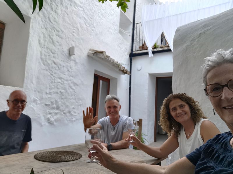
Enjoying our first reflections and new experiences: Grazalema

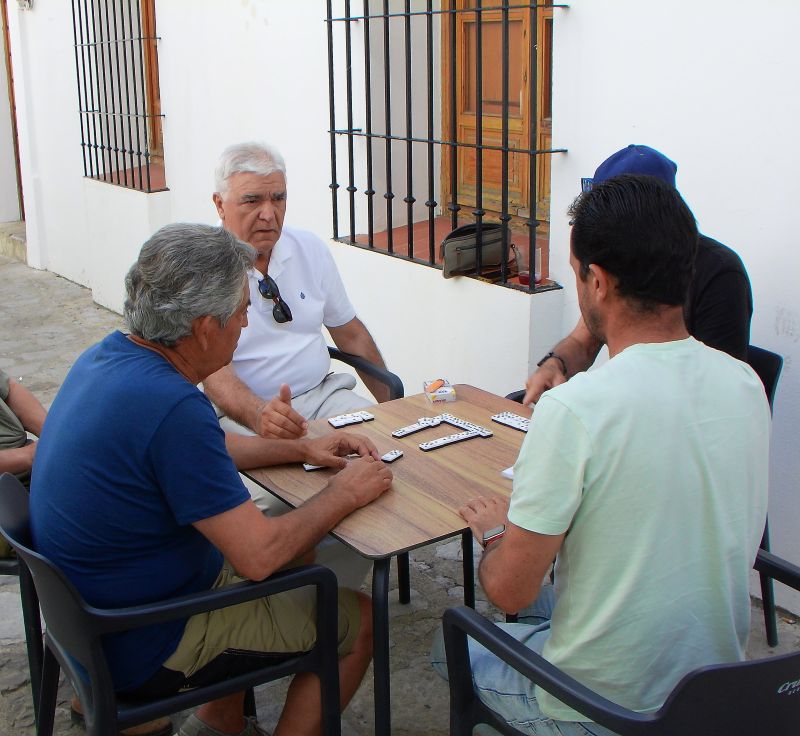
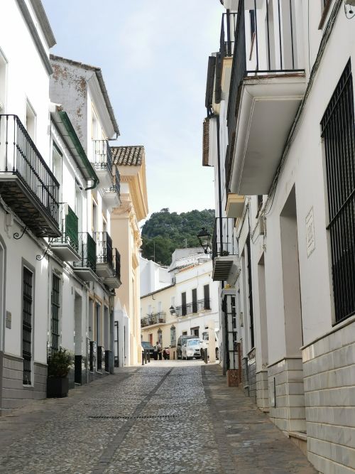
Turning our minds and feet towards the town, we found the places we wanted to visit. Along the way, we happened upon a group of local men playing dominoes at a table in the narrow cobbled alleyway. We enjoyed looking in a gift shop that we had been to in the past, and with the help of Manfred’s Spanish, chatting with the shop owner who was there in 2008 when the shop was newly opened.

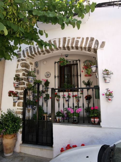
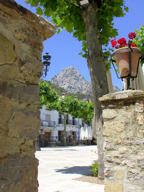
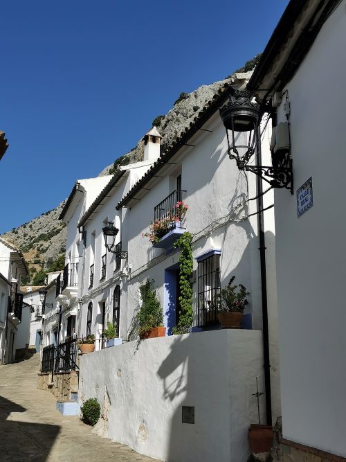
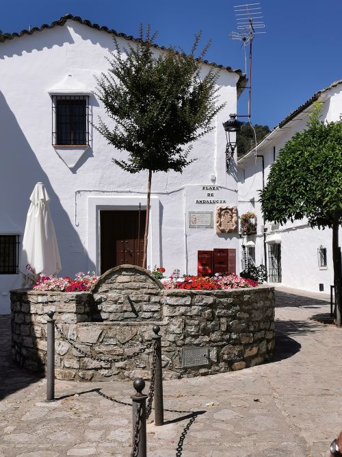
We wandered through the tree-lined square ‘Plaza de España’ and up a street where whitewashed houses are adorned with colourful flower pots, coloured doors, and ornate ironwork. This street leads out of town and over the hill to the lookout ‘Puerto del Boyar’, and on into the depths of the Grazalema National Park.
Remember to open up the groups of photos to see them fully!
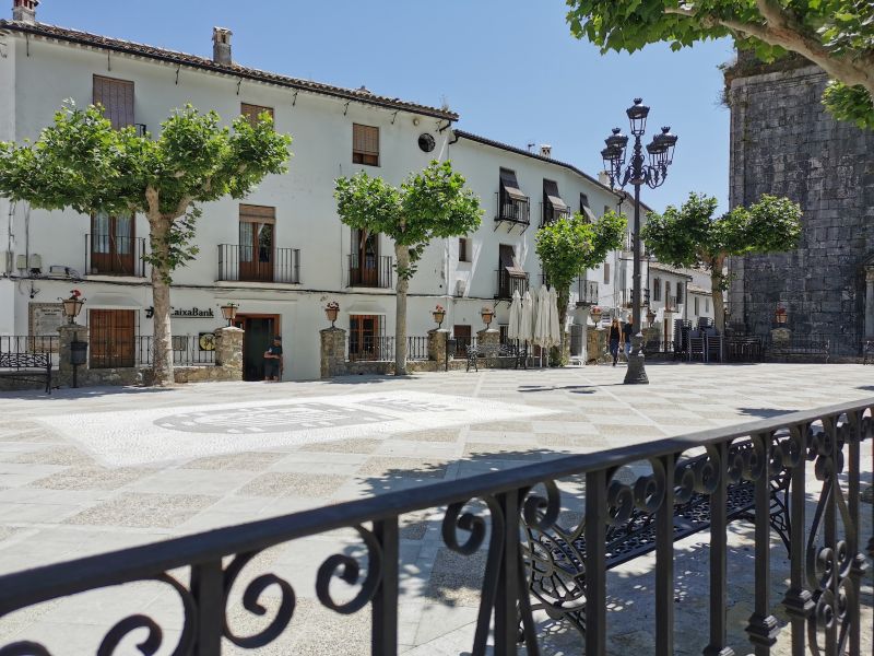


Plaza de Esapña & Plaza Andalucía
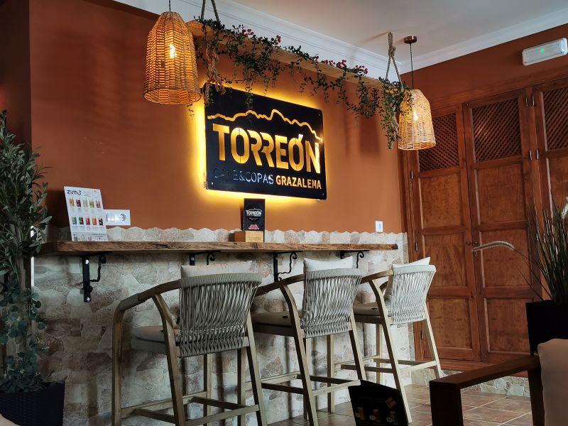
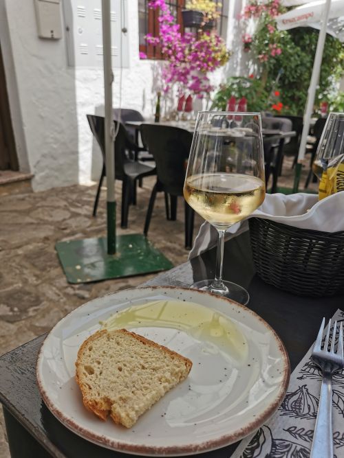
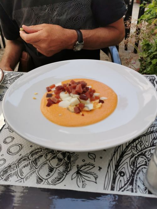
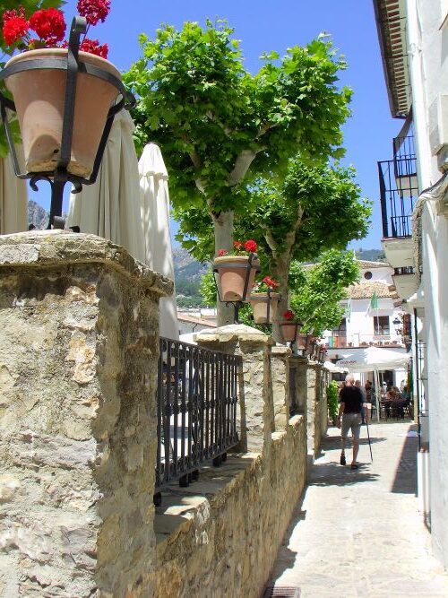
With food still on our minds, and restaurants in our sights, we made our way back down to the narrow lanes near the Plaza de España and found ‘Torreón Cafe & Copas Grazalema’ (check them out on Facebook, TripAdvisor and IG). We were not disappointed and enjoyed a meal under umbrellas in the warmth of the street, soaking in the relaxed ambience and watching customers coming and going.
Remember to open up the groups of photos to see them fully!


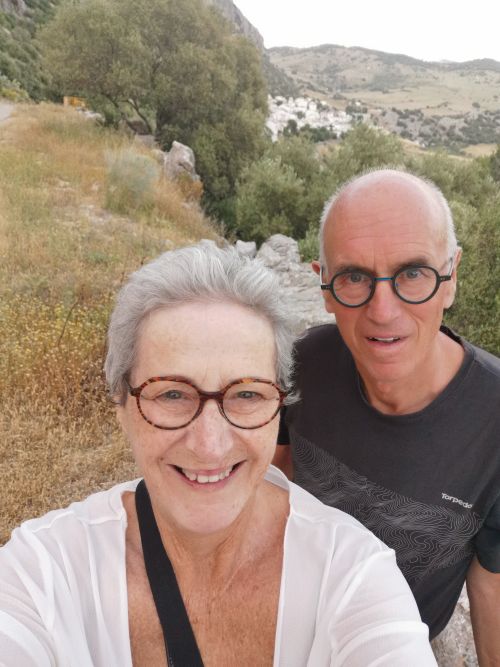
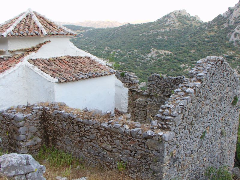
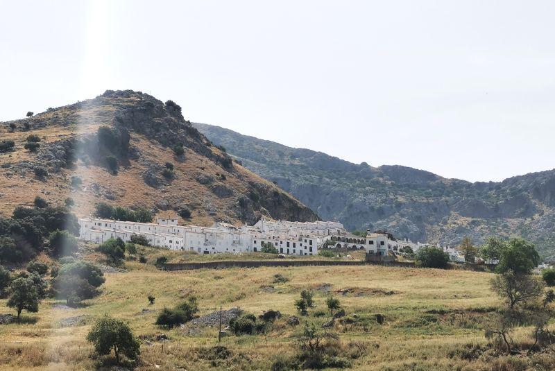
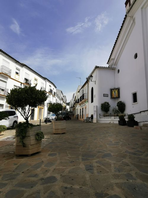
Villaluenga del Rosario
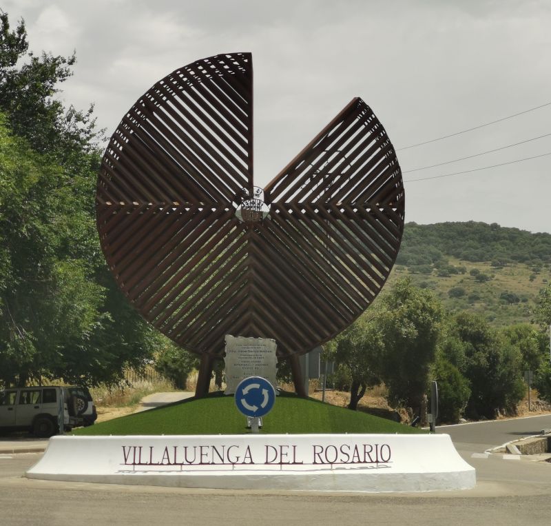
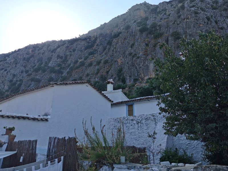
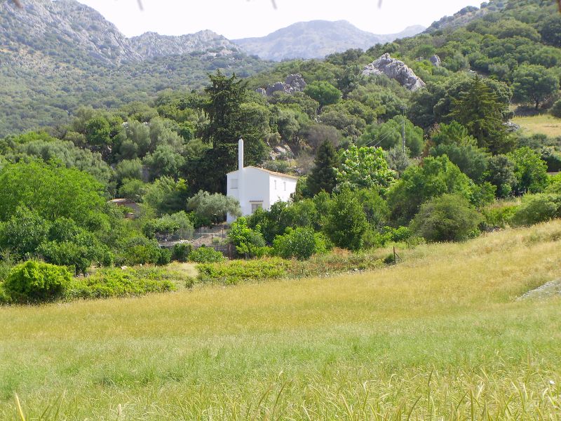
Soon it was time to drive to the other side of the mountain, to our home for the next 5 nights at Villaluenga del Rosario. This small white village sits at 900m (2953ft) on sloping foothills at the base of the cliffs of Navazo Alto Mountain. It is the highest, but the smallest, municipality of the Pueblo Blanco (white villages) in the province of Cádiz. At a roundabout at the entrance to the town is a sculpture which, due to the region’s fame for Payoyo goat cheese, is in the form of a round cheese with a segment missing. “Rather a cheesy sculpture”, Manfred said in amusement!

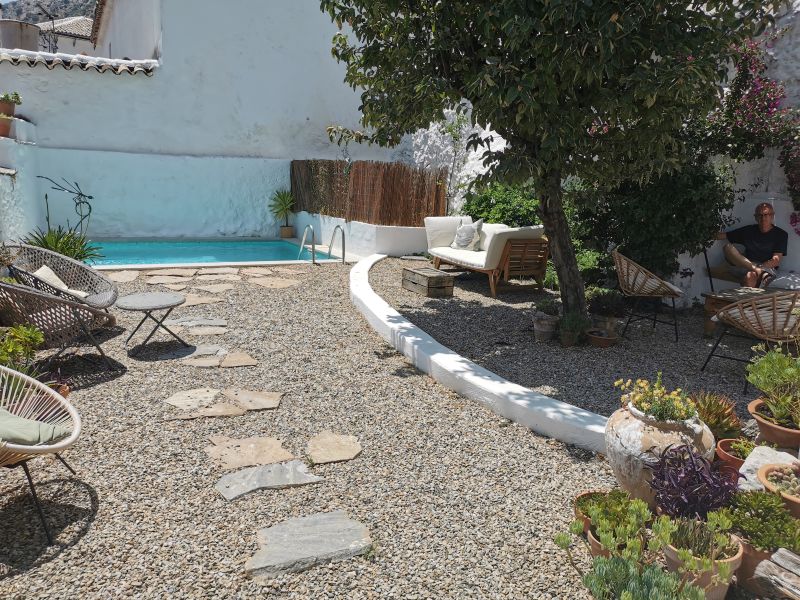
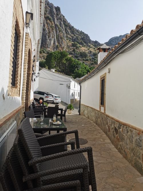
We found our way to our ‘Mountain Guest House’, Casa De Los Cuadros, at the top of the village. After 2-years of renovation, this spacious house, formally used as the home of local school mistresses, is restful and has many modern rustic features including two kitchens for the use of guests who can then sit at a variety of tables or outside by the old well. Steep, narrow steps lead to the enclosed garden where one can sit in the sun or under the shade of the trees, or enjoy the plunge pool. Each room has a garden or village view, and well-behaved pets and children over 12 years of age are welcome. Our hosts were English and had lived here for many years. They provided good information on walking trails, photography, the mountains, and the limitations on eating facilities in the small village. Their website (see below) gives a good indication of the house, the village and the region, and adventures in the Grazalema National Park, which surrounds Villaluenga.
From their website: ‘Situated in an unspoiled and authentic white village, Villaluenga Del Rosario, Casa de los Cuadros (House of Pictures) is a beautiful, spacious, typical Andalucian house, where you can enjoy the fabulous surroundings of Sierra de Grazalema, from your doorstep‘.
Right click here ☝️to visit the website in a new tab
Remember to open up the groups of photos to see them fully!


About the region
The village sits in the narrow limestone valley of the Arroyo Albarran, and is long and thin—being 800m by 250m; hence the name Villaluenga. Villa meaning house and Luenga, long. The ‘del Rosario’ was added due to the ‘deep-rooted’ devotion of the townspeople to ‘The Virgin of the Rosary’, the patron saint since the 18th century. It is not known when the village came into being, and like many others in the region it is thought that it existed in the Neolithic times, with the findings of well-preserved archaeological remains. Some Spanish villages have museums proudly displaying local artefacts dating back many thousands of years and telling a story about that particular area, which may differ from other parts of the region. These artefacts are recovered from tombs, dolmens, and other structures such as caves and dwellings.
On reading some Andalucian history and its proximity to Africa, it appears it was one of the early areas explored and settled by tribes, particularly in the south of the Iberian Peninsula. The multicultural melting-pot of ancient civilisations has historians disagreeing on when the early history of humans in this region began. Human remains have been found in caves; and in 1994, skeletons, since dated between 780,000 and 1.2 million years old, were found!
Read more fascinating history up to the Neolithic (Stone Age) 6,000 to 3,000 BC here:
https://www.andalucia.com/history/prehistory.htm
During the Neolithic time, the North African tribes, who became known as Iberians, came with their developed crops. There is evidence of seasonal agricultural cropping, while hunting was the primary source of food gathering. Tools made from wood and stone have been uncovered, along with ceramics and pottery made from clay and sand, gaining their red-ochre colour from the addition of ferric oxide. The tribes began to create dwellings as circular huts as they came out of cave living, which were by then predominantly used as burial chambers.
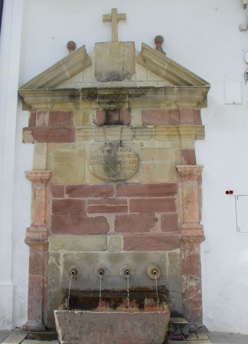
Villaluenga del Rosario, although thought to have grown from Neolithic origins, is best known to be of Arab origin, with the Muslims occupying it from 716 to 1485AD. The Village also has many connections to the Roman civilisation, seen by the 2,000-year-old, almost indistinct, Roman Road, and an aqueduct which terminates at the village beside the main road. At the time we were there, the water was running crystal clear.
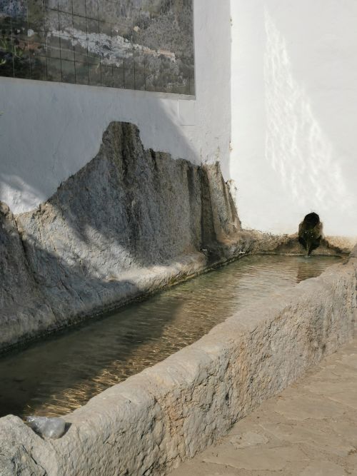
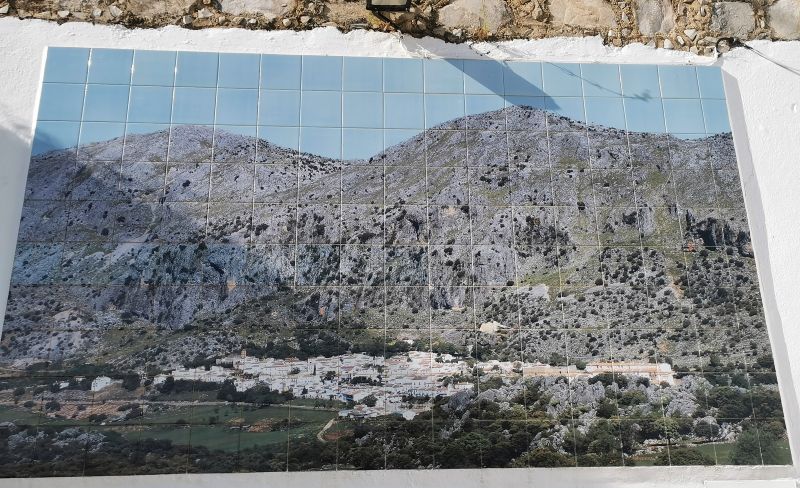
The aqueduct on the edge of the village & the mosaic tiled map of Villaluenga del Rosario
Known as the Cañada La Manga, the Roman Road was built on an ancient cattle route that runs from Benaocaz to Grazalema, and lies very close to Villaluenga. After many repairs and the building of the modern highway criss-crossing its pathway, it has in many places all but disappeared. The town has many other features in its narrow, cobbled, but steep streets, including one of the oldest and unique bullrings in the province of Cadiz. Unlike traditional round bullrings, this one is polygonal, built in the 18th century to incorporate the natural rock formations. There was a day of bullfighting associated with a festival, and while we did not attend, we could hear the cheering of the crowd from all over town.
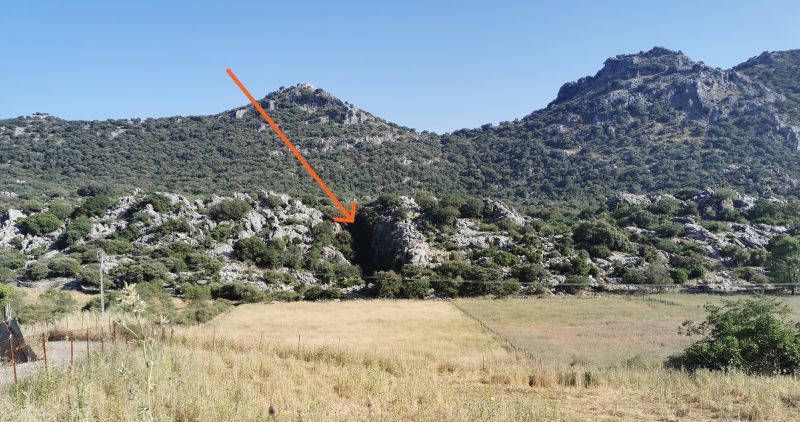
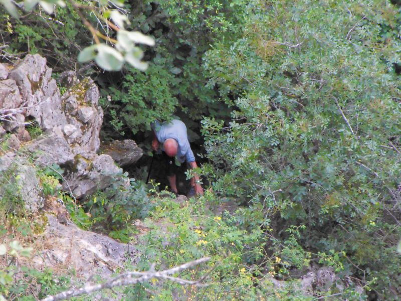
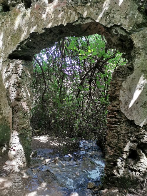
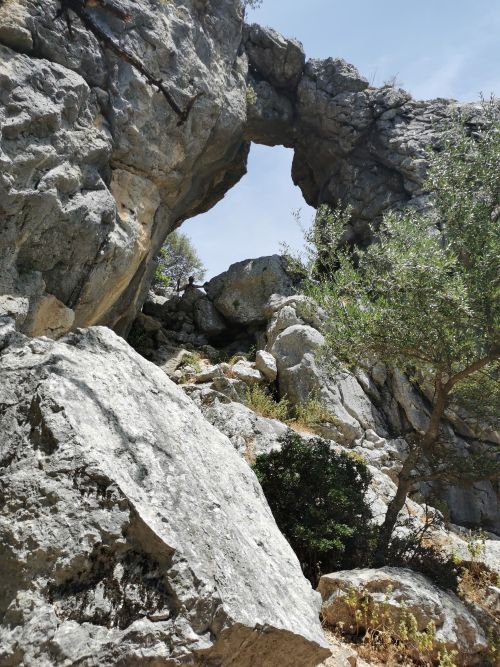
Sima de Villaluenga – a sinkhole
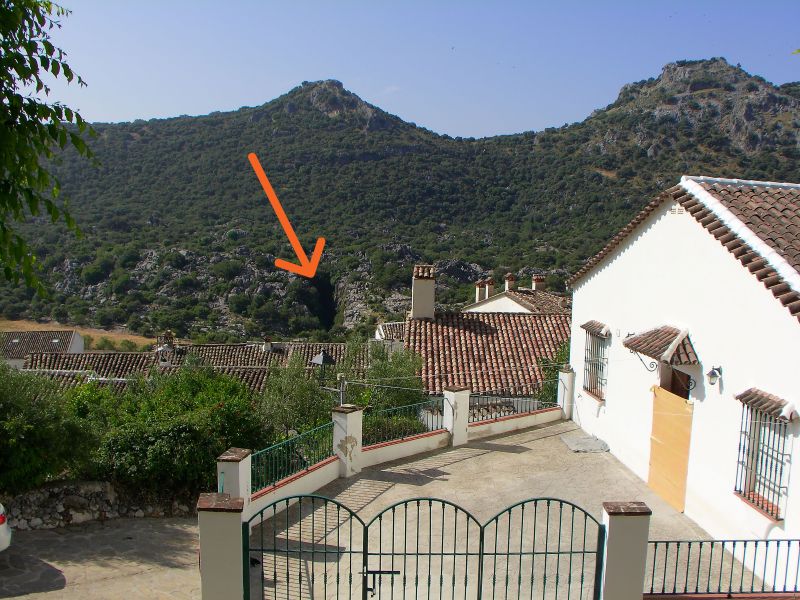
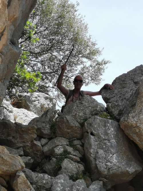
Across from the town is a ‘sinkhole’ called Sima de Villaluenga, a natural chasm, remarkable for its significant depth. It is popular for caving and geology in this karst landscape, limestone formations, and subterranean world. We visited it one evening, and Manfred delighted in going in as far as he could with walking stick in hand.
Remember to open up the groups of photos to see them fully!
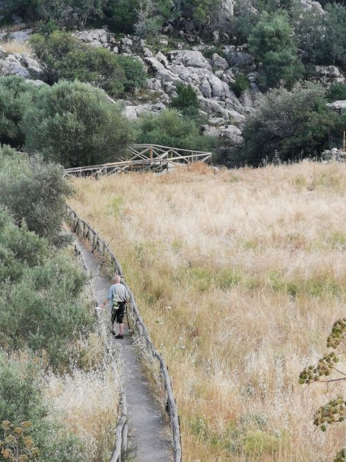
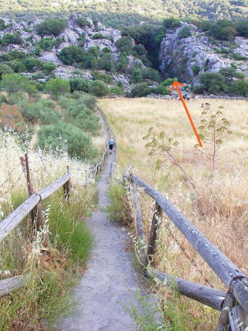


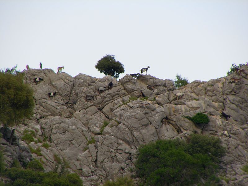
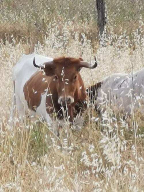
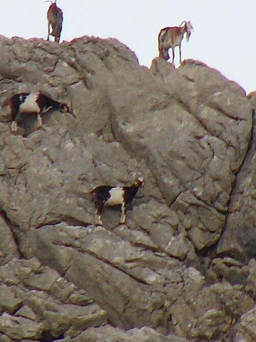
I sat and enjoyed the ambience, wildflowers, and the warm evening. On the walkway across the fields, we spotted Payoyo goats climbing on the rocks near the factory, and cows grazing in nearby fields.
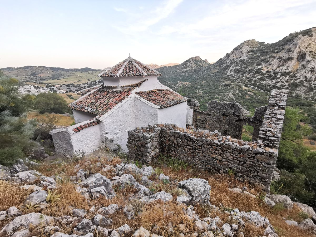
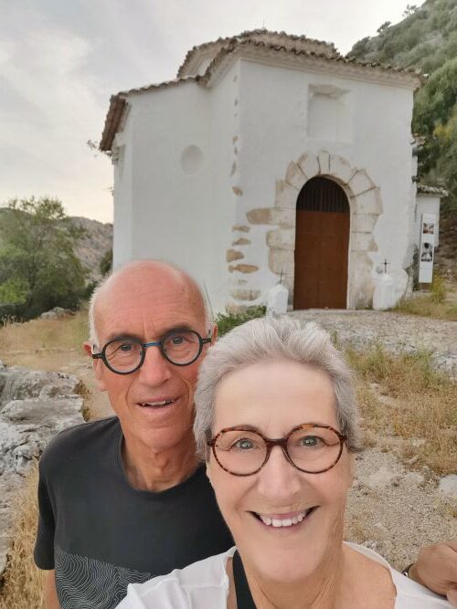
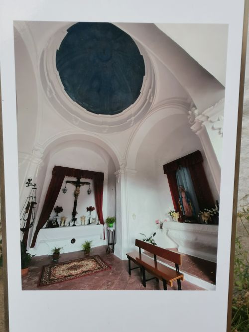
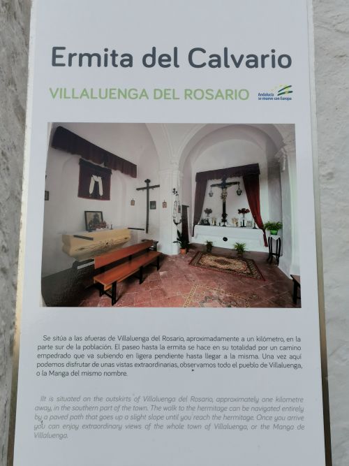
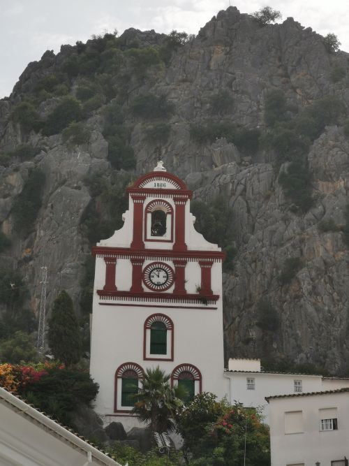
Ermita del Calvario – Villaluenga del Rosario
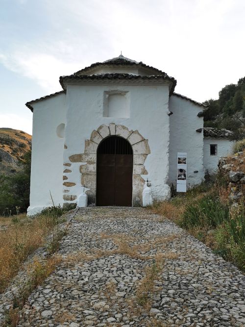
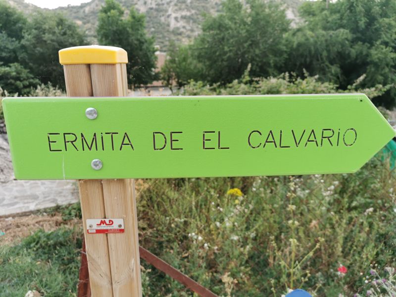
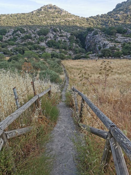
The town has an 18th-century Ermita (Ermita Del Calvario), and the 1km walk up the hill on the cobbled walkway to this little chapel passes the 12 Stations of the Cross. It was an enjoyable stroll in the evening when the air was cooler.
It can also be accessed from a roadside track. I clambered over rocks to get to the back, where I found ruins of what I presume is the original Ermita attached to the back of the small chapel. From here, we had amazing views of the village and the surrounding valleys of the Manga de Villaluenga.
Remember to open up the groups of photos to see them fully!
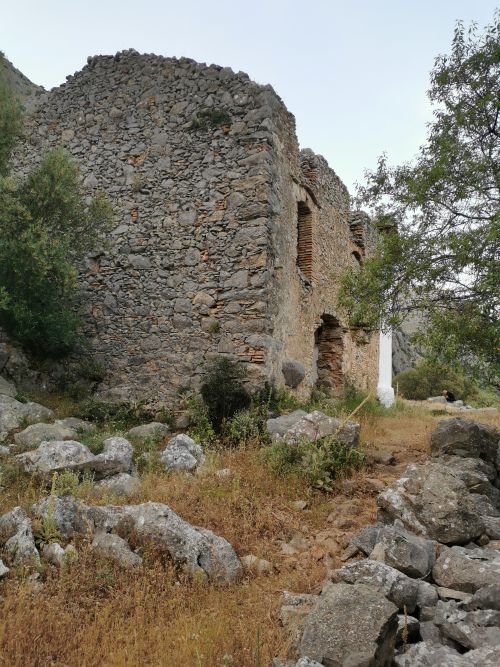
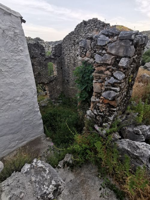
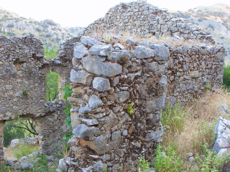
The ruins behind the Ermita and Villaluenga del Rosario behind us from the Ermita

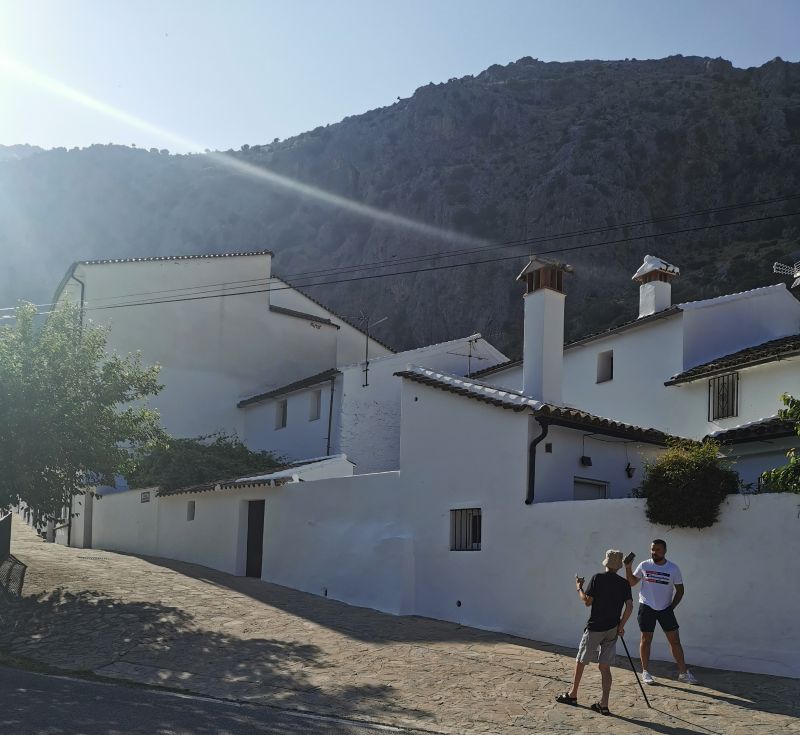
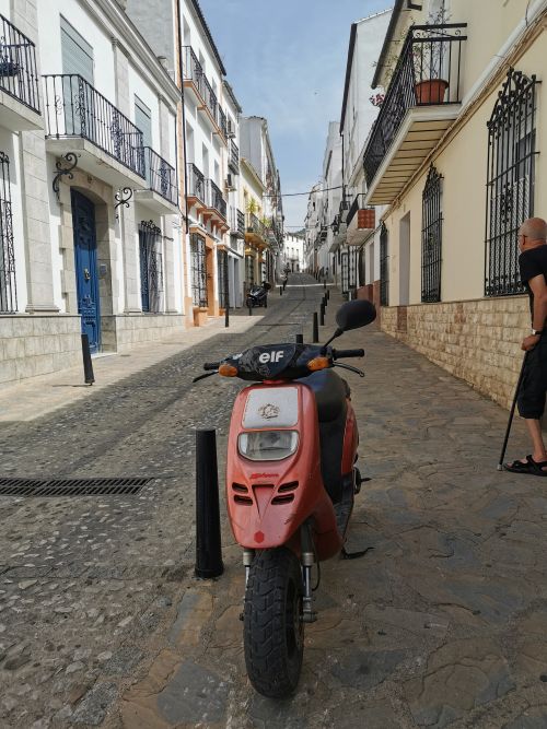
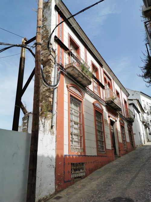
Discovering the village and the steep streets
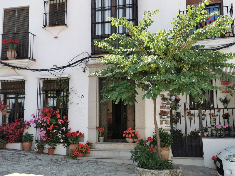
The following morning we went for a walk to the main road that passes through the lower edge of town. Negotiating the steep, cobbled streets it is interesting to see the roofs of the houses slope to the valley and chimneys rise above the whitewashed walls with shutters on narrow windows and balconies bearing colourful flowers. The village has some notoriety in the form of poets and writers—long since gone, but a museum in honour of the poet ‘Pedro Pérez Clotet’, the Literature Interpretation Centre, is open by appointment for viewing. We passed beside the bullring, with its museum underneath, and on down to the aqueduct trough.
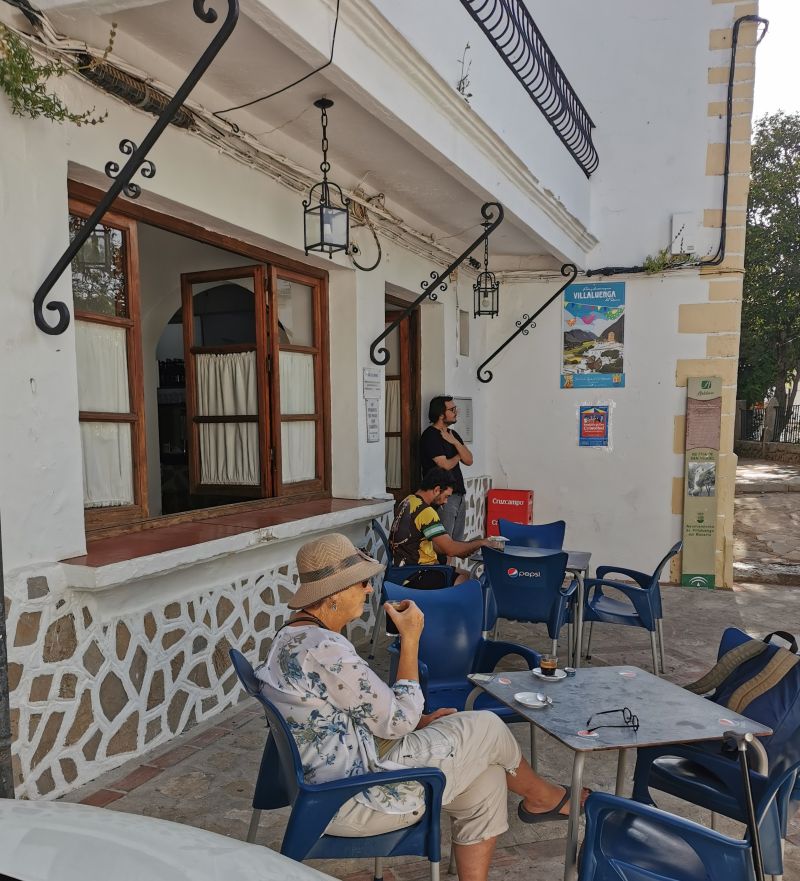
Finding no cafes open, we spoke to a young man coming down a street and he directed us up to the village square, ‘Plaza de la Alameda’, the grocery store, which belongs to the Payoyo Cheese Factory and a small bar nearby where we could get a coffee. The store was well stocked, and after buying some items we sat and enjoyed a coffee beside the tree-lined plaza with rose bushes and its covered platform for entertainers.

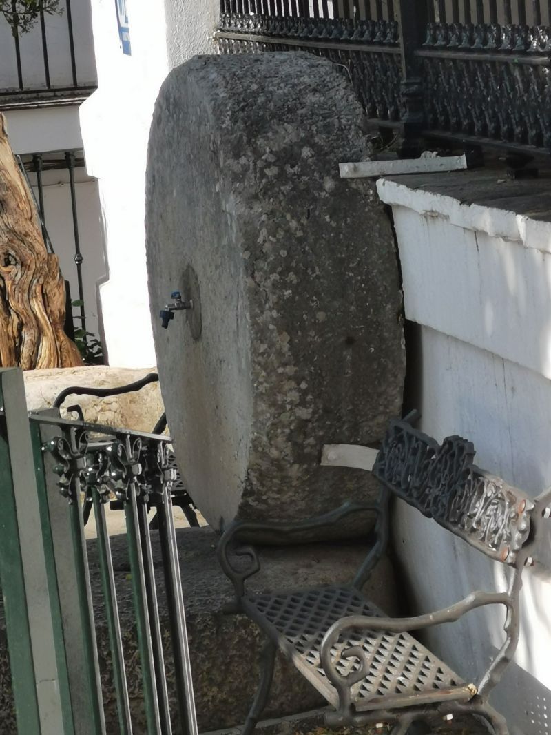
Coffee near the plaza and a great fountain made from an olive mill stone
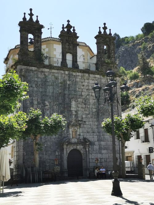
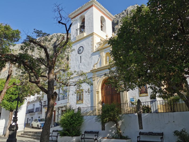
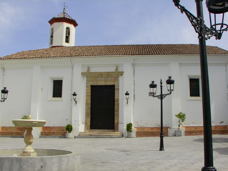
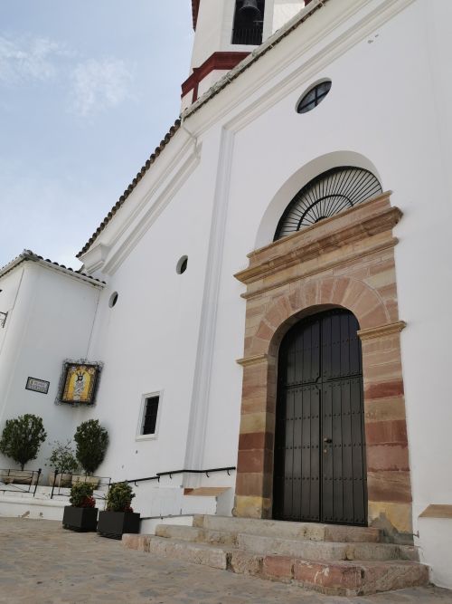
Plaza de La Alameda is right beside the 16th-century Church of San Miguel, which overlooks the comings and goings on the tree-lined avenue. The beautiful Baroque and Renaissance Basilica style church has 3 naves, which are separated with Tuscan columns and was inaugurated in November 1733. Inside, among other iconography, there is an Image of ‘Our Lady of the Rosary’ dating from the 18th century. A truly beautiful building to have on the edge of the plaza in the centre of this quaint and lovely village.


Daily coffee and a local meeting point
Remember to open up the groups of photos to see them fully!
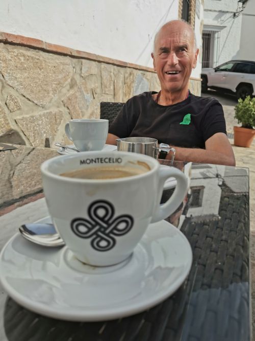

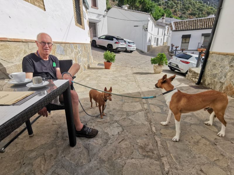
Each morning our ritual became a walk to the town’s only hotel, ‘La Posada’, to sit at the street-side tables for coffee, chatting to the locals and our host as he came by for coffee while out walking the dogs.

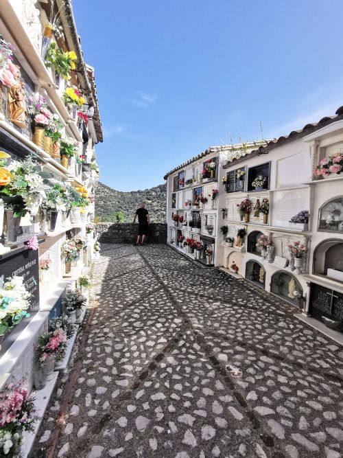
The village Cementerio
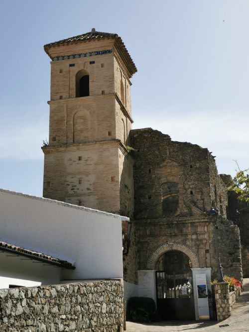
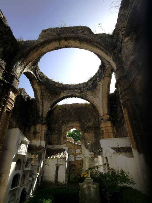
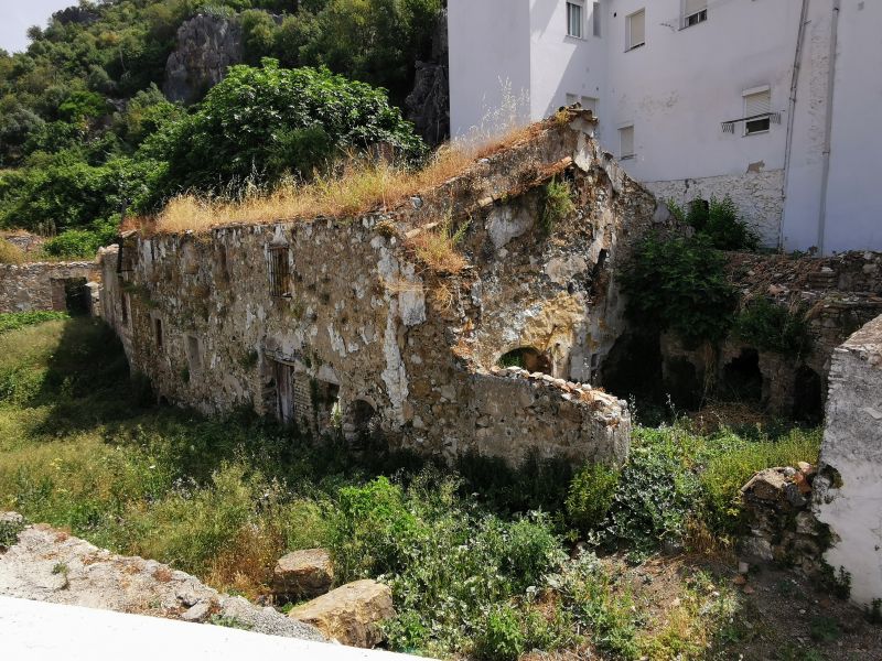
Nearby is the ‘Iglesia del Salvador’ (El Salvador Church), whose tower can be seen from all over the village and my curiosity was piqued to see what ‘treasures’ it held. So on our last evening in Villaluenga, we wandered up to view it, having found out more about its history. Built in 1722, it is now a ruin but houses a cemetery, which we were told has been voted the most beautiful cemetery in Spain; and on arrival, we could see why.
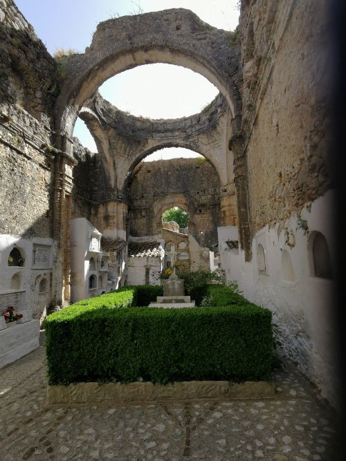
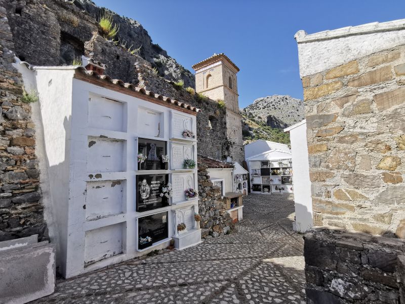
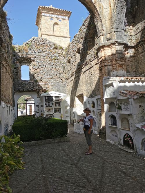
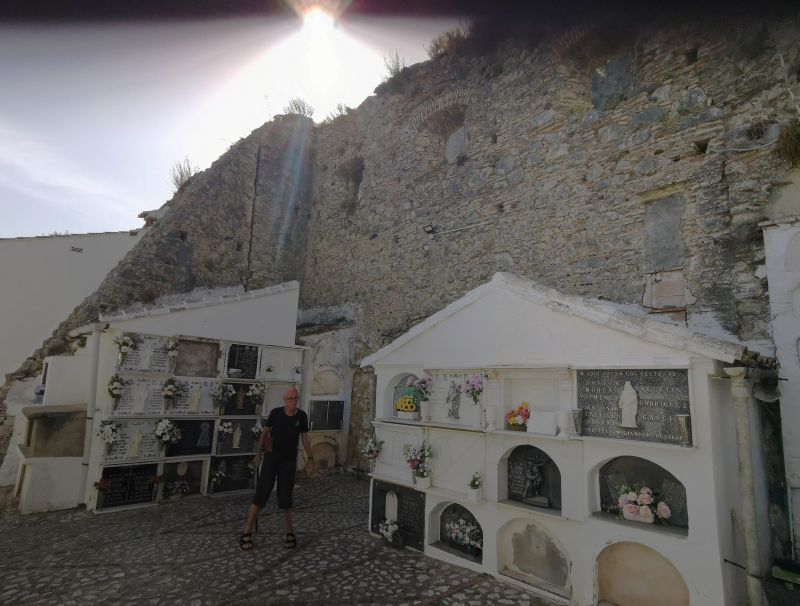
The church itself no longer exists after being burned by the Napoleonic troops in the early 19th century (1809-1814), when the village was ransacked and incredible damage occurred. Instead of rebuilding, they used every part of the church to build niches for burial.
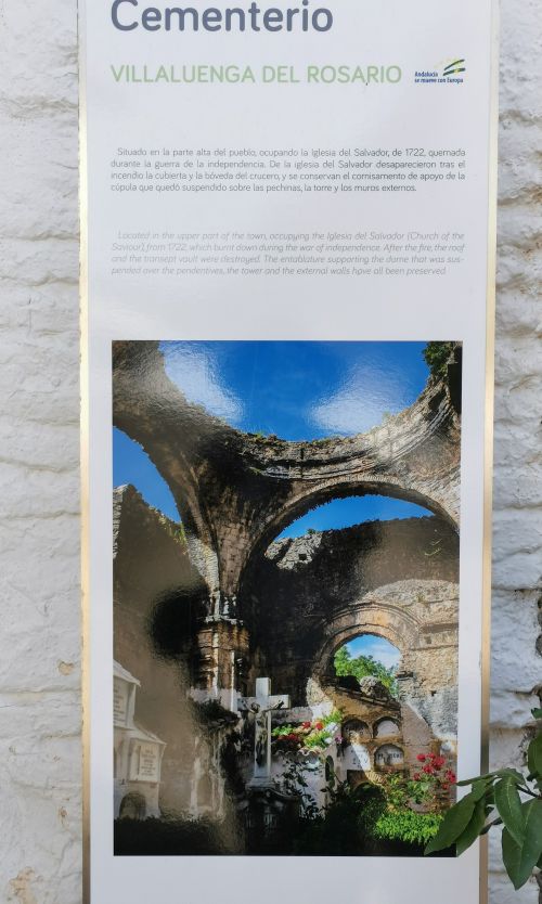
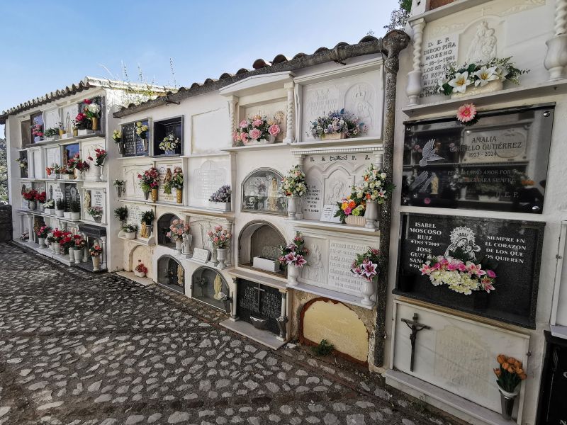
The ancient tower, skeletal walls, and vault of the church remained and are well preserved. The villagers created a beautiful place of peace for their dead to be laid to rest.
Day trips from Villaluenga del Rosario
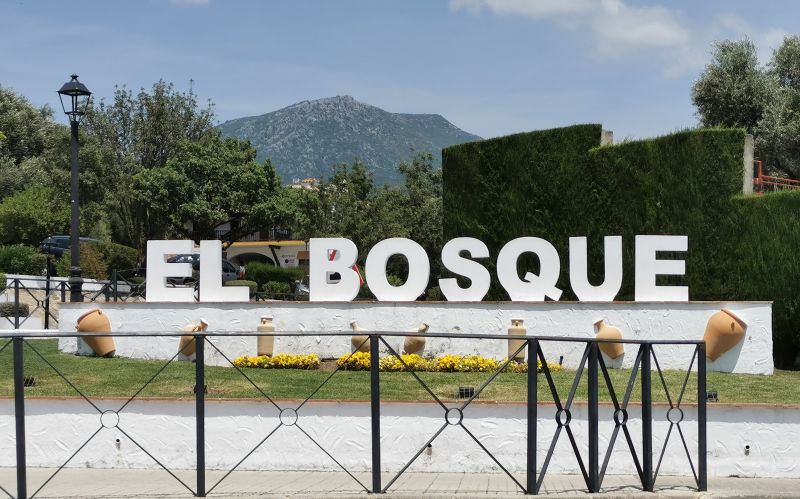
El Bosque
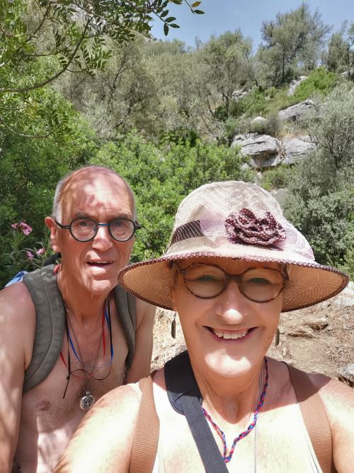
From Villluenga, we did day trips, starting with a trip to El Bosque, about a 30-minute drive through the stunning heart of the Grazalema National Park. We planned to get tickets to ‘Sendero Garganta Verde’, a protected area of the Park, where the number of people per day is limited and free entry tickets are essential. We had visited here in 2008 and remembered being told it is ‘not for the faint-hearted’, nor for those with vertigo, but the enticement was a viewing place to watch the Griffon Vultures. Sitting and watching was our first experience of these large and grand creatures, and we were in awe of their wingspan and ability to just hang in the air.
However, when we got to the park headquarters, we were told this area and one other, the Pinsipar Forest (we also visited in 2008), were closed due to ‘conservation measures’. Not to be disappointed, Manfred chatted with the park headquarters’ attendant about what we could do and eventually found out we had arrived on the day of the town festival.
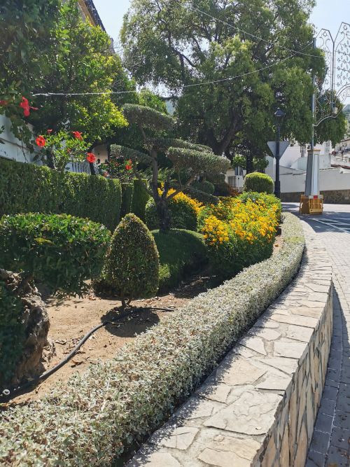
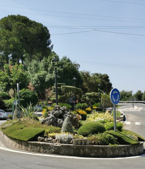
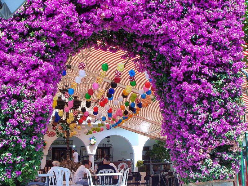
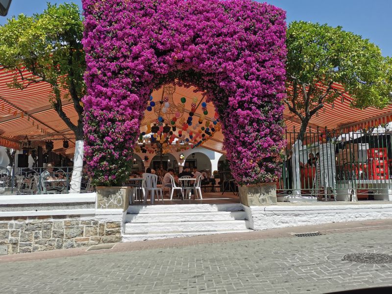
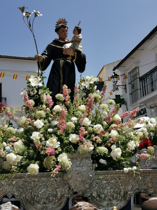
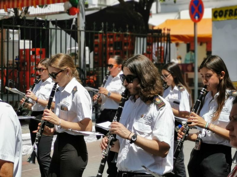
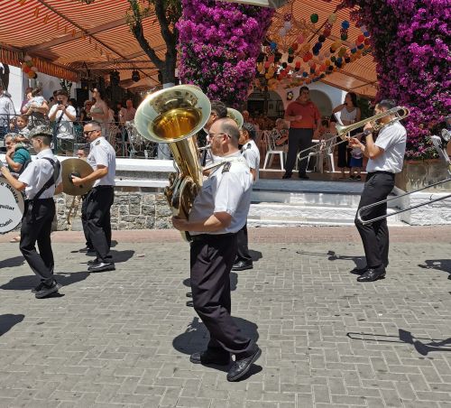
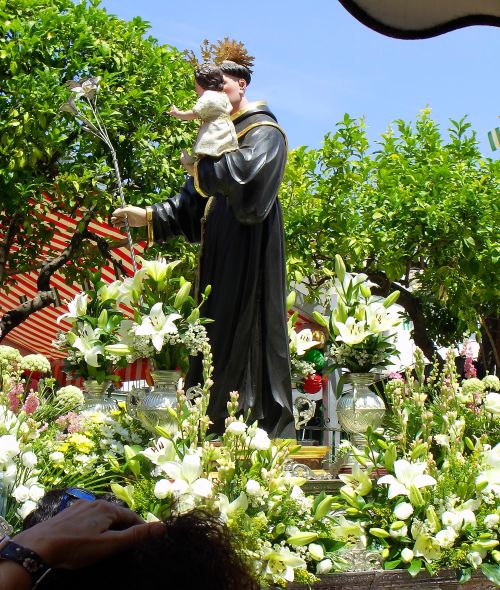
She told us where to drive and park, and once up in the town square (Plaza Mayor), we found a table at a restaurant bar opposite a raised covered area adorned in flowers and balloons with space for a musical band to play. We had tapas and a drink, and relaxed under the umbrellas in the warmth of the late morning. Many people gathered in all of the covered spaces, bars, and restaurants around where we were, and soon we heard music coming from an unseen area. The procession emerged with the statue of the patron saint, San Antonio de Padua, being paraded on a platform adorned with flowers and carried by men of the town walking in lockstep to keep the statue in place.
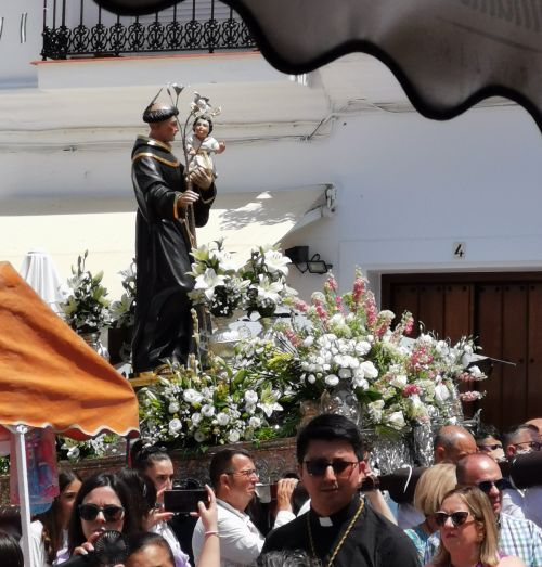
A large musical band followed and, to our surprise, stopped right in front of where we were sitting. It was a sight to behold, and Manfred got chatting to one of the men who had been carrying the platform. He encouraged us to stand in front of it for photos.

Sometime later, with the musicians melting in the midday heat, they picked the platform up and continued the procession, entering the Church of Santa María de Guadalupe. The infectious, joyful carnival atmosphere was typical of all the villages that have these celebrations; but before the party really got underway, we left to take a look at the local botanical gardens. Unfortunately, it was then 3pm, and closed for the day.


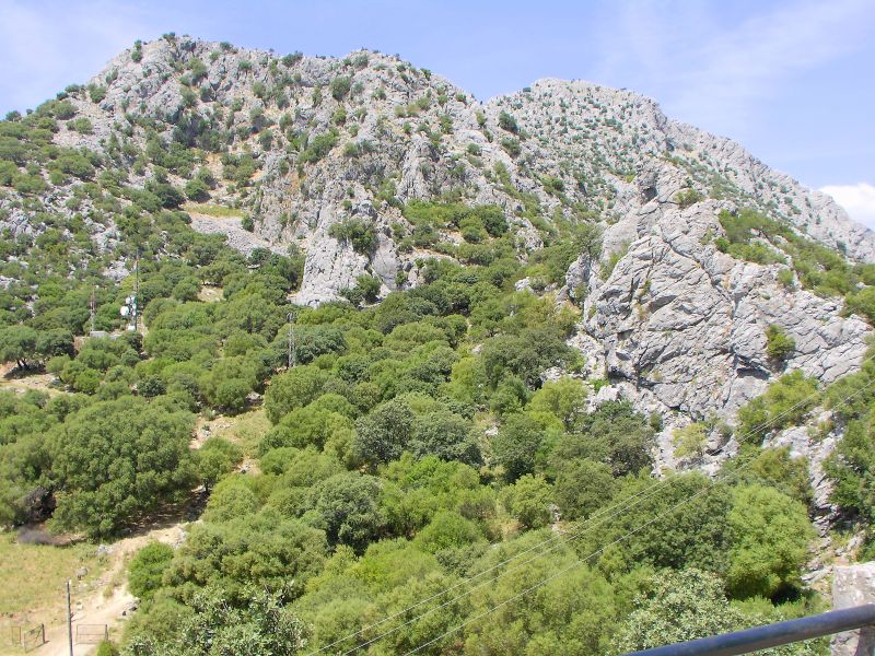
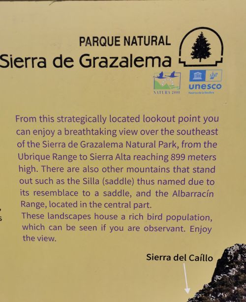
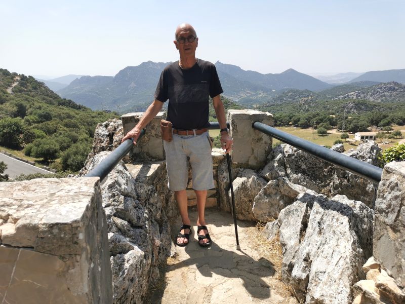
El Cintillo y Agua Nueva – Mirador
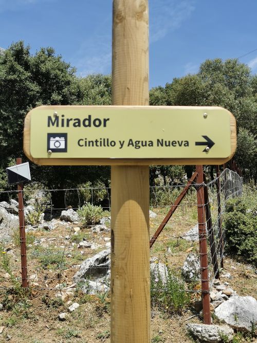
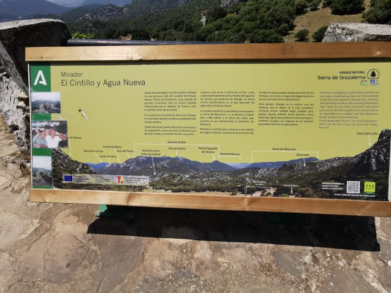
Making our way back to the village, through the breathtaking scenery of the National Park, we stopped at a ‘Mirador’ (viewing point) ‘El Cintillo y Agua Nueva’. We climbed up a steep track only to find that we could have driven up and stopped right at the Mirador! The view was spectacular and we stayed a while just to enjoy.
Remember to open up the groups of photos to see them fully!
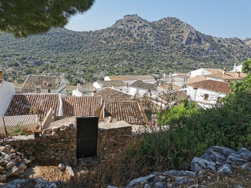
Benaocaz
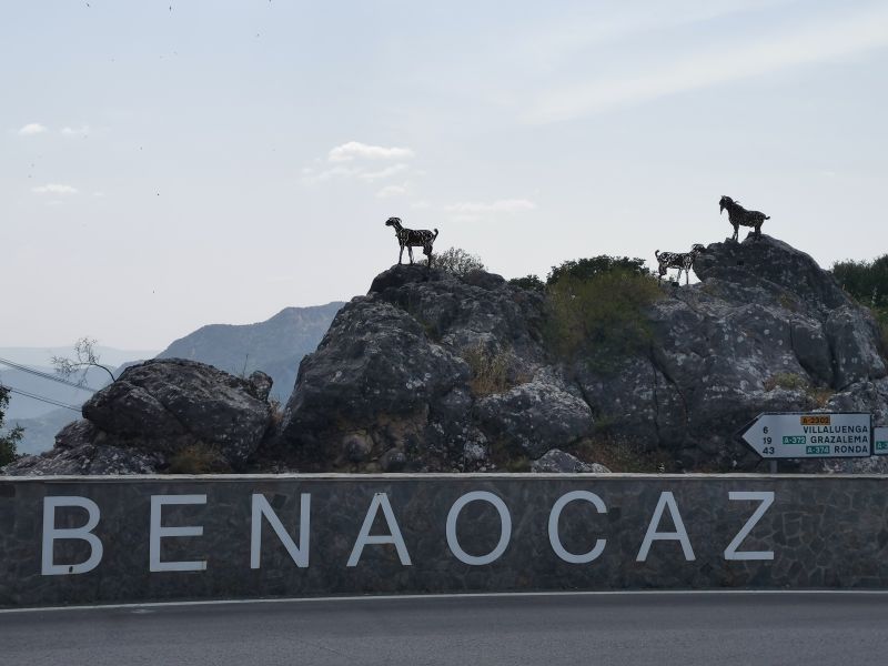
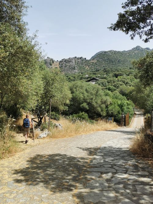
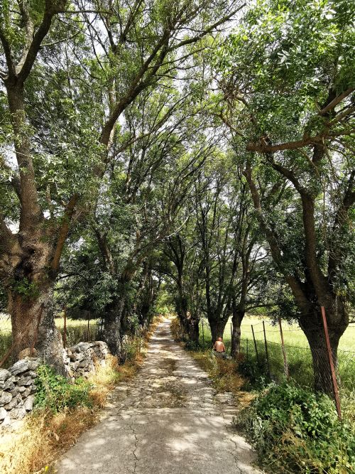
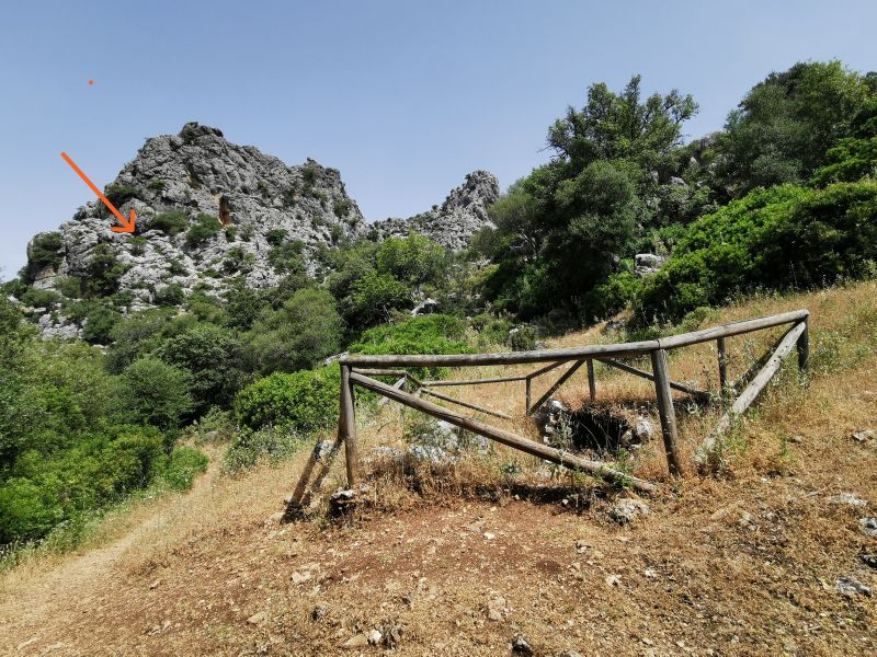
The following day we took the 10-minute, 7km drive to Benaocaz, a picturesque village known to have pre-historic origins. Dating from Neotlithic times, as gleaned from archeological findings discovered in nearby caves in La Manga and La Sima de la Veredilla, it has significant history from the time of the Moors (715–1845AD). Remains of paving from the Libyan-Phoenician times have been uncovered in the eastern section of the village. Benaocaz was very prosperous in the 18th century; however, due to the plague and the Iberian Peninsula War, it saw hardship and devastation, leading to near destruction due to ‘plundering’. It is also known for holding historical documents in an archive dating from 1515AD. The name Benaocaz comes from the Arabic Ocaz family, with Ben meaning ‘son of’. The village is part of the famous ‘Ruta de los Pueblos Blancos’ (Route of the White Villages), which explores the whitewashed houses of Cadiz and Malaga provinces.
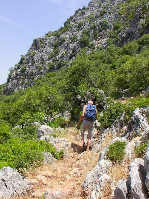
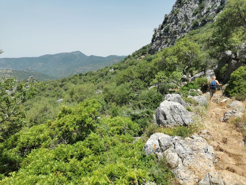
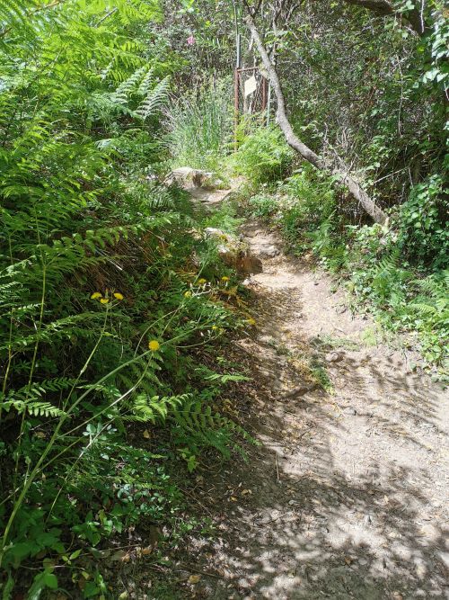
Our plan was to do a short hike near the village and come back for some refreshments in ‘Restaurante Nazari’. The hike is called ‘Sendero Ojo del Moro’, translating to ‘The Eye of the Moor’.
Remember to open up the groups of photos to see them fully!
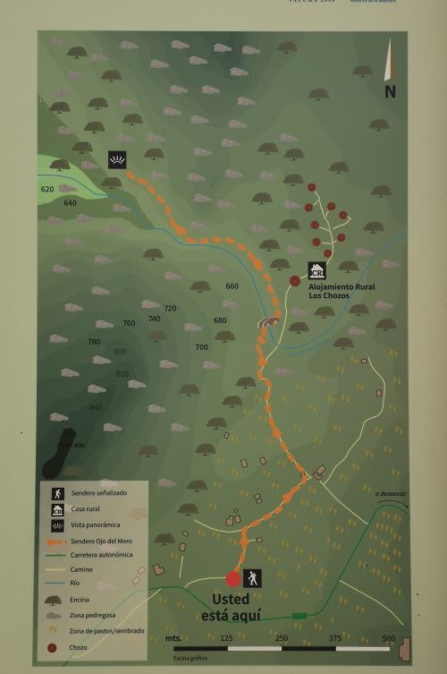
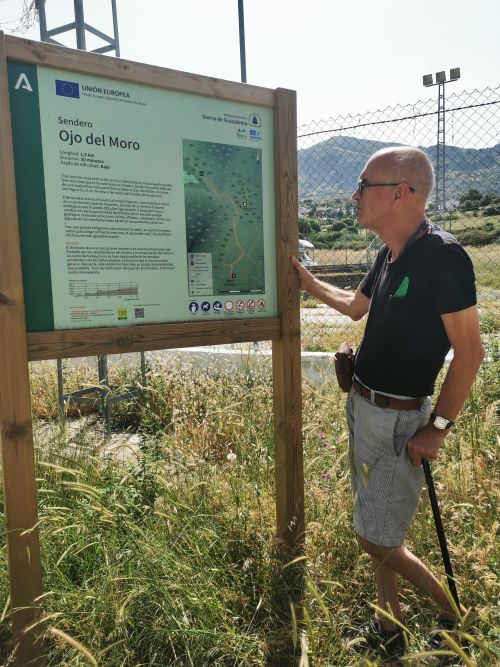


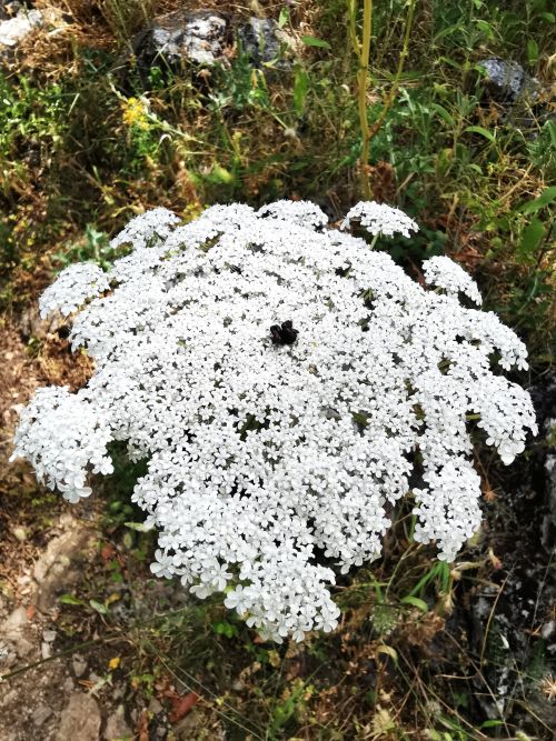
It was only supposed to be about 1.5km and take around 30 minutes each way, on a pretty track through the trees, bush, wild flowers, and in a rocky gully with an ancient Roman bridge.


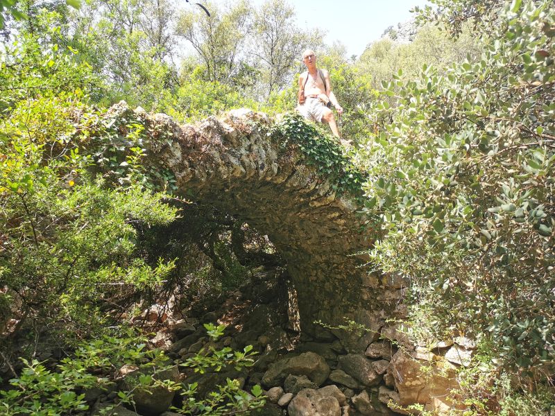

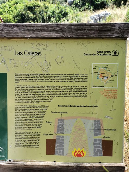
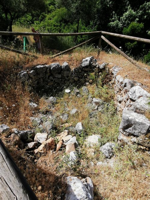
As we walked, we were commenting on the caves in the rocks higher up, and various other landmarks such as a ruin called ‘Las Caleras’, where above and below ground they used to make lime back in ancient times. The end product was used to whitewash the walls of the houses to keep them cool, as well as what we modern-day users know as cement and a disinfectant.

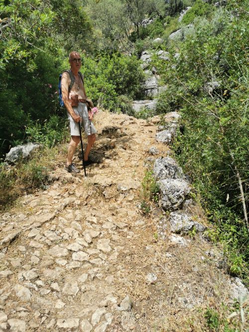
We came to a signboard indicating many landmarks over the expansive vista spread ahead of us, and a small sign saying we had come to the end of the track. Manfred inadvertently disturbed a nest of bees and was stung by one and chased by others—while not pleasant for him, it was an amusing sight for me to see him furiously waving his arms about to rid himself of them!
Remember to open up the groups of photos to see them fully!

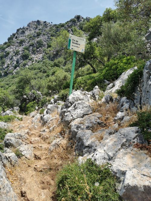
The end of the track – but we carried on….
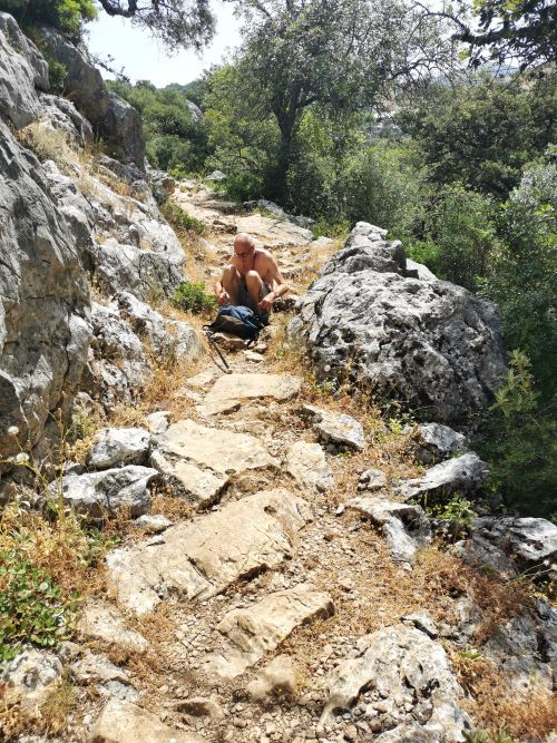
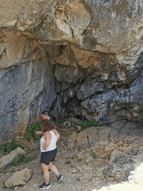
The track did carry on, but the ‘Ojo del Moro’ was nowhere to be seen. A Spanish couple arrived soon after, looking for the same landmark. Together we carried on down the track about another 1km, only to find the track ran out. The Spanish couple had internet and got onto YouTube to try and locate the ‘Ojo del Moro’ by following others’ postings.
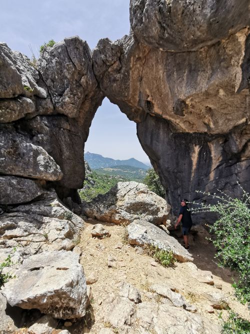
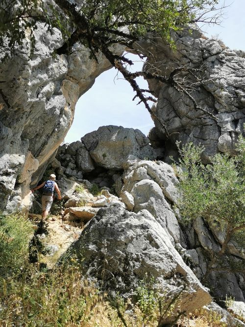
Eventually, as we made our way back towards the start of the track, thinking it was a futile mission, they called to us that they had found a way up some steep rocks and along below the ridge. We started to climb. Manfred decided to wait on the lower rocks, but I carried on climbing through a small gap in some rocks and found the Spanish couple in the ‘Ojo del Moro’.
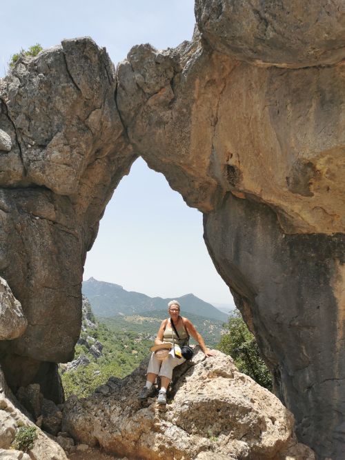
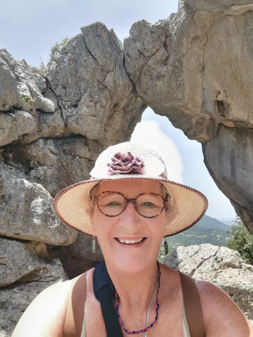
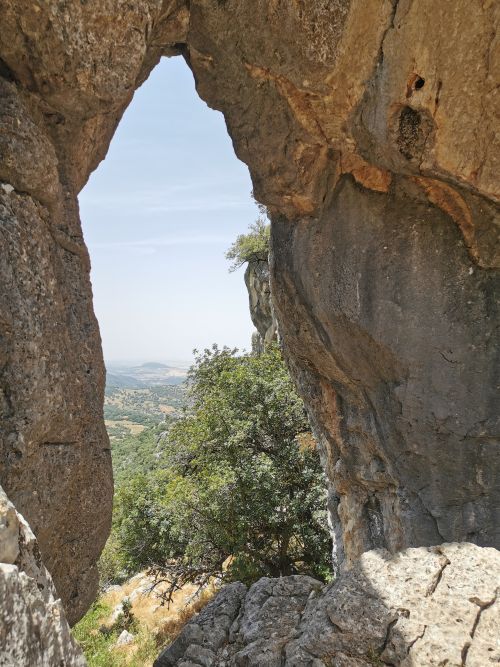
The last few metres were a stiff climb, but the canvas spread before us was totally worth the effort. After admiring the views in every direction and taking photos, they left a little ahead of me.
I climbed down and followed the track they took; however, it ran out, so I came back up, deciding to go back down the rocky incline where I had arrived from. I was running out of water, and it was hot, which gave me cause for concern. But just then I heard Manfred call out as he arrived at ‘the track’, which was not signposted, but the short, sharp climb we had been looking for from the main track.
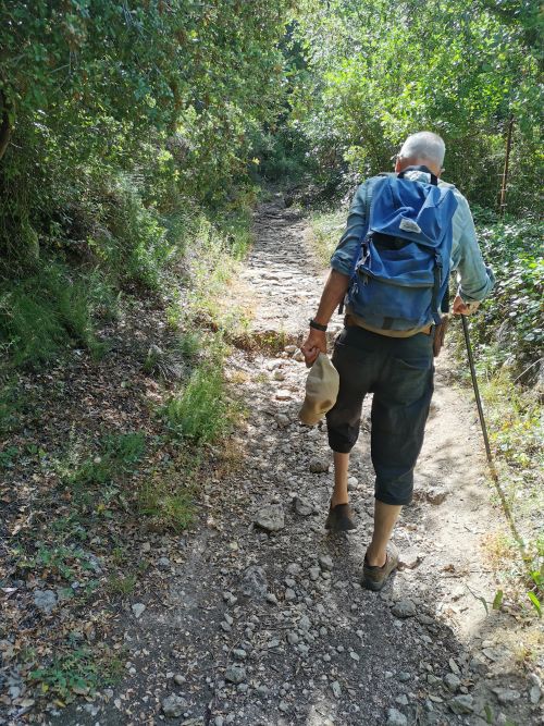
I rested, while he took in the sights from the ‘eye’. Satisfied, we meandered our way back on the main track and towards the Roman bridge and car, stopping frequently in the shade to conserve our energy. By the time we got to Benaocaz, there was only one bar open. We enjoyed copious amounts of cold water before heading back to Villaluenga and a dip in the cool plunge pool at Casa De Los Cuadros. The hike that should have been about 90 minutes turned into a 4-hour experience that left us slightly dehydrated but happy to have found ‘Ojo del Moro’ and its amazing views.

Villaluenga del Rosario to Grazalema via the high pass!
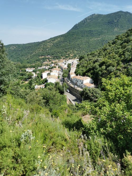
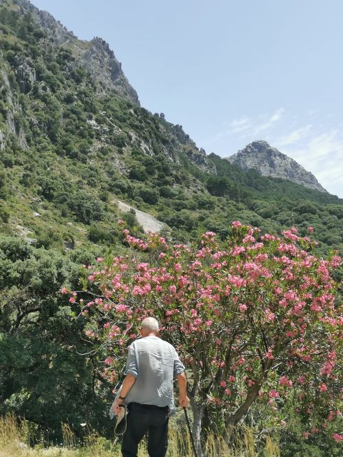
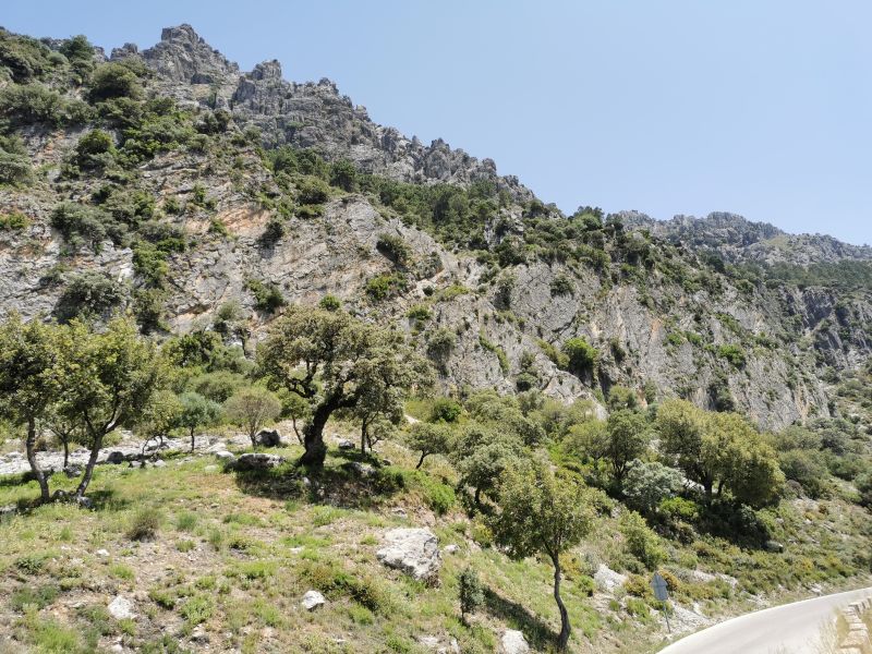
Our next adventure was a round trip from Villaluenga to Grazalema via the mountain route, which saw us drive via the same road past Benaocaz and Ubrique, turning off at El Bosque and driving towards Benamahoma and the Puerto del Boyar, sitting at 1,103m (3,619ft). The drive was ‘stupendous’. Upon leaving El Bosque, the 5km of road climbs steeply up towards Benamahoma, winding around the mountainside through forest and farmland. The village of Benamahoma curves around a mountainside, setting a stunning scene of stark white against a forest of green.
Across Southern Spain, the Moors, Berber tribespeople arrived about 714 AD and came from the mountains of Morocco with similar terrain. They built watch towers in most towns to provide an early warning attack system to defend their sites until the Christian forces defeated them about 1485 AD. Water provided by a spring powered flour and oil mills, and handicrafts in the form of textiles proliferated the market, creating much growth in the town and the building of Christian churches began.

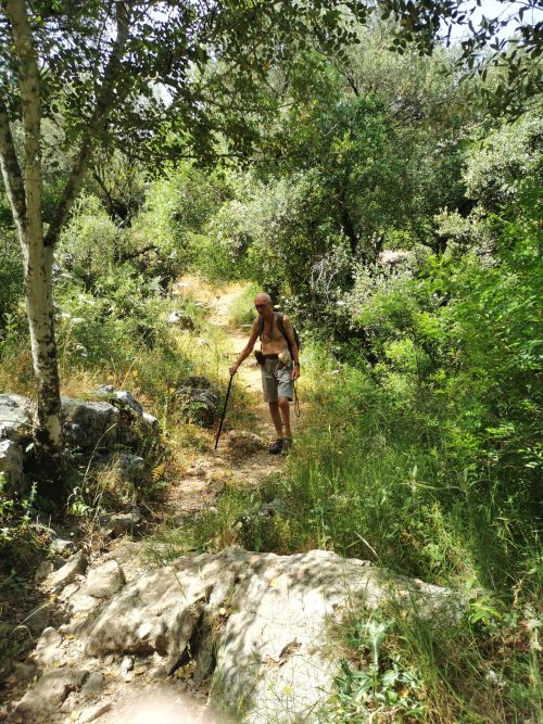
There are many walking trails in the surrounding forests, and once we arrived at Benamahoma we parked the car and found the route to ‘El Molino del Susto’, a difficult task when the only sign was an arrow on a small post with no name. We hoped we were on the right trail, particularly after the previous day’s debacle! Further up the steep, rocky 1.8km track, a similar post with arrows going both ways, with no named track, left us scratching our heads.
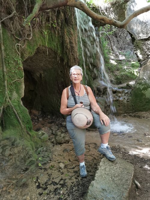
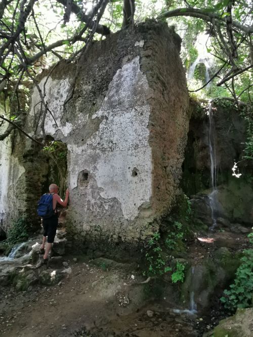
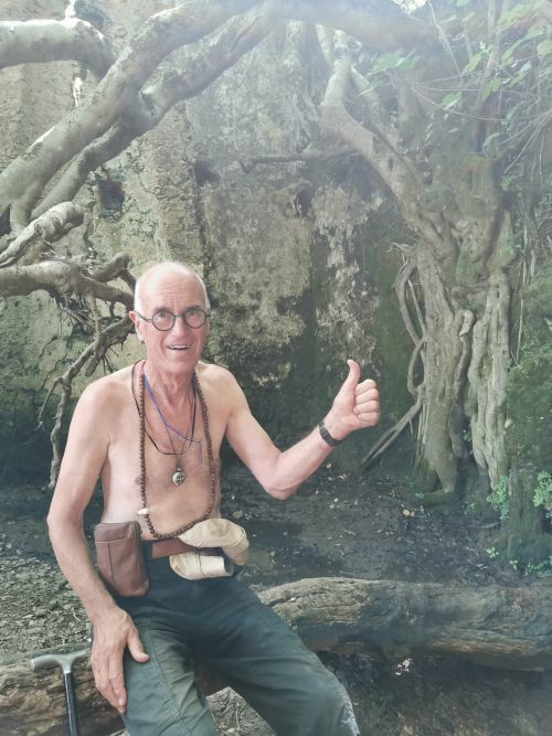
We finally made it to the destination where a weather-beaten board informed us we had arrived. It described that these ruins, built at the beginning of the 17th century, used to be an old flour mill that made use of the water from ‘Arroya del Descansadero’ (the Descansadero stream), a natural spring arising in the area of the mill to turn the millstone and grind the wheat.
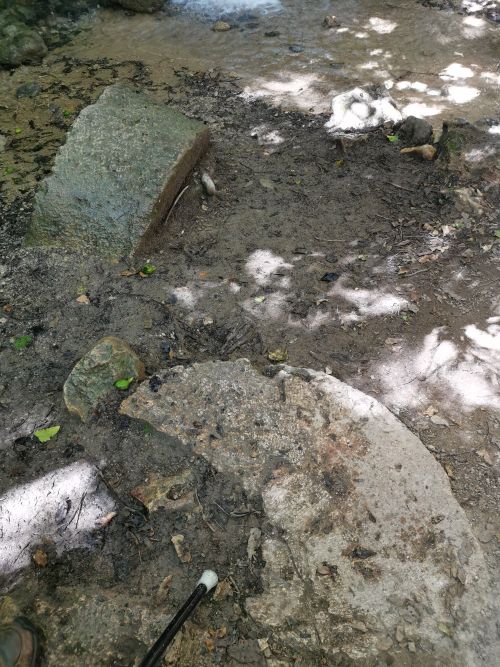
Half buried flour mill stones at El Molino del Susto
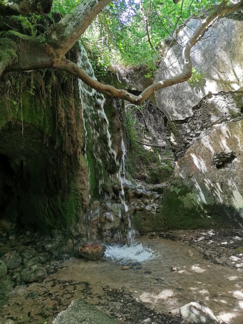
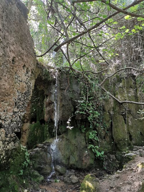
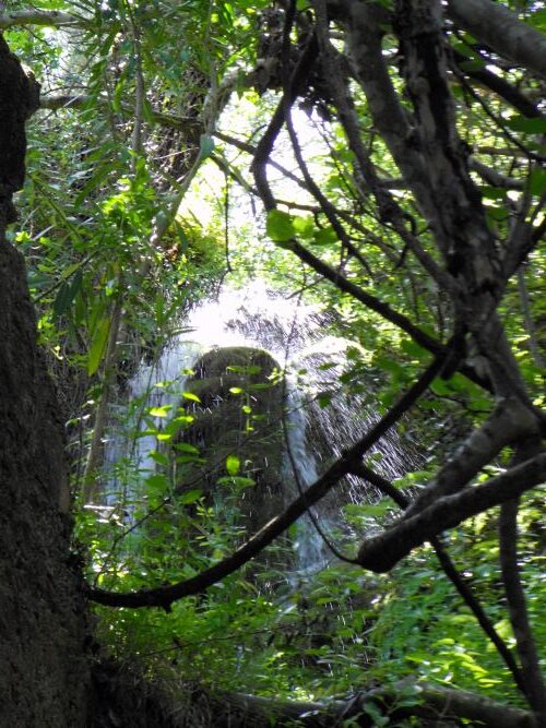
The information board revealed that the mill is now called ‘The Mill of Fright’ due to local ghost and paranormal stories of strange lights, unusual sounds, and even UFO sightings. Also known as ‘The Mill of Dread’ or ‘Scary Mill’, it was dismantled after the end of the Civil War. It is indeed mysterious, but we did not encounter any ghosts; instead, enjoyed the waterfalls made by the stream cascading down the sides and inside the ruins now infiltrated by moss-laden trees, ferns, and lichen.


After a short time, we took an equally steep track up to the road above the valley we had been exploring.
The trail restarted across the road and Manfred carried on that track for about 1km to ‘Fuente del Descansadero’ (a stone fountain) built at the beginning of the 12th century as a resting point to cool off on the cattle route, now a hiking trail. Meanwhile, I walked back along the road to get the car and met him at the fountain carpark.


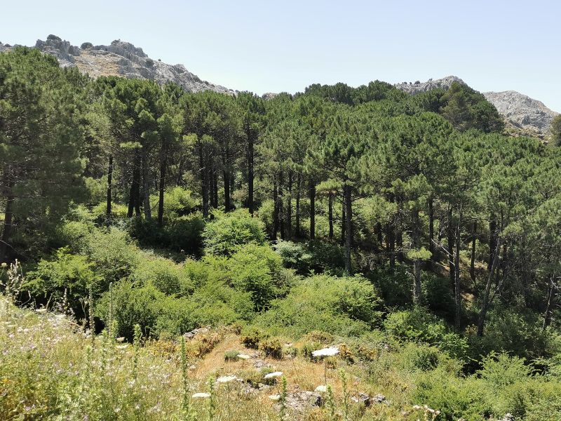
We drove on, stopping to marvel at the forests of Pinsipo and cork, the signs to walking trails, camping sites, and the expansive views. In this area is the mountain peak ‘El Torreón’ (also called Pinar), the tallest peak in this range of mountains, rising above the skyline to an elevation of 1,654m (5,427ft), very much loved by hikers and climbers.
Remember to open up the groups of photos to see them fully!
https://anywhereweroam.com/el-torreon
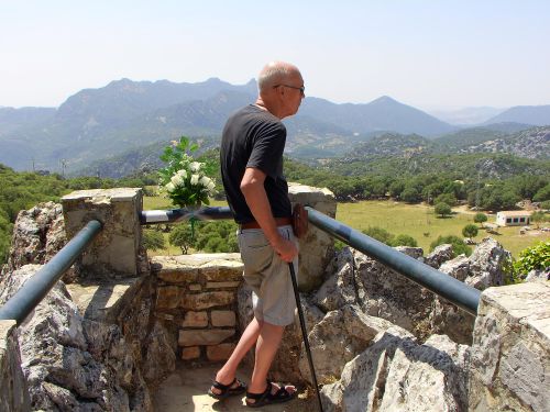
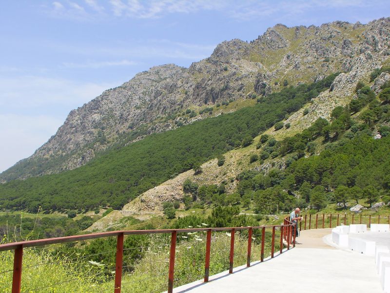
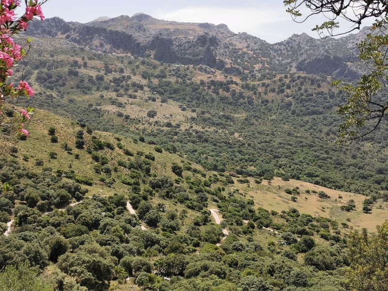
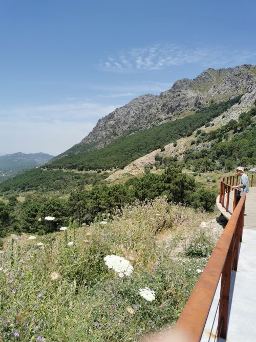
Eventually, we came to the high point on the road, the mountain pass of ‘Puerto del Boyar’, famous for having the ‘highest rainfall on the Iberian Peninsula’, its hiking trails, and amazing expansive views.

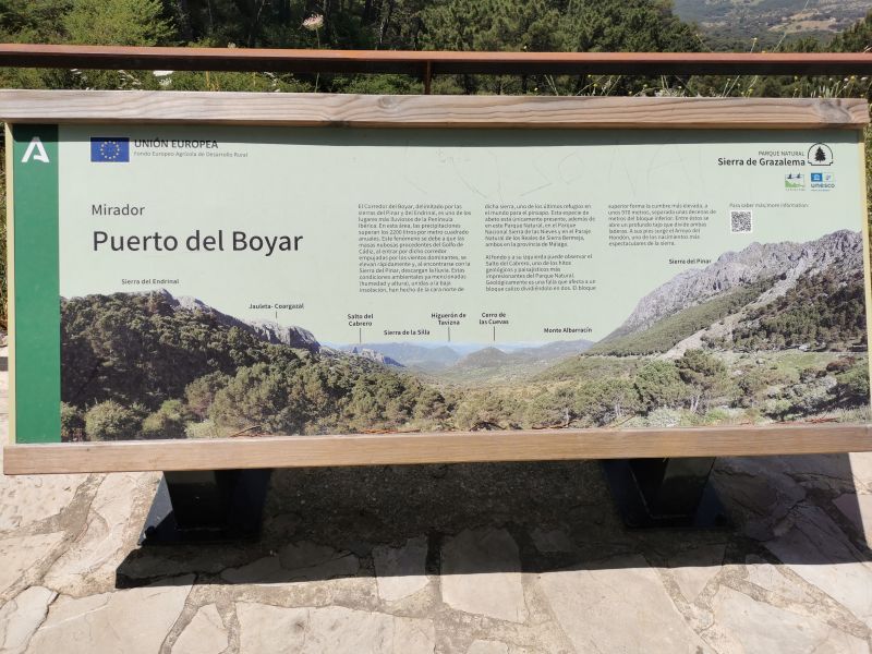
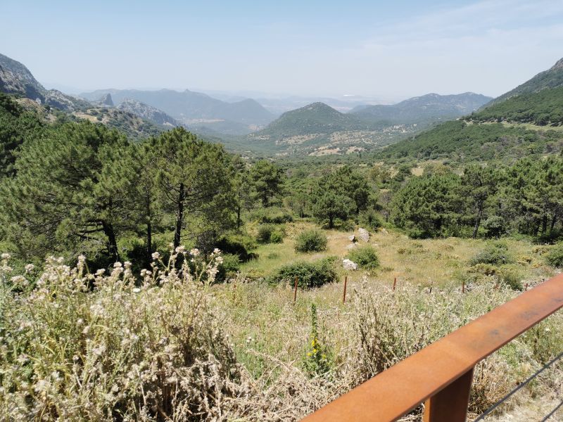
Cyclists and hikers find it a challenging destination, and many people enjoy picnicking in this area. It is a place of geological significance in the development of the region’s complex tectonic history, dividing ‘la Sierra del Endrinal and la Sierra del Pinar’.

Views from Puerto del Boyar – final photo is Saeto del Carbrero – (Leap of the goatherd)
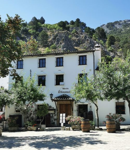
We drove on down into Grazalema and had a beautiful meal at Mesón El Simancón, a restaurant that was our favourite in 2008. The food was just as delicious and we lingered outdoors enjoying the ambience, as much as the food, before completing the circuit to Villaluenga and relaxing into our village lifestyle once again.
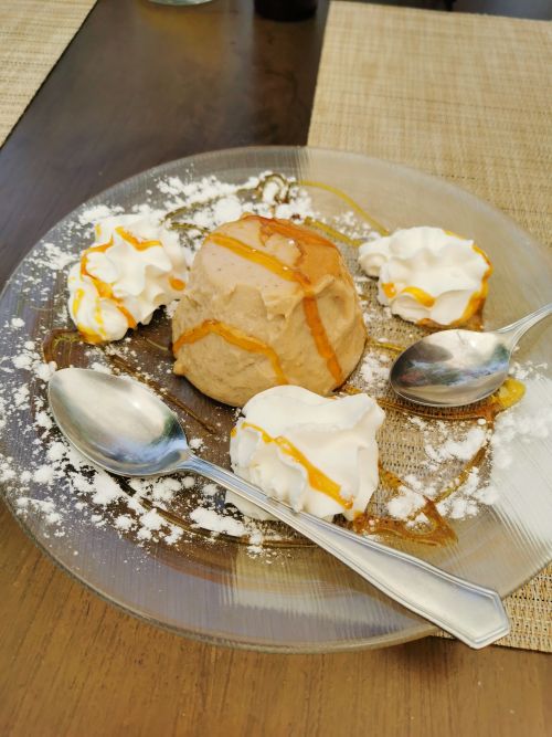

Chestnut Flan desert with good coffee at Meisón El Simancón restaurant in Grazalema
Ubrique: Leather capital of Spain

On our last day in Villaluenga, we observed our morning coffee ritual at the local hotel La Posada and set out on the 13.5 km 30-minute drive past Benacoaz to Ubrique. Known as the capital of European leather goods it started during the 19th century when Southern Italian immigrants began to arrive, bringing the craft with them. The high quality, variety, and finish of the products are valued worldwide, and the majority of the population now works in the leather industry. A museum of leather history documenting the history since the 17th century is housed in the ‘Convent of the Capuchinos’, a nunnery founded by the Capuchino order of nuns. Construction of this distinct building began in 1660AD.

Ubrique is the largest municipality in this region. Two rivers run through the town nestled into a valley surrounded by a rocky mountainous landscape, which gives it a microclimate that supports a diversity of flora and fauna that includes olive, carob, cork and other oak trees, mountain goats, vultures and other birds of prey. Like other towns in the region it dates back to prehistoric times, and there is evidence of human settlement even before the Palaeolithic times. Just 1km from the current town of Ubrique is the Roman walled city of Ocuri, which formed a natural watchtower over the region. Discovered in the 18th century by a local farmer who bought the land, he carried out most of the excavations himself in an effort to see if there were remains of the city buried by natural processes over centuries, such as erosion, the elements, and geological shifts. What he discovered was inscriptions bearing names of leaders, the city’s name ‘Ocuri’, and although mostly Roman in nature from the 1st century AD, its origins have been placed in the 2nd century BC. Now a museum, unfortunately it was closed on the day we wished to visit.
Arab Berbers brought prosperity to the area, and during their time the valley was planted with orchards which were maintained through the bloody battles at the time of the reconquista by the Christians through until the 1970s. Further difficult times include ‘the great earthquake of 1755’ and the burning of notable buildings with archives dating to the 15th century being destroyed during the Napoleonic wars in the 19th century. These events resulted in the reconstruction of churches and monuments, many of which are seen in the old town today.
Remember to open up the groups of photos to see them fully!
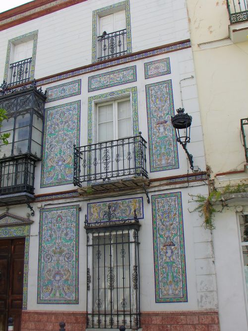
We arrived early and enjoyed a coffee with the locals after looking at some small leather goods as gifts. We started walking up a street in the old town towards squares lined with churches, fountains, nicely painted and decorated houses and restaurants. One we marvelled at had the preserved facade with the beginning of a whole new structure in the early stages of building behind it.


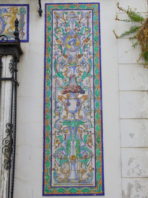
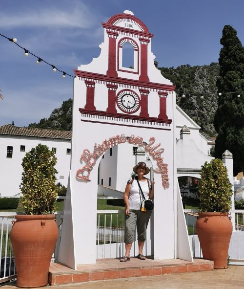
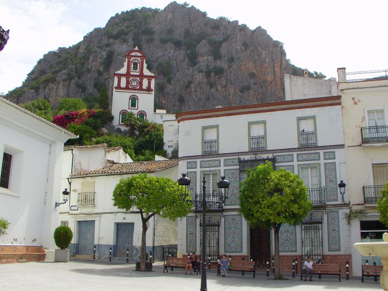
Stopping to enjoy and admire the old town’s treasures, we spotted a building with ornate tiling on the outside and an interesting church with a small bell tower and a clock, nicely painted white and red with stone cliffs behind, creating a very atmospheric canvas to look at. Ermita de San Antonio, or San Antonio Shrine, built as a hermitage in the 16th century, is seen as a symbol of Ubrique. There is a viewing platform with spectacular vistas over the town and the Sierra.
The square is La Plaza (Plaza del Ayuntamiento or the Town Hall Square), and we sat on a park bench under the orange trees taking in the scene. It was quiet, but we knew that by evening time it would be full of diners, locals chatting, children playing, and an atmosphere of gaiety would prevail.
Further up the cobbled streets, we stopped at a viewing platform right by the ‘Convent of Capuchinos’, built in a typical Baroque Monastery style with a gatehouse, church, and convent. The grounds were neat and well-kept, and we sat and enjoyed the view across the town.

Nearby is the Naciemiento de Cornicabia, a protected spring of major importance which provides 80% of the water to Ubrique and gives rise to the Ubrique River. These springs are fed by the clear flowing water of the mountains, which feed into a multitude of rivers in the area. This is perfect for supplying the water for the processing of the hides into leather. I only saw and took a photo of some ruins in the area, and then began to read about the spring. For interesting further reading, see below:
https://manuelcabelloyesperanzaizquierdo.blogspot.com/2011/01/el-nacimiento-de-la-cornicabra.html
We made our way back to the town centre via a different street, past lovely old buildings with interesting doors and decorated window boxes. We found a bar for a quiet drink on the street-side tables in the heat of the afternoon before driving back along the scenic road to Villaluenga and completing our sightseeing with a visit to the cemetery in the early evening. With a desire to visit Grazalema one more time, we drove over and enjoyed a meal at the ‘Restaurante Cádiz El Chico’, where we had also eaten in 2008.
Remember to open up the groups of photos to see them fully!

Following our last night in Villaluenga, we started our day with coffee at La Posada and farewells to our hosts before negotiating the steep streets out of the village. Back on the main road to Grazalema, which by now we knew so well, we branched off just before entering the town and took the road via Gaidovar towards the ‘Embalse de Zahara-el Gastor’ (a lake) and our next accommodation in the beautiful Casa Rural El Tajo (rural house) high on the hills near El Gastor and under the impressive rock formation of Tajo Algarín.